Cliquez sur la photo pour zoomer
Prix : 15,00 €TTC
12-2024, tome 121, 3, p.447-480 - Grégor Marchand, Marylise Onfray, Jorge Calvo-Gómez, Laurent Quesnel On sort la tête de l?amas ? Étude architecturale et géoarchéologique dune structure circulaire en périphérie de l?amas coquillier de Beg-er-Vil (Qu
On sort la tête de l'amas ?
Étude architecturale et géoarchéologique d'une structure circulaire en périphérie de l'amas coquillier de Beg-er-Vil (Quiberon, Morbihan)
Grégor Marchand, Marylise Onfray, Jorge Calvo-Gómez, Laurent Quesnel
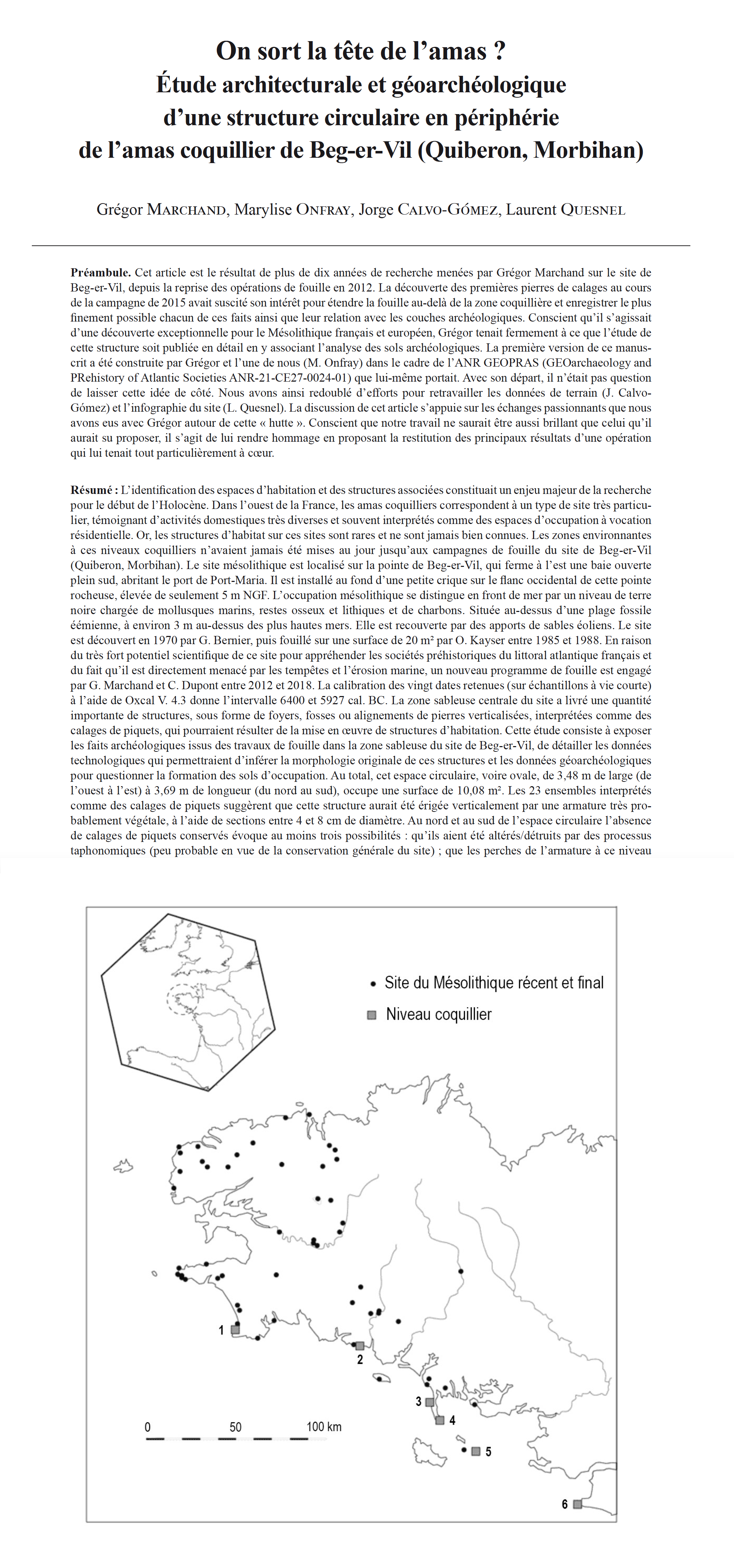
Résumé : L'identification des espaces d'habitation et des structures associées constituait un enjeu majeur de la recherche pour le début de l'Holocène. Dans l'ouest de la France, les amas coquilliers correspondent à un type de site très particulier, témoignant d'activités domestiques très diverses et souvent interprétés comme des espaces d'occupation à vocation résidentielle. Or, les structures d'habitat sur ces sites sont rares et ne sont jamais bien connues. Les zones environnantes à ces niveaux coquilliers n'avaient jamais été mises au jour jusqu'aux campagnes de fouille du site de Beg-er-Vil (Quiberon, Morbihan). Le site mésolithique est localisé sur la pointe de Beg-er-Vil, qui ferme à l'est une baie ouverte plein sud, abritant le port de Port-Maria. Il est installé au fond d'une petite crique sur le flanc occidental de cette pointe rocheuse, élevée de seulement 5 m NGF. L'occupation mésolithique se distingue en front de mer par un niveau de terre noire chargée de mollusques marins, restes osseux et lithiques et de charbons. Située au-dessus d'une plage fossile éémienne, à environ 3 m au-dessus des plus hautes mers. Elle est recouverte par des apports de sables éoliens. Le site est découvert en 1970 par G. Bernier, puis fouillé sur une surface de 20 m² par O. Kayser entre 1985 et 1988. En raison du très fort potentiel scientifique de ce site pour appréhender les sociétés préhistoriques du littoral atlantique français et du fait qu'il est directement menacé par les tempêtes et 'érosion marine, un nouveau programme de fouille est engagé par G. Marchand et C. Dupont entre 2012 et 2018. La calibration des vingt dates retenues (sur échantillons à vie courte) à l'aide de Oxcal V. 4.3 donne l'intervalle 6400 et 5927 cal. BC. La zone sableuse centrale du site a livré une quantité importante de structures, sous forme de foyers, fosses ou alignements de pierres verticalisées, interprétées comme des calages de piquets, qui pourraient résulter de la mise en ?uvre de structures d'habitation. Cette étude consiste à exposer les faits archéologiques issus des travaux de fouille dans la zone sableuse du site de Beg-er-Vil, de détailler les données technologiques qui permettraient d'inférer la morphologie originale de ces structures et les données géoarchéologiques pour questionner la formation des sols d'occupation. Au total, cet espace circulaire, voire ovale, de 3,48 m de large (de l'ouest à l'est) à 3,69 m de longueur (du nord au sud), occupe une surface de 10,08 m². Les 23 ensembles interprétés comme des calages de piquets suggèrent que cette structure aurait été érigée verticalement par une armature très probablement végétale, à l'aide de sections entre 4 et 8 cm de diamètre. Au nord et au sud de l'espace circulaire l'absence de calages de piquets conservés évoque au moins trois possibilités : qu'ils aient été altérés/détruits par des processus taphonomiques (peu probable en vue de la conservation générale du site) ; que les perches de l'armature à ce niveau aient été implantées directement dans le sédiment, sans calage empierré ; ou qu'ils s'agissent bien des ouvertures de l'architecture. Étant donné les conditions d'enfouissement du site, il est probable que ces interruptions correspondent à de véritables ouvertures dans l'architecture. L'analyse micromorphologique confirme la présence de sols d'occupation mésolithiques en lien avec le fonctionnement de l'amas coquillier. Plusieurs types d'activité sont enregistrés au sein de ces sols. Des piétinements plus ou moins intenses sont enregistrés dans la partie supérieure. L'étude micromorphologique apporte aussi des éléments pour discuter de la temporalité de cette occupation. En effet, dans les trois séquences étudiées, on enregistre une diminution des processus anthropiques en jeu dans la dynamique de formation de la séquence pédo-sédimentaire qui pourrait s'expliquer ici par une période où l'espace n'est pas occupé par les groupes humains mésolithiques. La fonction et le fonctionnement de cette hutte ne peuvent pas encore être restitués avec totale certitude. Cette étude permet d'avancer dans la caractérisation des vestiges archéologiques des groupes humains côtiers et de mieux appréhender leurs modes de vie.
Mots-clés : amas coquillier, structure circulaire, architecture, sol d'occupation, foyer, hutte, tente, technologie, micromorphologie des sols.
Abstract: The identification of settlement areas and their associated structures on early Holocene archaeological sites has long been an important topic in the study of the last groups of hunter-gatherers. In western France, shell middens constitute a very particular type of sites, which bear witness to very different domestic activities and are often interpreted as habitation sites. However, the residential structures at these sites are rare and never well known. The surroundings of these shell layers had never been excavated with modern protocols in Brittany until the field campaigns at the Beg-er-Vil site in Quiberon. The Quiberon Peninsula is located on the Atlantic coast, west of the Gulf of Morbihan, and extends 11 kilometres to the south. It lies in front of several islands: Téviec, Houat, Hoedic and Belle-Île-en-Mer. The Mesolithic site is located on the Beg-er-Vil promontory, which closes off a south-facing bay to the east, where the harbour of Port-Maria is located. It lies at the bottom of a small bay on the western flank of this rocky headland, which is only 5 metres above sea level. The Mesolithic settlement can be recognized on the beach promenade by a distinct layer of black earth laden with seashells, bone remains, ethics, and charcoal. It is located above a fossilised beach from the Eemian, about 3 metres above the highest sea level, and is covered by aeolian sands. The site was discovered in 1970 by G. Bernier and excavated over an area of 20 m² by O. Kayser between 1985 and 1988. Given the site's great scientific potential for understanding prehistoric societies on the French Atlantic coast, and due to the fact that it is directly threatened by storms and marine erosion, a new excavation program was launched between 2012 and 2018, managed by G. Marchand and C. Dupont. The calibration of the twenty selected dates (on short-lived samples) with Oxcal V. 4.3 suggests an occupation spanning between 6400 and 5927 cal. BC. The central sandy area of the site revealed a considerable number of structures in the form of hearths, pits, and vertical alignments of stones, interpreted as dwellings (or post-holes?). Due to the unique conservation of these type of archaeological discoveries in the region, the detailed study of these structures and the central area of the site is a crucial research topic for the study of the last hunter-gatherers??? populations in the region. The objectives of this paper are to present the archaeological data resulting from the excavation work in the sandy area of the Beg-er-Vil site, the detailed technological data supporting an interpretation of the original morphology of these structures, and the analysis of the micromorphological studies hinting at the formation of living floors. The results of the study show how the postholes, their organization, and their construction techniques, represent the last inorganic remains of a horizontal architecture, drawing an oval shape. These postholes are identified by empty spaces defined by a series of stones, mainly granite or quartz pebbles, placed on a vertical plan. In many cases, these were previously used as stone hearths. In the middle of this space lies a significant hearth structure, fitted with large granite stones, which according to C14 data was built at the beginning of the occupation phase. The series of vertical stones share some specific technological attributes, such as orientation, depth of implantation in the soil, and shape, that are significant to partially reconstruct this architecture even if many other elements are not (yet) known. With a width of 3.48 metres (east-west) and a length of 3.69 metres (north-south), this subcircular room covers an area of 10.08 m² in total. The 23 stone settings interpreted as stake wedges indicate that this structure was erected vertically by a scaffolding, probably made of plant material and consisting of parts with a diameter of 4 to 8 cm. To the north and south of the circular space, the absence of surviving stake wedges suggests at least three possible interpretations: that they were altered/destroyed by taphonomic processes (unlikely given the overall preservation of the site); that the poles of the armature at this level were set directly into the sediment, without stone wedges; or that they are in fact openings in the architecture. Given the conditions under which the site was buried, it is likely that these interruptions are genuine openings in the architecture.
The geoarchaeological investigation of three soil-sedimentary sequences located within, near, and far from the building shows the spatial and temporal disparity of the archaeological stratigraphy. Micromorphological analysis confirms the presence of occupied Mesolithic soils associated with the formation of the shell layer. Several types of activity were detected in these soils. There are discharge-type inputs associated either with combustion activities (heated stone) or with the construction of structures (stake wedges, slab hearths) requiring burial of the underlying layer (rolled gravel beds). Relatively intense trampling can be observed in the upper part of the soil. Micro-remains are rare and consist mainly of micro-charcoals and food remains. Like the soils outside the structure, the soils inside do not appear to have undergone any special preparation; their formation seems to be exclusively due to natural processes. There are also no signs of matting, neither with plant nor with animal material. The soils show variations in wetting and drying, as do the soils outside the structures. The micromorphological investigation also provides clues for the temporal classification of this colonization. In the three sequences analysed, there was a decrease in the anthropogenic processes involved in the dynamics of the formation of the soil-sediment sequence, which could be explained by a period in which the area was not occupied by Mesolithic human groups.
The function and uses of this structure cannot yet be deduced with absolute certainty. It might have been used for typical domestic activities on a daily basis, or for other types of activities related to food processing or crafting activities. The formation of anthropised soils suggests several occupation episodes related to the use of the structure. This study improves our understanding of the characterization of the archaeological remains of human groups on the coast, and of their ways of living.
Keywords: Shell midden, circular structure, architecture, living-floor, hearth, hut, tent, technology, soil micromorphology
Autres articles de " Bulletin de la Société préhistorique française 2024"
19-2024, tome 121, 4, p 693-718 - Guilaine J., Vaquer J., Costa K., Raynaud C. (2024) Une épée argarique du Bronze moyen à Bessède-de-Sault (Aude, France)
Une épée argarique du Bronze moyen à Bessède-de-Sault (Aude, France)
Jean Guilaine, Jean Vaquer, Kévin Costa, Christian Raynaud
Résumé : La mention de la trouvaille d'une épée en bronze dans la haute vallée de l'Aude, donnée et exposée au syndicat d'initiatives de Quillan, est restée longtemps confidentielle. Une enquête a permis de retrouver cet objet et de situer l'emplacement de sa découverte près du col de Pradels dans la commune de Bessède-de-Sault (Aude). Il s'agit d'une lame d'épée plate et légèrement étranglée à languette large munie de six rivets sur deux rangs, qui présente des caractères typiques des productions de l'étape B de la culture d'El Argar datable au début du Bronze moyen (1600-1400 av. J.-C.). Cette épée argarique est la seconde trouvée en France après celle de la Rouvière à Chusclan (Gard), légèrement différente (plus courte, à un seul rang de rivets) et associée à d'autres lames de style rhodanien de la fin du Bronze ancien. Ces découvertes reflètent les dynamiques d'échanges de productions métalliques liées à la fois à leur rôle fonctionnel et symbolique et aux compétitions techniques et sociales des divers centres européens de fabrication. Pour autant les épées du Bronze ancien et moyen sont rares dans le Midi. La pièce ici évoquée a été mise au jour dans une aire du piémont pyrénéen (le Pays de Sault) encore peu étudiée mais dont les données disponibles renvoient à des cultures locales (Bronze ancien à traditions campaniformes, Bronze moyen à vases polypodes). Dans le contexte plus large nord-pyrénéen, des apports d'objets de cuivre ou de bronze de souche ibérique sont toutefois attestés lors de ces périodes. En composition élémentaire, l'épée de Bessède-de-Sault se révèle être un bronze à fort taux d'étain (10 % Sn) et à faible teneur d'impuretés, et des comparaisons sont proposées avec divers documents de France et de la péninsule Ibérique. La teneur en plomb est faible ; fortement radiogénique, ce dernier élément oriente vers un cuivre de souche égéenne ou, plus vraisemblablement en raison de la typologie caractéristique de la pièce, du sud de l'Espagne.
Est également abordée la question de la genèse des épées dans le sud-ouest de l'Europe. Trois pôles sont reconnus. D'une part certaines épées courtes s'inscrivent dans la tradition des poignards à languette du Chalcolithique ibérique. Un second pôle est constitué par les épées Bonnánaro de type Sant'Iroxi de Decimoputzu de Sardaigne, à rivets et en cuivre arsénié. Les épées argariques, auxquelles se rattache l'épée de Bessède-de-Sault, constituent le troisième de ces pôles de production originaux, à l'écart des foyers de l'Europe continentale.
Mots-clés : culture d'El Argar, épée en bronze, métallurgie d'alliages cuivreux, cuivre arsénié, isotopes du plomb, âge du Bronze ancien, âge du Bronze moyen, péninsule Ibérique, Pyrénées.
Abstract: The mention of the finding of a bronze sword in the upper valley of the Aude, given and presented to the tourist information office of Quillan, remained confidential for a long time. An investigation made it possible to find this object and locate the site of its original discovery near the Pradels pass in the village of Bessède-de-Sault (Aude). It is a sword with triangular blade and strangulation under the guard, with lenticular section, marked with locally hammered sharp threads. The tongue is trapezoidal, sub-elliptical. The piece has a length of 55.3 cm including 4 cm for the tongue and 51.3 cm for the blade. The maximum width of the tab is 6.4 cm ; it was pierced with 6 rivet holes in two rows, five of which are still in place. The missing hilt was probably made of wood. The arrangement of the rivets (4 aligned, 2 unhooked) is found identically on the swords of the graves 429, 824 and 551 of the eponymous site of El Argar (Almeria) and the copy of the burial 9 of Fuente Alamo (Almeria). Similar ones are known from Puertollano (Ciudad Real, Castile) and Entrambasaguas (Santander, Cantabria). The proximal area of the blade, just below the guard, shows a pattern incised in double low arc. They are marks for the hilt or signs left by a sharp cleaning tool in the contact area between blade and handle.
The blade is well preserved except in the distal part where it was damaged on discovery which blew the patina and the oxidized crust and which probably bent the tip, this one straightened secondarily.
This argaric sword is the second found in France after that of the Rouvière in Chusclan (Gard), slightly different (shorter, with a single row of rivets) and associated with other Rhodanian style blades of the end of Early Bronze Age.
Argaric swords have given rise to typological classifications, the most common of which are those of M. Almagro Gorbea (1972) and D. Brandherm (2003). M. Almagro recognizes two main groups. On the one hand the parts with marked strangulation of the upper third (which gives them an overall appearance pistilliform), with rivet holes arranged on a single row: these would be the oldest (Early Bronze or transition with the Middle Bronze) and most of them would be arsenated copper. The blade of Chusclan belongs to this phase. The second group concerns the narrower triangular blades with straight edges, an enlarged guard and rivets arranged in two rows. It is to this category that the sword of Bessède-de-Sault is attached. It can be dated to stage B of El Argar culture, between 1600 and 1400 BCE. The majority of swords in this group are bronze, those in copper or arsenated copper being rarer. Various typological variants within these two groups have been characterized.
The interest of the sword of Bessède-de-Sault also lies in its place of discovery on the northern slope of the Pyrenees. It is also located in the South of France, where the swords of the Middle Bronze are very rare. In the Aude basin, little was known until now only the sword of Jugnes (La Nouvelle), with massive handle and blade decorated with long chevron patterns and whose style is part of a context of continental Helveto-Germanic influences (Daugas and Vuaillat, 2006). This weapon is related to the type of Cheylounet which include seven swords, perhaps, from the same workshop. Conversely, the sword of Bessède-de-Sault clearly refers to the argaric sphere whose rapiers are the subject of debate as to their function: instruments of combat or emblems of power ?
The sword of Bessède-de-Sault was unearthed in a local archaeological context, the Pays de Sault, still little explored but whose documentation available for the Early Bronze Age and Middle Bronze Age refers to local cultures located on both sides of the Eastern Pyrenees. The sepulchral cavities of Usson (Fontanès-de-Sault, Aude), Gardouch (Belcaire, Aude), Toureil (Mijanès, Ariège) highlight an Early Bronze Age in the Beaker tradition with a strong presence of prismatic V-perforated buttons. The Middle Bronze is notably represented by the Pyrenean-Aquitaine culture with polypod vases (Dourgne cave, Fontanès-de-Sault, Aude). More widely in the Eastern Pyrenees, the metal productions of the Middle Bronze are essentially axes with edges and median constriction (Casteldos, Le Bousquet, Aude ; Arnave, Ariège). Besides this regional metallurgy, one does not exclude the presence of metallic objects of Iberian influence or origin like the long chalcolithic dagger of Vernet (Ariège), the sword of Lafage (Saint-Amadou, Ariège) or the halberd of Hérédèche in Sost (Hautes-Pyrénées). Recall also that a sword with four rivets close to the Iberian models is given as coming from Vieille-Toulouse (Haute-Garonne) but does not in fact have a safe source.
The analysis in elemental composition of the sword of Bessède-de-Sault showed that it was a bronze with 10% tin, a kind of fairly general alloy at the beginning of the Middle Bronze. Arsenic, lead, antimony and silver levels are low. The blade and rivets were made with the same alloy. The best matches are found in various objects of the Iberian Peninsula but some pieces from the South of France present similar compositions. The isotopic analyses showed comparable results between the blade and the rivet. The lead content is low. It is highly radiogenic which limits the hypotheses on the origin of the ore on a European scale. Different approaches (graphic reading, statistical methods) refer to Greek minerals (Laurion, Cyclades) but also to Spanish minerals. The additional analysis by age model tends to confirm these hypotheses, limits remaining however (old geological data, unrecorded deposits in lead isotopy, possible metal recycling). Comparisons with remains from Iberian archæological sites indicate close lead isotopic ratios. In the end, the sword of Bessède-de-Sault shows a compatibility of its metal with certain parts of the argarian area but also with bronzes from northern Spain and the South.
It will never be known who (or what) was the holder (s) of this sword and its (their) gender. Weapons that may have been devolved to women in Argarian society are a hypothesis currently under debate.
In a more general way this weapon invites us to ask the question of the genesis of the oldest swords in South-West Europe. Unlike the swords with massive handle and decorated blade of the Central-European zone, the first rapières produced in the Western Mediterranean and South-Atlantic Europe are distinguished by different characters. Three areas seem to emerge. First an Ibero-Atlantic zone clearly inspired by the local tradition of beaker's tongue daggers. Another production centre is located in Sardinia and concerns the Sant'Iroxi type swords of Decimoputzu, in arsenated copper. The third area is that of the argarian swords to which the sword of Bessède-de-Sault is attached. All three sources favour wooden hilts but which could be set with a cover in silver or gold sheets as on the exceptional example of Guadalajara (Spain).
Keywords: Culture of El Argar, bronze sword, metallurgy of copper alloys, arsenated copper, lead isotopes, Early Bronze Age, Middle Bronze Age, Iberian Peninsula, Pyrenees.
18-2024, tome 121, 4, p 657-692 - Peche-Quilichini K., Martinet L., Lambert M., Camagny Th., Leandri C., Picornell Gelabert L., Sureda P. (2024) Mobiliers et écofacts de lhabitat de hauteur du Bronze ancien/moyen dI Stantari di u Frati è a Sora (Sartè
Mobiliers et écofacts de l'habitat de hauteur
du Bronze ancien/moyen d'I Stantari di u Frati è a Sora (Sartène, Corse-du-Sud)
Kewin Peche-Quilichini, Lauriane Martinet, Maryline Lambert, Thomas Camagny, Leandri, Llorenç Picornell Gelabert, Pau Sureda
Résumé : I Stantari di u Frati è a Sora est un habitat de hauteur de l'âge du Bronze situé à 5,6 km à l'est du littoral actuel du golfe du Valincu, dans le sud-ouest de la Corse. Repéré en 2014, il a été fouillé en 2019-2020 par des équipes de l'Inrap. La colline qui porte le site (49 m d'altitude maximale), dominant la vallée du Rizzanesi, est caractérisée par son substrat arénisé et son relief arrondi.
Le site est délimité par des structures défensives successives abritant des habitations. Des constructions ont également été identifiées à l'extérieur des limites artificielles. Dans un premier temps, il est délimité par des palissades. Ensuite, ce système est remplacé par un fossé à section en V, probablement doublé par une levée de terre elle-même palissadée. Le dernier état, superposé aux précédents, voit l'édification d'un double rempart en pierre sèche. Les constructions non défensives incluent trois habitations, des terrasses de délimitation et des creusements isolés. L'emprise fouillée, d'une surface d'environ 3000 m², correspond à une aire estimée à près d'un quart de l'habitat.
La chronologie de l'occupation s'étend de la fin du Bronze ancien 1a (2200-2000 av. J.-C.) à la fin du Bronze moyen 2 (1550-1450 av. J.-C.). La forte érosion est à l'origine de la disparition de la plupart des sols et des niveaux de fonctionnement, sauf dans l'habitation 1027, dont les murs latéraux ont en partie permis de préserver la conservation. Les autres niveaux en place constituent des remplissages de structures en creux.
L'objectif de cette contribution est de présenter les mobiliers et les écofacts du Bronze ancien et moyen, dans une perspective évolutive et culturelle. Les séquences matérielles du Bronze ancien 1, contemporaines de l'installation, sont réduites. La phase d'occupation la mieux représentée est celle du Bronze ancien 2b (1750-1650 av. J.-C.) / Bronze moyen 1 (1650-1550 av. J.-C.).
Les mobiliers céramiques incluent quelques éléments attribuables au Bronze ancien 1, comme les récipients à pseudo-perforations sublabiales alignées. L'essentiel de la production présente les caractères typiques des contextes de la transition Bronze ancien/moyen dans le sud de la Corse. Les infiltrations de répertoires italiques sont ici absentes. Les mobiliers lithiques attestent d'une forme de débitage sur galets, mais également de la présence d'outils en silex sarde pour la phase ancienne. Plusieurs meules, molettes et mortiers renseignent les pratiques alimentaires. Il faut aussi signaler la présence d'un lot de nodules facettés et polis d'hématite, dont la fonction reste en partie indéterminée. Quelques objets particuliers complètent ce panorama. Si les pièces métalliques sont absentes, quelques scories et fragments de moules en terre cuite révèlent la réalisation sur place d'outils en alliage Cu-As. En Corse, ces tendances caractérisent généralement le Bronze ancien et le début du Bronze moyen, ce qui est donc confirmé ici.
La mise en perspective des données met en relief une mutation graduelle et non synchrone des ressources mobilisées, des chaines opératoires et des répertoires. Cet état général trahit des transformations économiques en lien avec des dynamiques et des réseaux agissant à l'échelle tyrrhénienne, mais également des phénomènes d'exclusion d'ordre microrégional. Parallèlement aux innovations caractérisant les formes de l'habitat, ces évolutions définissent les particularités de la première moitié de l'âge du Bronze corse dans un territoire où les mécanismes de structuration sociale sont contraints par une géographie physique et culturelle propice au développement de formes particulières de cloisonnement.
Mots-clés : Corse, Bronze ancien et moyen, habitat, culture matérielle.
Abstract: I Stantari di u Frati è a Sora is a Bronze Age hilltop settlement located 5.6 km east of the current coastline of the Gulf of Valincu, in south-west Corsica. Discovered in 2014, it was excavated between 2019 and 2020 by Inrap Méditerranée. The site sits on a rounded hill of sandy substrate (maximum altitude 49 m) that dominates the lower part of the middle valley of the River Rizzanesi. The summit is partly covered by a layer of pebbles from an ancient alluvial deposit. These geological aspects have had a major influence on how the domestic features were organised.
Defensive features bound the settlement with its houses and other constructions. Buildings are also located outside the boundaries. Initially, up to four or five juxtaposed and sub-parallel palisades delimited the settlement. This system was then replaced by a V-shaped ditch and a palisaded earth rampart. The last construction phase that superimposed on the previous two includes the construction of a double dry-stone rampart with a typical south Corsican architecture. An entrance is located in the southern part of the rampart, around the eroded interfluve ridge linking the relief to the rocky massifs of Ghjumenta Grossa. The site has three dwellings, contour terraces and isolated pits. The excavated surface, around 3,000 m², is estimated to cover almost a quarter of the settlement.
The chronology of these supposedly continuous occupations ranges from the end of the Early Bronze Age 1a (2200-2000 BC) to the end of the Middle Bronze Age 2 (1550-1450 BC), according to Corsican chronology. Severe erosion of the soft soils caused the disappearance of most of the floors and occupation layers, with the exception of dwelling 1027, partly preserved by its elliptic sidewall. The other levels in place are the fills of the dugout features (pits, ditches, palisade trenches, foundation trenches and postholes).
In this paper, we aim to present the artefacts and ecofacts relating to economic and craft activities at I Stantari di u Frati è a Sora in the Early and Middle Bronze Age, if possible from an evolutionary and cultural perspective. The material from Early Bronze Age 1, contemporary with the first installation, is rare. The best-preserved occupation phase dates to Early Bronze 2b (1750-1650 BC) / Middle Bronze 1 (1650-1550 BC).
The pottery assemblage includes rare elements dated to Early Bronze Age 1, such as vessels with aligned sublabial pseudo-perforations. Most of the wares are typical of Early Bronze / Middle Bronze Age transition contexts in the south of the island: high carinated jars, soft angled handles, large vessels with long flared necks, etc. As always in the south of the Rizzanesi, there is no influence from Italic productions. From a functional point of view, the presence of table, kitchen and storage vessels is a typical configuration for Corsican Bronze Age settlements.
The stone tools attest to a form of pebble percussion, but also to the presence of Sardinian flint flakes in the early phase. Some grindstones and mortars, sometimes of particularly large dimensions, provide information about diet. Special objects (smoother, pendant, weight) enhance our perception of the use of lithic resources. Finally, we should mention the presence of some faceted and polished haematite nodules, the function of which remains undetermined.
Although there are no metal objects, some slag and fragments of terracotta moulds seem to indicate that Cu-As alloy tools were made on site. Tin is absent from the XRF spectra. In Corsica, these trends (arsenic copper and use of non-permanent moulds) generally characterise the Early Bronze Age and the beginning of Middle Bronze Age and our results confirm the dates.
To conclude, we present the results of the studies of the organic remains that point to a landscape a priori dominated by Erica sp., Arbutus unedo and Quercus ilex/coccifera, while the plant diet refers only to balanophagy.
Putting all the data into perspective highlights an occupation that sees a gradual and non-synchronous change in the mobilised resources, the chaines opératoires and the repertoires. They reveal economic transformations linked to Tyrrhenian dynamics and networks, but also micro-regional phenomena of exclusion the consequence of specific alliances systems. In parallel to the innovations observed in the settlement, these material developments define the specifics of the Bronze Age in Corsica, an island where mechanisms of social structuring were constrained by a physical and cultural geography conducive to the development of particular forms of compartmentalisation.
Keywords: Corsica, Early and Middle Bronze Age, settlement, material culture.
17-2024, tome 121, 4, p 645-655 - Binder D., Boulestin B., Rivollat M., Haak W., Deguilloux M.-F. (2024) Précisions sur la position chronologique et lapparentement culturel de la tombe néolithique de Germignac, « le Bois-du-Bourg »(Charente-Maritime)
Précisions sur la position chronologique
et l'apparentement culturel de la tombe néolithique
de Germignac, « le Bois-du-Bourg » (Charente-Maritime)
Didier Binder, Bruno Boulestin, Maïté Rivollat, Wolfgang Haak, Marie-France Deguilloux
Résumé : Les auteurs présentent et discutent les résultats d'une nouvelle datation des restes humains découverts en 1980 à Germignac, « le Bois-du-Bourg », réalisée dans le cadre d'une analyse paléogénétique qui s'est malheureusement révélée infructueuse. La révision de l'inventaire des restes osseux et dentaires indique qu'il s'agit d'une sépulture individuelle et non d'une sépulture double comme cela avait été précédemment proposé. La date obtenue situe les premiers témoignages de la diffusion du Néolithique dans le centre-ouest de la France dans le courant du premier quart du Ve millénaire AEC. Les ornements de pierre et de test ne présentent aucune similitude avec les productions méridionales contemporaines et orientent en revanche vers le complexe culturel du Blicquy/Villeneuve-Saint-Germain/Augy-Sainte-Pallaye (BVSG). Ces données appellent à une reconsidération des hypothèses envisageant une articulation du premier néolithique du Centre-Ouest avec les groupes méridionaux de tradition impresso-cardiale.
Mots-clés : radiocarbone, SMA, anneaux en pierre, parure en test, Rubané, Blicquy/Villeneuve-Saint-Germain/Augy-Sainte-Pallaye, Cardial final, Épicardial, transferts.
Abstract: The authors present and discuss the results of a new radiocarbon date of the human remains discovered in 1980 at Germignac, "le Bois-du-Bourg". This site has provided important data for the study of the Neolithization of the Atlantic façade of Europe in particular due to its location which is quite far from the territories colonized by the farmers of the Impresso-Cardial and Western Linear Pottery (LBK) during the 6th millennium BCE. The nature of the rich Germignac ornaments, most likely associated with human remains, has also helped to nourish the issues of attaching the "Néolithique Ancien Centre-Atlantique" (NACA) to either of the major Neolithic diffusion currents and of their possible interactions. These ornaments have already been extensively described and commented on: they associate a couple of ring-discs of exceptional dimensions, made from allochthonous metamorphic rock, with an impressive series of standardized discoid beads made of shell tests, carved out using the hollow drill technique.
Revision of the inventory of bone remains indicates that they do not belong to a twin burial as previously proposed, but to a single adult individual, perhaps quite young and of undetermined sex.
A first radiocarbon measurement by Accelerator Mass Spectrometry (AMS) carried out in 2001, obtained from a batch of human bone shafts, yielded a rather large standard deviation. The new AMS date from a tooth presented here is more accurate and was commissioned in conjunction with palaeogenetic analyses that were unfortunately unsuccessful. Both radiocarbon analyses meet similar quality criteria. As all the human bones collected at Germignac, "le Bois-du-Bourg" belong to the same individual, the two available radiocarbon measurements were merged using the Combined probability function implemented in OxCal, and calibrated with IntCal20 using the ChronoModel v.2 software. The obtained date falls within the first quarter of the 5th millennium, between 4986 and 4784 BCE (HPD 95%). This makes it the earliest evidence of a clearly dated Neolithic site in the Centre-Ouest, in a cultural environment that most probably refers to the Blicquy/Villeneuve-Saint-Germain/Augy-Sainte-Pallaye complex (BVSG), since the stone and shell ornaments bear no resemblance to contemporary southern production, but instead point to the LBK sphere.
The indication that technical paradigms from the LBK tradition could have spread to Aquitaine should lead us to reconsider the potential evidence of southern influences in this region. Ceramic decorative techniques and syntaxes (e.g., rocker impressions, T-composition, ...) are largely shared by southern and northern cultural groups, which had established cultural interactions as early as the last quarter of the 6th millennium, and thus before the establishment of the BVSG. As a result, while southern influences can be detected in the decoration of ceramics from central-western France, it remains particularly difficult to distinguish between direct influences from Occitania or the Iberian Peninsula and reinterpretations by post-LBK groups of northern origin previously connected to the Cardial/Epicardial throughout the Rhône valley. These difficulties could be partly reduced by technological analysis of early ceramic production in Western France, given the fundamental differences in pottery forming methods that have been observed, to date, between the LBK and Impresso-Cardial domains.
Keywords: radiocarbon, AMS, stone rings, shell ornaments, LBK, Blicquy/Villeneuve-Saint-Germain/Augy-Sainte-Pallaye, Late Cardial, Epicardial, transfers.
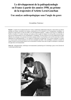
16-2024, tome 121, 4, p 629-643 - Torterat G. (2024) - Le développement de la paléopalynologie en France à partir des années 1950, au prisme de la trajectoire dArlette Leroi-Gourhan : une analyse anthropologique sous langle du genre
Le développement de la paléopalynologie en France
à partir des années 1950, au prisme de la trajectoire d'Arlette Leroi-Gourhan
Une analyse anthropologique sous l'angle du genre
Gwendoline Torterat
Résumé : A partir de la seconde moitié du xxe siècle, l'archéologie préhistorique française s'inscrit dans un contexte politique de réforme structurelle des instances représentatives de la recherche et de l'enseignement scientifique. La période de l'après-guerre est ainsi favorable à son développement général, y compris au niveau de ses méthodes de fouille et d'analyse. Cet article s'interroge sur la place qu'ont occupée les femmes et le rôle qu'elles ont joué dans ce processus de transformation à la fois institutionnel et scientifique. En tant qu'épouse de l'un des préhistoriens les plus influents de son époque, il est question de montrer comment Arlette Leroi-Gourhan a joué un rôle crucial dans le développement de la paléopalynologie. Ce cas auquel ni la littérature en archéologie, ni en sciences humaines et sociales ne s'est pas encore consacré jusque-là, est tout aussi exemplaire qu'inédit. Cette scientifique a construit sa carrière en marge de modes de gouvernance genrés tout en centralisant de manière innovante les apports techniques et analytiques des approches environnementales.
Mots-clés : paléopalynologie, archéologie environnementale, épistémologie de l'archéologie, genre, travail, histoire de l'archéologie préhistorique.
Abstract: From the second half of the 20th century onwards, French prehistoric archaeology was part of a political context of structural reform of the bodies representing scientific research and teaching. The post-war period was thus favourable to its general development, including in terms of excavation and analysis methods. This article looks at the place occupied by women and the role they played in France in this process of institutional and scientific transformation. The scientific career of French prehistorian Arlette Leroi-Gourhan (1913-2005) is the focus of this study. We will take stock of the consequences of the general context of centralization of research institutions on women's working conditions. Indeed, it was not until the years following the creation of the Centre national de la recherche scientifique (CNRS) in 1939 that the backstage areas of research institutions became more feminized. Nevertheless, women were mainly employed as secretaries, typists or, more rarely, as laboratory secretaries. During this period of economic depression, unemployment particularly affected married women scientists. Some joined their husbands' laboratories, either as assistants or collaborators, or more rarely as research associates, with a position that enabled them to continue their own research. Under the guise of a professional opportunity, marriage in fact reproduced, and consequently amplified, gender inequalities similar to those already in place in the private and public spheres.
The general lack of recognition of women's contributions to science is now a phenomenon that the history of science has amply documented. The multiple choices and alliance strategies to which women have turned during their careers remain to be analyzed. This is a specific and complex field of analysis that offers great promise. It is from this angle that this article intends to engage. It follows in the footsteps of historiographical works that highlight the role of women in the scientific development of archaeology. Prehistorians such as Madeleine Colani (1866-1943) and Annette Laming-Emperaire (1917-1977), both pioneers in their field, have remained as famous as their husbands, whom they followed in their field abroad. Historiography also provides numerous examples of women scientists who were recognized by their peers and who chose to maintain their independence by remaining volunteers or without institutional affiliation. This contribution follows this line, but also shows how Arlette Leroi-Gourhan succeeded in blending in with the scientific interests of her husband, André Leroi-Gourhan (1911-1986), and indirectly integrating the institutions to which he held the keys. This great figure of archaeology made a major contribution to the restructuring of the organization of French archaeological research and higher education. He also held a number of key positions of responsibility throughout his career. Arlette Leroi-Gourhan's motivation was to establish pollen analysis as a fully-fledged scientific field for archaeology (paleopalynology). The unprecedented nature of her career will be discussed, firstly from the point of view of her constant mobility between the private and public spheres, and secondly in terms of the trio she formed with her husband and research assistant, Michel Girard. Starting in the 1950s, this young chemist began working with her on a piecework basis, analyzing various pollens. He soon obtained a permanent position as a palynologist.
The aim of this study is to understand how Arlette Leroi-Gourhan managed to introduce a range of epistemological and methodological innovations while remaining on the bangs of her institution. Indeed, gender norms forced her to create her own space within a field that men had largely abandoned, a space that would later become a fully-recognized field of scientific research integrated into professional practices. The story of Arlette Leroi-Gourhan's career and her scientific work will be told through the succession of spaces in which she worked, from her kitchen laboratory to the one in which she later worked in the basement of the musée de l'Homme in Paris. It will also describe the place of two men in particular, her husband and her research assistant, who played an important role in her life and career. Through the history of their relationships, we'll see how the boundaries of the classic image of the gendered male/scientist and female/assistant duo on which social science studies have often built their analyses are blurred.
This article is based on original sources that correspond to a new oral archive consisting of around a hundred filmed interviews, part of which is online (Mémoires en partage series on Canal U, online). The information in this article was first collected in 2016 as part of my collaboration on the 2ARC project, ARChives de fouilles ARCy-sur-Cure (funded by Labex Les Passés dans le Présent, COMUE Paris-Lumière, State aid managed by ANR-11-LABX-0026-01, coordinators: Nejma Goutas, Ludovic Mevel and Pierre Bodu of UMR 8068). A second research period between 2019 and 2021 enabled me to continue data collection, as part of the ANTHROP'ARC project (funded by the DIM Matériaux Anciens et Patrimoniaux, Île-de-France, coordinators: Nejma Goutas of UMR 8068 and Baptiste Buob of UMR 7186). The interviews on which this article is based were conducted during these two research phases.
Keywords: paleopalynologic, environmental archaeology, epistemology of archaeology, gender, work, history of prehistoric archaeology.

15-2024, tome 121, 3, p.573-602 - Catherine Losier, Grégor Marchand, Cédric Borthaire Archéologie, réseaux et saisonnalité dans larchipel de Saint-Pierre-et-Miquelon sur le temps long
Archéologie, réseaux et saisonnalité dans l'archipel de Saint-Pierre-et-Miquelon sur le temps long
Catherine Losier, Grégor Marchand, Cédric Borthaire
Résumé : L'archipel de Saint-Pierre-et-Miquelon se compose de trois îles principales situées à environ vingt kilomètres au sud de l'île de Terre-Neuve au Canada. Malgré son éloignement de la métropole, sa petite superficie et le faible nombre d'habitants par rapport à d'autres territoires d'outre-mer, il serait erroné de le considérer comme un cul-de-sac. Les notions de centralité et de périphérie prennent tout leur sens dans un contexte relationnel, et en l'occurrence, cet archipel est constamment connecté à l'île de Terre-Neuve, voire au Labrador à la période précoloniale, ainsi qu'à toutes les côtes atlantiques au cours des périodes moderne et contemporaine. Les réseaux et la saisonnalité sont au coeur de l'existence des populations de Saint-Pierre-et-Miquelon depuis son peuplement initial, avec des motivations et des moyens techniques variés selon les groupes et les époques. Cet article a un double objectif. D'une part, il vise à dresser un bilan des données archéologiques récemment acquises dans l'archipel de Saint-Pierre-et-Miquelon, au cours d'une période marquée par une intensification notable de la recherche. D'autre part, il s'attache à analyser les réseaux et la saisonnalité, qui sont des concepts essentiels pour comprendre les occupations de l'archipel au cours des cinq derniers millénaires.
Mots-clés : Saint-Pierre-et-Miquelon, historiographie, réseaux, saisonnalité, période précoloniale, période moderne.
Abstract: The Saint-Pierre and Miquelon archipelago consists of three main islands located approximately twenty kilometers south of the island of Newfoundland in Canada. Despite its remoteness from mainland France, its small size, and low population compared to other overseas territories, it would be incorrect to consider it a dead-end. The notions of centrality and periphery gain significance in a relational context, and in this case, the archipelago is consistently connected to Newfoundland, and even to Labrador in the precontact period, as well as to all Atlantic coasts during the modern and contemporary periods. Networks and seasonality have been central to the existence of the populations in Saint-Pierre and Miquelon since their initial settlement, with motivations and technical means varying across groups and epochs.
This article has a dual objective. Firstly, it aims to provide a historiography of the archaeological data recently acquired in the Saint-Pierre and Miquelon archipelago, during a period marked by a notable intensification of research. We are at a point in the history of the development of archaeological practice in the archipelago where it is still possible to take stock of all the projects that have been conducted and to identify the key players who have contributed to the genesis of this discipline in Saint-Pierre-et-Miquelon. The first archaeological site, Anse à Henry, a pre-contact indigenous settlement, was identified in the 1980s, and in the same decade, an important survey of the archaeological potential of the archipelago was conducted. However, the beginning of organized archaeological projects in the archipelago occurred only in the early 2000s, with a project at Anse à Henry focusing on indigenous occupation and another at Roche à la Biche (Miquelon) aiming to document the European occupation of the archipelago. Archaeological research continued sporadically until 2016, when there was a genuine acceleration in research. Today, thirteen sites (precontact and associated with European occupation) are known, this is excluding seventeen farm sites of Miquelon and Langlade which consist of a particular data set. The diversity of archaeological projects demonstrates that all facets of human occupation in Saint-Pierre-et-Miquelon can be explored through archaeology (settlement patterns, lithic material extraction, fishing, agriculture, coastal occupations, and maritime activities), and that archaeological methods can document the lives of the men and women who settled in the archipelago from the earliest moments of settlement, or during periods for which archival records are sparse, such as the First Colonial Empire.
Secondly, this paper aims to position networks and seasonality as two essential concepts for understanding the archipelago's occupations over the last five millennia. Regarding the connected nature of the archipelago, it would be a grave mistake to conceptualize Saint-Pierre-et-Miquelon as a closed island, ignoring the exchange networks and mobility associated with the archipelago during the precontact period and after European expansion.
Networks and mobility were necessary in the past, as they are today, because the archipelago's resources could not allow groups to be completely autonomous. Therefore, it is essential to consider that groups were mobile, and that local, regional, or even transatlantic networks enabled them to supply the local population. The second essential concept influencing life in Saint-Pierre-et-Miquelon is the seasonality of occupations. It is easier to discuss seasonal cycles for pre-contact hunter-fisher-gatherer populations than for populations of European descent, where the Judeo-Christian ideal associates nomadism and/or non-pastoral transhumance with vagabonds and other undesirables. However, when considering life in the North Atlantic, we must recognize that places of activity and residence varied throughout the year, and that sedentariness is a relatively recent phenomenon. In the case of Saint-Pierre-et-Miquelon, there is a clear link between animal migrations, particularly marine animals, and human mobility. This is true for both the pre-contact period and the era of European expansion in the North Atlantic. It must be considered that the season of activity for Indigenous groups in Saint-Pierre-et-Miquelon likely spanned from June to October, when marine resources converged towards the North Atlantic. The implication of this observation is that the presence of pre-Inuit and Native groups in the archipelago can only be understood by taking into account the seasonal cycle, which probably includes winter settlements on the island of Newfoundland. Therefore, similar to the distribution networks that supply materials from Newfoundland and even Labrador, the pre-contact occupations of Saint-Pierre-et-Miquelon can only be conceptualized by considering the seasonal cycle that brought groups to various locations within a vast region, including Newfoundland. The emergence of the cod-fishing industry from the early 16th century onwards led to the movement of populations and resources across the Atlantic world, establishing global networks from fishing stations in the Gulf of St. Lawrence. This mobility is characterized by a seasonality closely linked to the migration of marine species, notably capelin, cod, and various types of whales. Thus, seasonal mobility was fundamental to the exploitation of North Atlantic marine resources and their distribution throughout the Atlantic world. Seasonality drives the mobility of European populations and is expressed on various scales : transatlantic, regional, and local. The chronological overview of the development of the archaeological discipline in Saint-Pierre-et-Miquelon presented in this article is the result of a significant increase in research since the late 2010s and emphasizes the fact that for at least 2,500 years (up to 5,000 years), human occupation of the archipelago has been closely connected to Newfoundland and, later, to the Gulf of St. Lawrence and all shores of the Atlantic world. Additionally, at all times, human occupations follow seasonal rhythms linked to animal migrations and seasonal climate.
Keywords: Saint-Pierre-et-Miquelon, historiography, networks, seasonality, precontact period, modern period.
14-2024, tome 121, 3, p.543-569 - Grégor Marchand, Claire Manen - Un retard à l'allumage ? Lémergence des économies agricoles en France atlantique entre Loire et Pyrénées
Un retard à l'allumage ?
L'émergence des économies agricoles en France atlantique entre Loire et Pyrénées
Grégor Marchand, Claire Manen
Résumé : L'émergence du mode de vie agropastoral en Europe est associée à différents courants culturels dont les expressions sont régulièrement remodelées au gré de facteurs environnementaux, sociaux, démographiques... Mosaïque dans le temps et l'espace, ce processus prend ses racines au Proche-Orient durant le 10e millénaire avant notre ère pour aboutir, quelques millénaires plus tard, sur la façade atlantique de l'Europe. En France, les régions comprises entre le fleuve Loire au nord et les montagnes des Pyrénées au sud ont connu, à la fin du 6e millénaire et dans la première moitié du 5e millénaire avant notre ère, la convergence des deux principaux courants de néolithisation européens se surimposant aux substrats mésolithiques autochtones. Cette vaste région constitue ainsi un domaine de recherche privilégié pour illustrer la variété et la complexité des scénarios de néolithisation européenne. Cependant, les sources documentaires de cet espace restent lacunaires, souvent sujettes à discussion et sont parfois mobilisées dans les synthèses à large échelle sans en discuter la fiabilité. Cet article a pour objectif de proposer une révision globale des acquis dans une perspective critique et de publier un certain nombre de nouvelles fouilles réalisées sous la pression d'aménagements ou de l'érosion marine. Il incite à réinterroger les scénarios de néolithisation et à reconsidérer le degré des influences méditerranéennes et danubiennes dans la construction de ce premier Néolithique. Il invite également à aborder l'hypothèse d'une néolithisation tardive de la France atlantique, peut-être seulement dans le second quart du 5e millénaire avant notre ère, laissant très rapidement place à l'émergence des différentes formes d'architectures monumentales qui caractérisent la région.
Mots-clés : France atlantique, Aquitaine, Pays de la Loire, Néolithisation, Second Mésolithique, Néolithique ancien.
Abstract: The emergence of the farming way of life in Europe is associated with various cultural trends, the expressions of which are regularly reshaped according to environmental, social and demographic factors, etc. Mosaic in time and space, this process had its roots in the Near East during the 10th millennium BC and ended a few millennia later on Atlantic Europe. In France, the regions between the Loire River in the north and the Pyrenees mountains in the south saw the convergence of the two mains European Neolithization waves at the end of the 6th and first half of the 5th millennium BC, superimposed on the indigenous hunters-gatherers substrate. This vast region is therefore an ideal research area for illustrating the diversity and complexity of European Neolithization scenarios.
However, documentary sources from this area remain incomplete, often subject to discussion, and are sometimes used in large-scale syntheses without discussing their reliability. The aim of this article is to propose an overall review of what we know from a critical perspective, and to publish several new data. The recent renewal of the archaeological archive is due to new excavations carried out under the pressure of development or marine erosion.
While the process of Neolithisation cannot be understood without analysing the interactions between the last hunter-gatherers and the first farmers, it has to be said that for the region covered in this article, there are no new data or in-depth studies that could add to the overviews already published elsewhere.
A detailed analysis of the sedimentary and archaeological contexts of various Early Neolithic sites considered to be reference sites has led us to rule out some of them. Le Grouin du Cou (La Tranche-sur-Mer, Vendée) presents remains discovered outside any sedimentary context and the dating was carried out on charcoal and has a too great standard deviation. La Lède du Gurp (Grayan-et-l'Hôpital, Gironde) is emblematic because it has led to the definition of the "Cardial Atlantique". This site had been excavated between 1982 and 1993 and presents a long stratigraphy from 9th to 1st millennium BC. Faced with the inescapable destruction of the last archaeological levels of the Lède du Gurp by coastal erosion, a last excavation was conducted in 2014. Unfortunately, no archaeological layers linked to the Neolithic transition have been identified. This operation has been associated with a revision of all the data available (fieldwork archives, radiocarbon data, ceramic and lithic remains). And it now seems clear that the Lède du Gurp cannot help to characterize the transition between the last hunter-gatherers and the first farmers, due to the lack of sedimentary records for much of the 6th millennium BC, nor can it helps to characterize the Early Neolithic of the Atlantic, given the scarcity of remains, the extent of mixing and the uncertainty of absolute chronology. Finally, Le Bétey (Andernos-les-Bains, Gironde) has provided a huge amount of lithic industry but discovered by surface prospections. This site gave his name to an arrowhead, "the Betey arrowhead", well known in northern Iberia in Neolithic context. But without any sedimentary, archaeological and chronological contexts it can't be used to improve our understanding of the neolithisation process.
Thus, few sites resist to the "taphonomic filter" and permit to reconsider the topic of the neolithisation between Loire and Pyrenees: among them we can name Les Ouchettes (Plassay, Charente-Maritime), Port-Punay (Châtelaillon-Plage, Charente-Maritime), La Grande Sablière (Buxerolles, Vienne). It should be noted that if these sites has been carefully excavated, taphonomic problems (low dilatation of sedimentary horizons and/or major erosive processes) remain.
On the basis of a review of all this old and new data, we discuss a few points that should constitute important themes for future research on the Neolithization between Loire and Pyrenees. First of all, it was given too much weight to the use of shells to decorate ceramics to link the Atlantic groups to the Mediterranean area and to ensure an "ancient" chronology. Indeed, the focus on this type of decoration has probably led to underestimate potential affinities with the danubian area. Our discussions are still confined to a few decorative markers when, in order to make progress in the analysis, we need to propose a global approach combining the reconstruction of the shaping and decoration chaine-opératoire and the overall characterisation of morpho-stylistic characteristics. Whatever the case, it is important to reconsider the degree of Mediterranean and Danubian influences in the construction of this first Neolithic between Loire and Pyrenees. Next, in the current state of data, it is no longer possible to use the radiocarbon data from Le Grouin du Cou and La Lède du Gurp to place the development of the Neolithic in the second half of the 6th millennium BC. Therefore, very few arguments can be used to date the emergence of the Neolithic community before 4800 cal. BC. Of course, a large-scale field program has yet to be launched to offer robust data to solve this question. But these audited data open the door to the hypothesis of a "late"Neolithization, perhaps only in the second quarter of the fifth millennium BC, which very quickly gave way to the emergence of the various forms of monumental architecture that characterize the region. Lastly, it should be emphasised that this geographic area is undoubtedly one of interaction, polarisation and syncretism that is difficult to decipher in archaeological documentation unless certain paradigms are called into question and an appropriate working method is put in place, based on a critical prioritisation of the quality of available data and their renewal.
Keywords: Atlantic France, Aquitaine, Pays de la Loire, Neolithisation, Second Mesolithic, Early Neolithic.
13-2024, tome 121, 3, p.485-539 - Grégor Marchand, Laure Déodat, Alain Braguier, Solène Denis, Mikaël Guiavarch, Fabrice Redois, Sylvain Soriano, Olivier Troccaz, Erwan Vaissié, Antoine Zanotti, avec la collaboration de Philippe Forré Des roches et de
Des roches et des hommes
Les matières premières et leur exploitation par les populations préhistoriques en Maine-et-Loire
Grégor Marchand, Laure Déodat, Alain Braguier, Solène Denis, Mikaël Guiavarc'h, Fabrice Redois, Sylvain Soriano, Olivier Troccaz, Erwan Vaissié, Antoine Zanotti, avec la collaboration de Philippe Forré
Résumé : Le département de Maine-et-Loire, implanté sur les marges orientales du Massif armoricain et celles occidentales du Bassin parisien, offre un formidable champ d'investigation pour tout lithicien travaillant sur les dynamiques d'acquisition et de circulation des matières premières siliceuses exploitées par les populations préhistoriques. Mais, préalablement à toute étude géo- ou pétroarchéologique, un inventaire de l'ensemble des ressources potentiellement disponibles et exploitables, et aussi exhaustif que possible, s'impose. Ce sont ainsi plus de deux cents échantillons de roches, aux qualités clastiques extrêmement variées, allant des cinérites carbonifères aux silcrètes du Cénozoïque, en passant par une multitude de silex jurassiques, qui ont été collectés, décrits, photographiés, cartographiés et rassemblés au sein de la lithothèque PETRA de l'UMR 6566. Au travers de plusieurs assemblages lithiques, allant du Paléolithique à l'âge du Bronze, nous pouvons apprécier toute cette diversité de roches, leur circulation dans un territoire fortement influencé par l'axe ligérien, et les modalités d'exploitation propres à certains matériaux. Le but ultime de cette base de données, présentée dans un système d'information géographique (SIG), mise en ligne et accessible pour tout public, est qu'elle devienne une référence à toute personne s'intéressant à ce sujet, aussi bien pour les études portant sur le département de Maine-et-Loire, que sur l'ensemble des Pays de la Loire, voire en dehors de la région.
Mots-clés : Gîte, matière première, Maine-et-Loire, Préhistoire, Protohistoire, roche.
Abstract: The Department of Maine-et-Loire, located on the eastern margins of the Armorican Massif and the western margins of the Paris Basin, offers a remarkable opportunity for lithic specialists to study how prehistoric populations acquired and circulated siliceous raw materials. This type of study must first and foremost involve the detailed inventory of all potentially available and exploitable resources before engaging in any geo- or petroarchaeological studies. The landscape of this department, located at the crossroads of the Paris Basin and the Armorican Massif, has a complex geological history that we aim to reconstruct and to understand in a historiographical chapter that presents the major scientific figures who have contributed to this research (chapter 1). This leads on to a detailed presentation of the geology of Anjou (chapter 2). Chapter 3 outlines the methodology from field sampling to database construction, including the necessary terminology, analyses, and a presentation of archaeological collections. Chapter 4 highlights the knappable materials of the Maine-et-Loire and outlines the online database Petra and the catalogue that brings together nearly a hundred samples of rocks, with extremely varied clastic qualities ranging from Carboniferous cinérites to Cenozoic silcretes, and including a multitude of Jurassic and Cretaceous flints. Samples have been collected, described, photographed, mapped, and assembled into a lithothèque that presents an evolving database to be refined and reinforced during future research. This work has demonstrated the great variability of knappable materials in the Department of Maine-et-Loire. On the one hand, an outcrop may yield different facies or sub-facies. On the other hand, the macroscopic characteristics of each sub-facies can vary greatly from one sample to another. Selected lithic assemblages dating from the Paleolithic to the Bronze Age show the diversity of rocks, how the Loire influences their circulation within the area and the methods used to extract them (chapter 5). This brief diachronic overview of the exploitation of raw materials in Maine-et-Loire shows the specificities of each chronological period. In the earliest periods, Neanderthal populations selected a wide variety of siliceous resources, indicating an excellent knowledge of the area they lived in. During the Late Glacial period, hunter-gatherer groups focused on local materials, derived from the ancient terraces of the Loire. The exploitation of opal-resinite, for example, seems to be specific to Neolithic agro-pastoral populations. In the Bronze Age, opportunistic lithic production focused on local poor quality bartonian-ludian silcretes. The ultimate aim of this database, presented in a geographic information system with open online access, is for it to be considered as a reference for anyone interested in this subject, both for studies centered on the Department of Maine-et-Loire and the entire Pays de la Loire region. Furthermore, this work has highlighted the significant variability of the materials that can lead to difficulties when identifying raw materials in archaeological assemblages in particular sub-facies. This remains perceptible in archaeological corpora. However, correlating variability from macroscopic classification with the identified geological variability remains complex. This level of detail demands an approach that includes petrographic analysis of the materials presented in this study at the microscopic scale. This method should help to understand the routes taken by prehistoric populations within their environment.
Keywords: Sources, raw material, Prehistory, Protohistory, Maine-et-Loire Department, rocks.
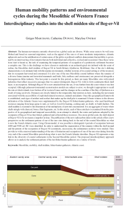
11-2024, tome 121, 3, p.421-443 - Grégor Marchand, Catherine Dupont, Marylise Onfray Human mobility patterns and environmental cycles during the Mesolithic of Western France: interdisciplinary studies into the shell midden site of Beg-Er-Vil
Human mobility patterns and environmental cycles during the Mesolithic of Western France
Interdisciplinary studies into the shell midden site of Beg-er-Vil
Grégor Marchand, Catherine Dupont, Marylise Onfray
Abstract: The human movements currently observed on a global scale are diverse. While some seem to be well established and based on seasonal migrations, such as the appeal of the sun or of more moderate temperatures, climatic upheavals such as the aridification of certain areas of the globe or political conflicts demonstrate that mobility is governed by an interweaving of movements that are both individual and collective, cyclical and occasional. Once these variations start to haunt us, the task of examining the temporal patterns of occupation of a prehistoric settlement becomes a complex one. This is the challenge we have chosen to undertake at an archaeological site imbued with the scent of iodine, the Mesolithic shell midden of Beg-er-Vil in South Britany (Quiberon, Morbihan). One of the site's defining characteristics is its intimate link with the marine environment, whether in terms of its coastal setting or of the resources that its occupants harvested and consumed. It is also one of the rare Mesolithic coastal habitats where the remains of a diverse fauna (marine and terrestrial mammals and birds, fish, molluscs and crustaceans) are preserved alongside a homogeneous lithic industry. This last point is crucial for this period, as there are many Mesolithic sites with mixed industries that reflect successive passages that we cannot distinguish. Beg-er-Vil, with its forty-centimetre-thick shell layer, is an exception. Although Beg-er-Vil is now attacked from the sea, it was further from the coast when it was first occupied. Although palaeoenvironmental reconstruction models are subject to error, we thought it appropriate to recall the rate at which islands were broken off in western France and the changes in the coastline of the Bay of Quiberon as a result of rising sea levels. Distances are closely linked to the temporality that interests us here, including the movement associated with the accessibility of exploited mineral resources, animals and plants. Once this geographical framework is established, each type of artefact and ecofact that makes up the shell pile is examined. It bears witness to the diverse utilization of the Atlantic Ocean were supplemented by the Beg-er-Vil fisher-hunter-gatherers, who used land-based resources ranging from large game to nuts, as well as wood for heating, cooking and, no doubt, to build shelters. The shell midden is essential to the illustration of the multiplicity of activities encountered. It is an aggregate of waste where shells mingle with charcoal, bones, flint fragments, etc. In this article, each of these artefacts is examined from the perspective of its geographical and temporal accessibility, in an attempt to identify the routes and patterns adopted by the occupants of Beg-er-Vil as they fished, gathered and collected these resources. On a more global scale, the shell deposit at Beg-er-Vil is by no means a snapshot in time. The publication of the new radiocarbon dates in this article offers a new perspective on the settlement pattern of one of the rare sites dating back to the end of the coastal Mesolithic on what is now the French Atlantic coast. Using Chronomodel, it was possible to distinguish 4 periods of occupation between 6400 and 5920 cal. BC were identified. In order to understand the organization of the remains within the shell mound and the pattern of the occupation of Beg-er-Vil (continuity, succession), the sedimentary archives were studied. They provide us with a renewed understanding of the rate of formation and occupation of one of the rare sites dating from the very end of the coastal Mesolithic period along what is now the French Atlantic shoreline. Beg-er-Vil represents a tiny link in the diversity of coastal settlements in the Second Mesolithic period. The proposed interdisciplinary approach allows us to analyse the settlement pattern of the last fisher-hunter-gatherers on a variety of levels.
Keywords: Mesolithic, mobility, shell midden, fisher-hunter-gatherers, Atlantic coast.
Résumé : Les mobilités humaines observées actuellement à l'échelle mondiale sont variées. Si certaines semblent bien rodées et calées sur des migrations saisonnières, comme l'attrait pour le soleil, voire pour des températures plus modérées, les bouleversements climatiques comme l'aridification de certaines zones du globe ou les conflits politiques montrent que les mobilités sont régies par une imbrication de déplacements à la fois individuels et collectifs, cycliques et exceptionnels. Certains évènements observés à l'échelle de nos vies humaines comme la mort massive de nos ainés liée à une canicule nous rendent humbles devant l'objectif fixé. Dès lors que que l'on garde à l'esprit ces exemples, la complexité à aborder le rythme d'occupation d'un habitat préhistorique est posée. C'est le défi que nous nous sommes fixés à partir d'un site archéologique, largement imprégné des effluves iodés qu'est l'amas coquillier mésolithique de Beg-er-Vil (Quiberon, Morbihan). Une de ses spécificités est son lien intime avec les environnements marins, que ce soit du point de vue de son implantation en contexte côtier, des matières premières ou des ressources alimentaires que ses occupants ont exploitées. Il est également un des rares habitats côtiers du Mésolithique côtier où les restes de faunes variés (mammifères et oiseaux marins et terrestres, poissons, mollusques, crustacés) sont conservés au côté d'une industrie lithique homogène. Ce dernier point est crucial pour cette période car nombreux sont les sites du Mésolithique aux industries mélangées reflets de passages successifs qu'il ne nous est pas possible de différencier. Avec ces quarante centimètres de couche coquillière Beg-er-Vil fait figure d'exception. D???autres sites auraient pu être de bons candidats, comme les amas coquilliers de Téviec ou d'Hoedic aussi localisés dans le Morbihan. Malheureusement, l'ancienneté de leurs fouilles, à un moment où la couche de coquille n'était considérée que comme du sédiment a gommé nombre d'informations spatiales, stratigraphiques mais aussi la diversité des vestiges archéologiques. La prise en compte dès la fouille de Beg-er-Vil de son caractère exceptionnel nous a amené à multiplier les observations de terrain qui n'ont eu que de cesse d'évoluer au fur et à mesure du développement même des disciplines de l'archéologie sur le temps court des fouilles qui a été de six ans et le temps long de la post-fouille qui à l'instar de Téviec et Hoedic à encore de nombreuses années devant elle. Beg-er-Vil ne se résume pas à son amas coquillier. Nos investigations à proximité de ces zones d'accumulation de déchets et de vie ont mis au jour l'existence de huttes témoignant de l'extension d'un site archéologique dont nous ne pouvons observer que des bribes. Cette vision partielle du site est importante, car elle est aussi visible dans les paysages actuels dans lesquels s'est implanté cet habitat préhistorique.
En effet, si Beg-er-Vil subit actuellement les assauts de la mer, il était sans doute légèrement en retrait du trait de côte lors de son fonctionnement. Si les modèles de reconstitution des paléoenvironnements sont accompagnés de marge d'erreur, il nous a semblé opportun de rappeler le rythme du morcellement des îles à l'échelle de l'ouest de la France et les modifications du trait de la baie de Quiberon induits par la remontée du niveau de la mer. En effet, ces modifications changent les distances d'un site à l???autre, mais aussi celle de Beg-er-Vil aux lieux de pêche, de collecte, de cueillette et de chasse. Ces distances ont un lien étroit avec la temporalité qui nous intéresse ici dont celle des déplacements liés à l'accessibilité des ressources minérales, animales et végétales exploitées.
Une fois ce cadre géographique posé, l'ensemble des artefacts composant l'amas coquillier est disséqué. Il témoigne à la fois des exploitations multiples de l'océan Atlantique par les pêcheurs-chasseurs-cueilleurs de Beg-er-Vil mais aussi de celles de milieux plus boisés avec des ressources d'affinité terrestre qui vont du gros gibier aux fruits à coque en passant par le ramassage du bois pour se chauffer, cuire sa nourriture mais aussi sans doute pour s'abriter. L'amas coquillier est central dans la description de la multiplicité de ces activités. Il est un agrégat de déchets où coquilles se mêlent aux charbons, ossements, éclats de silex??? Chacun de ces artefacts est interrogé du point de vue de son accessibilité géographique et temporelle pour tenter d'y déceler les parcours et les rythmes des occupants de Beg-er-Vil nécessaires à la pêche, la cueillette et la collecte voire le ramassage de ces ressources. A cette accessibilité théorique des ressources animales basée sur l'actualisme, d'autres instantanés sont recherchés comme par exemple la saison de collecte de certains coquillages abordée via la sclérochronologie. Pour le silex la question de la temporalité peut être approfondie en prenant en compte la diversité des outils taillés et confrontée aux modèles existants. Parmi les artefacts majeurs de la temporalité, les charbons sont centraux. Ils ont fait preuve d'une sélection méticuleuse pour mieux comprendre l'évolution du site au cours du temps. Les datations radiocarbones sont ainsi confrontées à la lecture stratigraphique de terrain. Elles aident à mieux comprendre la succession de l'utilisation de certaines structures comme les foyers ou fosses par exemple. Certaines de ces datations sont inédites, elles ont été multipliées pour tenter de déceler des phases d'occupation sur un site qui peut frapper par l'homogénéité de son industrie lithique.
Enfin, pour tenter d'approcher le rythme d'occupation de Beg-er-Vil (continuité, succession d'occupation) les archives sédimentaires sont interrogées. Elles permettent de nous donner une vision renouvelée du rythme de formation et d'occupation d'un des rares sites de la toute fin du Mésolithique côtier le long de notre actuel littoral atlantique français.
Beg-er-Vil représente un maillon infime de ce que pouvait être la diversité des occupations du littoral du second Mésolithique. L'approche interdisciplinaire proposée permet d'aborder le rythme d'occupation des derniers pêcheurs-chasseurs-cueilleurs à des échelles variées.
Mots-clés : Mésolithique, mobilité, amas coquillier, chasseurs-cueilleurs-pêcheurs, côte atlantique.
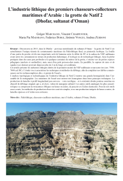
10-2024, tome 121, 3, p.399-417 - Grégor Marchand, Vincent Charpentier, Maria Pia Maiorano, Federico Borgi, Jérémie Vosges, Andrea Zerboni L?industrie lithique des premiers chasseurs-collecteurs maritimes dArabie : la grotte de Natif (Dhofar, sultanat
L'industrie lithique des premiers chasseurs-collecteurs maritimes d'Arabie : la grotte de Natif 2 (Dhofar, sultanat d'Oman)
Grégor Marchand, Vincent Charpentier, Maria Pia Maiorano, Federico Borgi, Jérémie Vosges, Andrea Zerboni
Résumé : Découverte en 2013, dans le Dhofar - province méridionale du sultanat d'Oman - la grotte de Natif 2 est actuellement l'unique témoin de communautés maritimes du Paléolithique final, en péninsule Arabique. La fouille d'une partie du porche révèle une importante activité humaine entre le début du IXe et le milieu du VIIIe millénaire avant notre ère, notamment en termes de production halieutique, d'écologie ou de technologie lithique. Ainsi la pêche pratiquée dans des eaux peu profondes et à quelques centaines de mètres de la grotte, s'oriente vers de petites espèces pélagiques (anchois et sardinelles), mais aussi d'un petit poisson-chat marin. En parallèle, la capture de raies et de squales (ces derniers pouvant dépasser plus de 2 m de long), est confirmée.
Cet article présente les industries lithiques datées de la première moitié du VIIIe millénaire avant notre ère (env. 7950-7600 cal. BC). L'étude vise à caractériser les techniques et méthodes de débitage, afin de compléter nos faibles connaissances sur les technocomplexes dits « à pointe de Fasad ».
L'analyse typologique et technologique de l'industrie lithique de Natif 2 montre une grande homogénéité dans l'ensemble de la stratigraphie. Les armatures de Fasad sont surtout très homogènes dans leurs principes techniques. La production de lamelles à profil longitudinal peu convexe - voire rectiligne - et à extrémité distale pointue constitue un objectif de débitage original, qui a, de facto, valeur de marqueur culturel. Les autres outils aménagés les plus caractéristiques se composent de troncatures obliques sur lames ou éclats, de perçoirs et d'éclats denticulés. Pour de tels outils assez courts, les méthodes de production observées sont très simples, avec une production intégrée de lames courtes, de lamelles épaisses et d'éclats non corticaux.
Mots-clés : Paléolithique, chasseurs-cueilleurs maritimes, mer d???Arabie, sultanat d???Oman, Dhofar.
Abstract: Discovered in 2013 in Dhofar, the southern province of the Sultanate of Oman, Natif 2 Cave stands as a witness to the maritime communities of the final Paleolithic in the Arabian Peninsula. The cave's entrance, located at the base of a 600-meter-high cliff from Jebel Samhan, underwent meticulous excavation during a campaign in 2016. These efforts uncovered compelling evidence of significant human activity spanning the early 9th to mid-8th millennium BC, offering unparalleled insights into early fishing practices, ecological dynamics, and lithic technology. The proximity of shallow waters, a few hundred meters from the cave, facilitated targeted fishing for small pelagic species, including anchovies, sardines, and a small marine catfish. The capture of larger marine species, such as rays and sharks exceeding 2 m in length, further attests to the diversity of prehistoric maritime pursuits.
This article delves into the lithic industries of Natif 2, specifically those dating to the first half of the 8th millennium BC (approximately 7950-7600 cal. BC). The focal point is the comprehensive characterization of knapping techniques and methods. Typological and technological analyses show the homogeneity prevalent throughout Natif 2's stratigraphy, presenting a consistent picture of cultural and technological practices.
The lithic assemblage, spanning the entire deposit and exhibiting over 540 pieces per square meter, provides a rich lithic record for this first exploration. Flint, featuring minimal thermal alterations, emerges as the primary raw material. Noteworthy is the diverse range of raw materials, including opaque black, blond, and translucent blond-orange flint adorned with manganese dendrites. Small flakes, constituting 43.8% of the total lithic material, are prevalent, characterized by their size (less than 10 mm).
Central to the lithic exploration are the Fasad points, distinctive projectile armatures of the Early Holocene. These points, though relatively small, not exceeding 40 mm in length, exhibit diversity in dimensions while maintaining uniformity in technical principles. Crafted from elongated non-cortical supports, typically rectilinear blades, the Fasad points feature a pointed unmodified distal end, axial symmetry, direct and abrupt retouching of the stem. Moreover, traces of use and accidental breakage provide valuable insights into their functional axis.
Beyond Fasad points, the lithic assemblage includes an array of tools, such as truncations, borers and denticulates. Truncations, along with tools featuring chipped edges, suggest multifaceted functional applications, encompassing scraping and cutting.
Furthermore, the lithic production at Natif 2 is marked by an opportunistic utilization of various raw materials for expedient purposes. A recurrent method involves the production of longitudinally convex or rectilinear bladelets with pointed distal ends, achieved through direct unidirectional hard percussion.
The typological and technological analysis of Natif 2 lithic industry unveils a remarkable homogeneity across the stratigraphy. Fasad points and associated tools manifest a simplicity of production methods conceived for relatively short tools. This system, reminiscent of expedient techniques in European prehistory, attests to its adaptability in highly mobile human contexts. The low pre-determination aligns with the abundance of materials in traversed territories, eliminating the need for reshaping or producing anticipatory toolkit replenishment.
The abundant marine remains in Natif 2's stratigraphic sequence, including fish bones and mollusk shells, raise intriguing questions about maritime adaptations. The study underscores the necessity for future functional analyses to unravel the potential involvement of lithic tools in diverse maritime activities, especially in processing soft animal materials.
The article offers a preliminary analysis of the site and its lithic component for understanding of the trajectories of these ancient communities in the territory during the final stage of the Palaeolithic. The juxtaposition of diverse technical systems contributes to a nuanced exploration of cultural and technological adaptations, enriching our comprehension of Southern Arabia prehistoric societies.
Keywords: Palaeolithic, maritime hunter-gatherers, Arabian Sea, Sultanate of Oman, Dhofar.
09-2024, tome 121, 3, p.373-396 - Grégor Marchand, Nicolas Naudinot, Stéphan Hinguant Les industries lithiques de la fin du Paléolithique et du Mésolithique de la grotte Rochefort (Saint-Pierre-sur-Erve, Mayenne)
Les industries lithiques de la fin du Paléolithique et du Mésolithique de la grotte Rochefort (Saint-Pierre-sur-Erve, Mayenne)
Grégor Marchand, Nicolas Naudinot, Stéphan Hinguant
Résumé : La situation particulière, pour le Massif armoricain, du « canyon » de Saulges, avec son contexte karstique et la conservation, exceptionnelle dans la région, de restes osseux parfaitement fossilisés, confèrent aux sites de la vallée de l'Erve une extraordinaire valeur scientifique. En préalable à la fouille des couches solutréennes encore en place dans la grotte Rochefort, les niveaux les plus récents ont fait l'objet d'investigations entre 2001 et 2005. Sous les couches médiévale et antique, un dépôt funéraire gaulois scellait un petit horizon attribué l'âge du Bronze. Puis, à vingt centimètres sous la surface de circulation actuelle, sont apparus les premiers niveaux préhistoriques proprement dits, en l'occurrence un horizon principalement rapporté au Mésolithique final, scellé entre deux planchers stalagmitiques, et une occupation du Paléolithique supérieur injectée en surface d'un dépôt argileux archéologiquement stérile attribuable au Tardiglaciaire. Mais leur faible épaisseur sédimentaire respective a engendré de nombreux mélanges, les fréquentations plus récentes de la cavité, comme les fouilles anciennes du xixe siècle, ayant de leur côté également perturbé ces couches. Pourtant, les deux unités ont pu être discriminées sur la base des corpus fauniques mis au jour, caractérisés par des cortèges adaptés aux conditions environnementales de chaque période, typiques de la seconde moitié du Tardiglaciaire pour les occupations du Paléolithique supérieur et plus tempérés pour le Mésolithique. Mais c'est surtout à partir des artefacts lithiques, comptant une forte proportion d'outils retouchés, que les deux unités peuvent être restituées, même si une approche préliminaire des matières premières mises en oeuvre illustre certaines similarités dans les géoressources exploitées. Attestant d'occupations éphémères de la cavité, possiblement dans le cadre d'activités orientées, les industries lithiques du Paléolithique supérieur et du Mésolithique de la grotte Rochefort sont de toute première importance car elles témoignent de deux périodes et techno-complexes qui, aujourd'hui bien définis sur le plan régional, sont encore trop peu documentées dans l'Ouest de la France.
Mots-clés : Laborien, Tardiglaciaire, Paléolithique supérieur, Mésolithique, industrie lithique, Massif armoricain.
Abstract: The particular situation of the Saulges "canyon" in the Armorican Massif, with its karstic context and the preservation, exceptional in the region, of perfectly fossilized bone remains, give the Erve valley sites a special scientific value. Prior to the excavation of the Solutrean layers still in place in the Rochefort cave, the most recent levels were investigated between 2001 and 2005. Beneath the medieval and Antic layers, an Iron Age funerary deposit sealed a small horizon attributed to the Bronze Age. Then, twenty centimeters below the current circulation surface, the first prehistoric levels appeared, in this case a horizon essentialy dating back to the Final Mesolithic, sealed between two stalagmitic floors, and a Late Paleolithic occupation injected into the surface of an archaeologically sterile clay deposit attributable to the Lateglacial. However, their respective low sedimentary thicknesses have led to numerous mix-ups, with more recent use of the cave, such as early 19th-century excavations, also having disturbed these layers. However, the two units can be discriminated on the basis of the faunal corpus unearthed, characterized by groups adapted to the environmental conditions of each period: typical of the second half of the Lateglacial for the Final Paleolithic occupations and the more temperate Early Holocene for the Mesolithic. But it's mainly from lithic artefacts, with a high proportion of retouched tools, that the two units can be reconstructed, even if the lithic raw materials used are very similar. The Late Upper Paleolithic and Mesolithic lithic industries from the Rochefort cave are of prime importance, as they bear witness to two periods and techno-complexes that, although now well-defined at regional level, are still under-documented in western France.
Keywords: Laborian, Lateglacial, Upper Paleolithic, Mesolithic, lithic industry, Armorican Massif

08-2024, tome 121, 2, p.307-330 - Cicolani V., Huet Th.., Zamboni L. (2024) Modélisation des interactions en Italie du Nord au premier âge du Fer : de la circulation de parures aux réseaux dinfluences culturelles
Modélisation des interactions en Italie du Nord au premier âge du Fer : de la circulation de parures aux réseaux d'influences culturelles
Veronica Cicolani, Thomas Huet, Lorenzo Zamboni
Résumé : Dans les approches traditionnelles fondées sur les sources écrites, le plus souvent postérieures et reflétant un point de vue extérieur, les cultures archéologiques de l'Italie du Nord sont souvent définies comme étant des entités autonomes (peuples), caractérisées par des productions spécifiques et surtout délimitées par des frontières géographiques et culturelles clairement établies. Dans le cadre du projet ANR JCJC Itineris (https://itineris.huma-num.fr/), consacré à l'étude des pratiques artisanales en Italie nord-occidentale au premier âge du Fer, le réexamen critique de la documentation et l'analyse des nouvelles données permettent d'aborder sous un autre angle de vue les relations entre entités culturelles et territoriales, dépassant l'interprétation dichotomique et hiérarchique de centre-périphérie et les approches culturalistes. Il est alors possible d'interpréter les processus d'interaction entre entités dites marginales à travers une modélisation des données archéologiques. Cet article propose donc de réexaminer les rôles des populations décrites comme périphériques dans les réseaux d'interactions et de transferts technoculturels avec les grands « centres » : domaines culturels de Golasecca, ligure, étrusque et Este. Le corpus retenu rassemble plus de 2000 objets en alliage à base cuivre, essentiellement des parures et des déchets liés à leur fabrication, issus tant des habitats que des contextes funéraires, bien documentés et localisés dans le Piémont méridional (communautés indigènes de Ligurie intérieure) et en Émilie occidentale (communautés indigènes du secteur occidental de la plaine du Pô). Par l'application de modèles statistiques (programmation R et analyse des réseaux), l'objectif a été de visualiser et ordonner ces données, complexes et hétéroclites, afin de dégager une première typologie dynamique de réseaux et de sous-réseaux connectés, reliant entités périphériques et grands domaines culturels selon des géométries variables. Pour cela faire, le corpus, qui fait l'objet de publications et révisions récentes, a été structuré sur la base de descripteurs hiérarchiques et sa caractérisation (typologie, contexte et quantification) complétée par l'ajout d'une variable qualitative, ici nommée « style ». Ce critère, issu de l'étude morphostylistique de chaque objet, a pour rôle de traduire en termes factuels les goûts/adaptations locales de modèles et types suprarégionaux, permettant ainsi de modéliser les rapports d'influence culturelle entre communautés. La modélisation, fondée sur la théorie des graphes et l'application d'algorithmes de détection de communautés (ici edge.betweenness.community, du package "igraph" de R), permet d'évaluer le degré d'importance et de proximité entre les groupes par segmentation hiérarchiques des liens, aboutissant ainsi à l'identification d'ensembles cohérents (communautés de caractères). Appliquée pour chaque période, les résultats de cette modélisation sont ensuite représentés sur une carte pour faciliter la lecture spatiale et l'interprétation géographique des résultats obtenus. Cette démarche a mis en évidence le rôle majeur des fibules en tant qu'élément vestimentaire et ornement le plus adopté et adapté, tant sur le plan morphologique que stylistique et technique. Néanmoins, sa présence diffuse dans l'ensemble de l'Italie du Nord finit par masquer la reconnaissance et la circulation de certaines connexions plus spécifiques, soulevant le problème de l'usage de ce marqueur en tant qu'indicateur privilégié de mobilité ou d'identité culturelle. Si l'influence de Golasecca est attestée le long de toute la période ici considérée, des interactions plus localisées et centrées sur des classes spécifiques d'objets dévoilent un jeu subtil d'influences qui traduit des relations à géométrie variable, jamais univoques et unidirectionnelles, et où productions locales, adaptations, créativité et importations décrivent des réalités sociales en mouvement et d'une complexité croissante.
Ainsi, cette étude comparative des types et des styles de vêtements anciens et leur mobilité permet d'explorer plus en profondeur la nature de leurs interactions, tout en clarifiant, par la même occasion, l'impact de leur diffusion à courte et moyenne échelle en Italie du Nord.
Mots-clés : Âge du Fer, Italie du Nord, réseaux, modélisation des interactions, identités matérielles, parures, influence culturelle, périphéries.
Abstract: In traditional approaches based on written sources, most often posthumous and reflecting an external point of view (etic), Italian archaeological cultures are often defined as autonomous entities (peoples), characterized by specific productions and sharing clearly established geographical boundaries. Within the framework of the ANRJC Itineris (https://itineris.huma-num.fr/), focusing on the study of craft practices in north-western Italy during the first Iron Age, the critical re-examination of the documentation and the analysis of new data allows us to approach the interactions between cultural entities from another angle, going beyond the dichotomous and hierarchical interpretation of centre-periphery, and thus to be able to interpret the phenomena of cultural interactions between so-called marginal entities through a modelling of the archaeological data. This paper therefore proposes to re-examine the roles of italic populations described as peripheral within the networks of interaction and technocultural transfers that developed in the early Iron Age in northwestern Italy. By applying statistical and spatial data modelling (R program and Graph theory), it is possible to visualise and order complex and heterogeneous data, such as archaeological records, as well as to identify a dynamic typology of connected networks and sub-network. The selected data set includes more than 2000 copper-based alloy objects, mainly ornaments and the waste products associated with their production, from both settlements and funerary contexts, well documented and located in southern Piedmont (indigenous communities in Inner Liguria) and western Emilia (indigenous communities in the western sector of the Po valley). By applying statistical models (R programming and network analysis), the aim was to be able to examine and classify this complex and heterogeneous data, in order to identify a first dynamic typology of connected networks and sub-networks, linking neighbouring entities and major cultural areas according to variable geometries. This data set, which has recently been published and revised, has been structured on the basis of hierarchical descriptors, and its characterization (typology, context and quantification) has been completed by adding a qualitative variable, here called 'style'. The role of this factor, based on the morphostylistic study of each object, is to translate into factual terms the local tastes/adaptations of supra-regional models and types, thus making it possible to model the relationships of cultural influence between communities. The modeling, based on graph theory and the application of community detection algorithms (here edge.betweenness.community, from 'igraph' R package) enables the degree of importance and proximity between groups to be assessed by hierarchical segmentation of links, in order to identify coherent clusters. By breaking the links between sub-groups of nodes, we can identify groups of nodes that share more with each other than they share with the other nodes in the graph (communities of attributes). Applied for each period, this segmentation is represented on a map by assigning the color of the groups (clusters) to the sites, thus facilitating spatial reading and geographical interpretation of the results. The visual analysis of the graph, or the statistical analysis of the network, is in fact both a model and a powerful formalism, but it is no substitute for the archaeological and historical interpretation of the data. This approach has highlighted the major role played by fibulae as the most widely adopted and adapted item of clothing and ornament, in terms of morphology, style and technique. Nevertheless, their widespread occurrence across the whole of northern Italy ultimately masked the identification and circulation of more specific connections, raising the issue of the use of this marker as a key indicator of mobility or cultural identity. While the influence of Golasecca is attested throughout the period under consideration here, more localised interactions based on specific classes of objects reveal a sophisticated interplay of influences that reflects relationships with variable geometry, never unambiguous or unidirectional, and where local production, adaptation, creativity and imports describe social realities on the move and of growing complexity.
Starting from this point of view, the comparative study of clothing item types and styles has allowed us to explore more deeply their interactions, clarifying, by the same way, the impact of their dissemination in a medium scale: Northern Italy. Highlighting these dynamic, non-exclusive links based on creativity and adaptation, rather than on predefined geographical or cultural boundaries, illustrates how these boundaries are socially negotiated and dynamically recomposed over time, defying the traditional, unidirectional perception of a hierarchical structure of dependence between center and periphery.
The goal is to produce operational distinctions between local productions, imports, imitations, and local transformations. By modelling the fashion tradition through the analysis of shared clothing items, this paper would like to propose a critical review of the markers of cultural identity, mobility, interaction traditionally used looking for alternative theoretical interpretation and social narrative of the role of indigenous communities in the North Italic trade et craft activities.
Keywords: First Iron Age, Northern Italy, networks, interaction modeling, material cultures, ornaments, buffer zones, cultural influence.
07-2024, tome 121, 2, p.243-305 - Panloups É., Bonnaire E., Cadart J., Fechner K., Lecher É., Monchablon C., Onfray M., Paulmier T., Salavert A. (2024) Architectures domestiques et activités économiques au Néolithique final : lhabitat de Rebreuve-Ranch
Architectures domestiques et activités économiques au Néolithique final
L'habitat de Rebreuve-Ranchicourt (Pas-de-Calais)
Élisabeth Panloups, Emmanuelle Bonnaire, Justine Cadart, Kai Fechner, Élodie Lecher, Cécile Monchablon, Marylise Onfray, Thibaud Paulmier, Aurélie Salavert
Résumé : Nouvelle découverte d'habitat structuré dans la sphère d'influence du complexe culturel de Deûle-Escaut, le site de Rebreuve-Ranchicourt a livré les vestiges de trois bâtiments diachroniques, dont une partie de la chronologie a pu être retracée. La grande particularité de cette occupation est la découverte d'un mobilier riche et varié qui a permis d'engager une réflexion sur la spatialisation des activités au sein et autour de la maison. Cet habitat vient également compléter les informations pour la chronologie interne du Néolithique final. Ainsi le site de Rebreuve-Ranchicourt semble pouvoir se placer dans une étape moyenne du Néolithique final, tel qu'il est actuellement défini, notamment par l'absence d'éléments campaniformes. Ces résultats se heurtent toutefois à des dates chronométriques plus tardives, concordant avec une étape terminale de la fin du Néolithique. D'autres questions, d'ordre géographique, se posent sur l'homogénéité culturelle du Deûle-Escaut. A l'échelle du Nord-Pas-de-Calais, les sites livrant un ou plusieurs plans de bâtiment apparaissent groupés sur deux zones distinctes. Les principaux habitats Deûle-Escaut sont regroupés, comme leur nom l'indique, le long des vallées de la Deûle et de l'Escaut, incluant les vallées secondaires de la Scarpe et de la Sensée. Les sites situés au nord des vallées de la Lys de l'Aa marquent une seconde concentration d'habitats située à environ 40 km au nord-est des sites les plus proches de la vallée de Deûle. La découverte de Rebreuve-Ranchicourt occupe une position géographique un peu particulière, à mi-chemin de ces deux pôles. La comparaison de l'ensemble de ces habitats, localisés sur un très large périmètre, laisse entrevoir des différences au niveau de la culture matérielle, comme les décors céramiques ou la part des matériaux siliceux exogènes, questionnant sur les sphères d'influences et les contacts entre les communautés de la fin du Néolithique.
Mots-clés : France du Nord, Néolithique final, chronologie, habitat, bâtiment, micromorphologie, céramique, lithique, macrolithique, carpologie, anthracologie, phosphore.
Abstract: At the scale of Nord-Pas-de-Calais, the main habitats of Deûle-Escaut are grouped together, as their name suggests, along the valleys of the Deûle and the Scheldt, including the secondary valleys of the Scarpe and the Sensée. This sector includes more than a dozen sites. To the north of the Lys basin and at the junction with that of the Aa, three other sites mark a second concentration of habitats located about 40 km northeast of the Deûle valley sites.
The discovery of Rebreuve-Ranchicourt occupies a somewhat particular geographical position, halfway between these two poles. This occupation includes three diachronic buildings, to which two pits can potentially be attached. The multidisciplinary approach put in place has made it possible to address several aspects of this occupation, from the construction of the buildings to their abandonment, focusing on the domestic, agricultural, and craft activities that took place inside and around the dwellings.
The two large buildings of Rebreuve-Ranchicourt find elements of easy morphometric comparison in the Deûle-Escaut cultural sphere, with a certain homogeneity in the length of the buildings, generally between 17 and 26 meters long. Building 1000, of smaller size, is rarer.
One of the major interests of the Rebreuve-Ranchicourt habitat site is its building 200. The construction methods are unusual, with oversized foundations that remain difficult to interpret. A reconstruction phase of part of the building could be considered, but has not been highlighted through the various stratigraphic and micromorphological studies. Similarly, a simple abandonment of the building does not explain the impressive quantities of discovered artifacts and in such good condition. In fact, this material data is rare in dwellings. Generally, it is not the foundation structures that yield artifacts, but the pits and occupation levels associated with the houses. For us, the field data and studies conducted on the site converge towards the highlighting of a complete destruction of the building, probably accompanied by a recovery of timber. The homogeneity of the archaeological material and the absence of alterations testify to conditions of rapid burial compatible with a deliberate leveling action. One plausible explanation for this leveling may be related to the erection of a new building nearby, building 700.
Thanks to the destruction of this building, many traces of the daily life of its occupants have been preserved over several millennia. While the entire lithic corpus fits perfectly into the known acquisition, management, and production patterns of flint tools for the Deûle-Escaut cultural group, the scarcity of finished products in exogenous materials raises questions about its integration into networks of circulation of highly valued objects. The discovery of a Bartonian flint blade during the nearby excavation of Houdain could indicate an insertion of these populations into networks of object circulation that may be broader than suggested by the assemblage from the buildings. The general composition of the series and the macrolithic tooling is comparable to the productions of sites in the Deûle-Escaut group with building plans. Quantitatively, it is a small series, characterized by fragmentation and significant recovery of supports. The types of tools are also in line with the regional Late Neolithic assemblages: hammerstones, burins, and intermediate pieces. While the cup-shaped grinding stone does not stand out in the Late Neolithic productions, this tool is less frequently encountered than rimmed grinding stones. It raises questions about the possible significance of this morphological difference: functional, chronological, or other. The ceramic assemblage finds its best comparisons with sites located further north in the Lys valley, with the same decorative registers of smooth or digitate cords placed under the rim or in rupture of the body. These decorations exist in the Deûle valley corpus, but in a more discreet manner. The absence of short-necked and high-keeled vessels at Rebreuve-Ranchicourt, and generally in the sites of the Lys valley, constitutes another notable difference with the eastern Deûle-Escaut occupations. The presence of decorated ceramics and the absence of bell-beaker pottery sherds invite placing this corpus in the middle phase of the Deûle-Escaut cultural complex.
Thus, the cross-referencing of the furniture studies agrees to integrate the Rebreuve-Ranchicourt site within the Deûle-Escaut cultural complex. The sites located north of the Lys valley find comparative parallels sometimes more relevant with the Rebreuve-Ranchicourt occupation than the sites located to the east. Furniture studies have also focused on the spatialization of activities carried out inside and outside of this dwelling, with debatable results. Projecting a functional determination near the place of discovery of the movable remains is tempting, but the exploitation of the results obtained lacks convincing parallels for the interior of dwellings. Furthermore, it remains difficult to clearly attribute the furniture to the occupation of the building itself. Finally, the characterization of actions laden with meaning, such as breaking a complete millstone and placing it in a former post hole, remains difficult to grasp and could only be interpreted from a functional point of view.
This habitat also complements the information for the internal chronology of the Late Neolithic. Thus, the Rebreuve-Ranchicourt site seems to be able to be placed in a middle stage of the Late Neolithic, as it is currently defined, notably by the absence of bell-beaker elements. However, these results are confronted with later chronometric dates, coinciding with a terminal stage of the Late Neolithic.
Keywords: Northern France, Late Neolithic, chronology, habitation/dwelling site, building, micromorphology, ceramics, lithics, macrolithics, carpology, anthracology, phosphorus.
06-2024, tome 121, 2, p.211-241 - Brunet V., Millet-Richard L.-A., Durand J., Gosselin R., Blaser R. (2024) Des croissants au pays des « livres de beurre » à la fin du Néolithique
Des croissants au pays des « livres de beurre » à la fin du Néolithique
Véronique Brunet, Laure-Anne Millet-Richard, Juliette Durand, Renaud Gosselin, Romana Blaser, avec la collaboration d'Ève Boitard-Bidaut
Résumé : La découverte récente en contexte préventif de croissants en silex en Île-de-France, en dehors de la Touraine où ils ont été identifiés la première fois, est l'occasion de s'interroger sur cet outil si particulier et rare. L'objectif de notre recherche était de recenser cet objet dans la bibliographie à l'échelle nationale et hors des frontières de l'Hexagone, d'en déterminer le nombre, les contextes de découverte, sa fonction et la place qu'il occupe au sein des productions de la fin du Néolithique.
Les croissants sont des objets plutôt rares, une quarantaine est connue à ce jour dans toute la France. On les trouve essentiellement dans deux régions, en Touraine et en Île-de-France. On les rencontre le plus souvent dans les habitats, mais ils apparaissent également en contexte minier, d'atelier de taille du silex et même sépulcral.
Ils se caractérisent par une morphologie particulière avec l'aménagement de deux pointes. Peu de dissemblances sont lisibles dans les dimensions de l'outil, mais l'aménagement des bords diffère d'une région à l'autre, il est systématique en Touraine à l'inverse des exemplaires franciliens. Les pointes des croissants tourangeaux sont bien dégagées, tandis que les franciliennes apparaissent avec une convexité plus accentuée.
De nouvelles recherches sur leur fonction ont permis de compléter les premières analyses tracéologiques des croissants tourangeaux qui n'avaient pas été concluantes en raison des états de surface. Les résultats tendent à montrer que les traces d'usage ne sont généralement pas observées dans l'encoche à l'exception de l'une d'entre elles qui atteste d'un contact avec une matière dure d'origine animale ou végétale. Le bilan de l'analyse fonctionnelle est faible mais permet de s'interroger sur le traitement des pointes, dont un certain nombre s'avère cassé et/ou ébréché ce qui pourrait être compatible avec un contact plus ou moins violent avec une matière dure animale ou végétale.
Mots-clés : croissant, Néolithique récent, Néolithique final, Le Grand-Pressigny, Touraine, Île-de-France.
Abstract: A recent discovery of flint croissants in a preventive excavation in Île-de-France, outside the area where they were first discovered in Touraine, provided an opportunity to investigate this rather particular artefact. A search was made in the literature published both within and outside France, in order to determine the numbers of croissants and their find contexts, as well as to examine their function and role in later Neolithic flint production.
Croissants are quite rare objects, as about forty are currently recorded for the whole of France. Occurring in two regions, Touraine and Île-de-France, they are most often found in settlements, but also appear in mining, workshop and even burial contexts.
Of the thirty or so croissants known in the Grand-Pressigny area, twenty-two were discovered in the commune of Abilly (Indre-et-Loire), thirteen of which come from excavations on the Foulon site and one other from La Madelone, about 1 km to the north-west. In the Île-de-France region, croissants are still few and far between, with six examples and only one per occupation. Two come from sites in the north of the Seine-et-Marne département, located in the river Marne valley and less than 5 km apart. There is one example in the Loiret département, another from the Val d???Oise and lastly there are two from the Yvelines.
This tool is generally made from local raw materials. The morphology is particular, due to the creation of two tangs. Although there is little difference in tool dimensions between the two regions, the shaping of the edges differs from one region to another. The edges are systematically retouched in Touraine, while this is not always the case in Île-de-France. The Touraine croissants have clearly defined tangs, whereas the Île-de-France croissants appear less concave.
While selected flakes may have been specifically produced by hard direct percussion, some flakes from the Grand-Pressigny area are derived from the preparation or maintenance of "pound of butter" (livre de beurre) cores. The croissants were most often produced along the axis of the flakes, with retouched tangs on each of the two lateral ends. The retouch was done by hard hammer. The lengths croissants vary from 32 to 65 mm in Touraine and from 25 to 90 mm in Île-de-France. In Touraine widths are between 29 and 93 mm and in Île-de-France between 33 and 146 mm. The Touraine croissants are mostly between 10 and 19 mm thick, whereas in Île-de-France thickness ranges from 6 to 23 mm.
While the croissants from Touraine and western Île-de-France can be grouped in the same family because of their similarity in shape, the eastern Île-de-France croissants are more difficult to include as they deviate from the norm. This suggests that they are probably different objects. In fact, the morphology of the croissant from Coupvray in Seine-et-Marne has little in common with the broad family of croissants. Nevertheless, it does show similarities in function with the Touraine examples, as indicated by similar use-ware flaking observed on the barbs of the tool.
The initial use-wear analyses of the Touraine croissants were not conclusive, due to the surface conditions. The new study undertaken here generally shows that no traces of use can be observed in the concavity, with one exception attesting to contact with a hard material of animal or vegetable origin. The result of the functional analysis is thus limited but does raise questions about the treatment of the tangs, some of which are broken and/or chipped, which could be compatible with more or less violent contact with a hard animal or plant material.
In the Île-de-France region, croissants are frequently associated with flaked axes. Other associated tools vary greatly from one area to another. In Touraine, fourteen different categories of tools are recorded, mainly daggers, micro-denticulates, notched side-scrapers, retouched blades, scrapers etc.
In Île-de-France, the tool categories are more numerous, with up to twenty different categories in the west and a dozen in the east. This is probably due to the context in which the tools were found, with the composition of the associated tools differing between workshops and settlements, with a majority of bifacial pieces with active cutting edges in the former and scrapers in the latter.
The croissants from Île-de-France may possibly be older than their counterparts in Touraine, since the latter are associated with occupations dated to the Final Neolithic. In Île-de-France, croissants are found in the Late Neolithic and perhaps even as early as the Middle Neolithic at Adon (Loiret).
Since only two regions have so far produced evidence for croissants, in different proportions, this raises the question of the origin of the tool type. Was it mainly produced in Touraine, spreading to Île-de-France with the Pressignian phenomenon, or the reverse from east to west?
Keywords: croissants, late Neolithic, final Neolithic, Grand-Pressigny, Touraine, Île-de-France.
05-2024, tome 121, 2, p.187-210 - Schmitt A., Gasnier M., Bovagne M., Negroni S., Reggio A., Van Wiligen S. (2024) Une sépulture du Néolithique moyen liée à la pratique de la crémation sur le site de Piechegu (Bellegarde, Gard)
Une sépulture du Néolithique moyen liée à la pratique de la crémation sur le site de Piechegu (Bellegarde, Gard)
Aurore Schmitt, Marion Gasnier, Marilyne Bovagne, Sabine Negroni, Adrien Reggio, Samuel van Willigen et la collaboration de Blandine Lecomte-Schmitt
Résumé : Le site de Piechegu (Bellegarde, Gard) fouillé par l'Inrap en 2016, a livré, entre autres, 140 structures s'échelonnant entre le VIe et le IVe millénaire avant notre ère. Parmi les vestiges funéraires néolithiques, qui témoignent surtout de la pratique de l'inhumation, une sépulture secondaire à crémation a été découverte ainsi qu'une trentaine de fosses datées du Néolithique moyen 2. La structure 3614, datée entre 4250 et 4000 avant notre ère, contenait des restes humains calcinés accompagnés d'un mobilier constitué de onze récipients en céramique, neuf armatures, deux lames de hache et un objet en bois. Si les différents types d'objets représentés ne se démarquent pas de ce qui est connu par ailleurs dans la région, leur nombre est plus surprenant et fait de FS3614 une des plus riches sépultures du Néolithique moyen du Midi de la France, tous types de traitement des défunts confondus. De plus, la disposition des objets dans la sépulture n'est pas aléatoire et témoigne d'une véritable mise en scène impliquant des tris sur le bûcher.
La pratique de la crémation est attestée dans le Néolithique moyen méditerranéen depuis les découvertes du Vallon de Gaude à Manosque et du Camp del Ginebre à Caramany dans les années 1990. Avec une trentaine d'occurrences, ce type de traitement des corps peut être considéré actuellement comme l'une des composantes du système funéraire du Néolithique moyen méditerranéen. Cela nous conduit à poser la question du statut des défunts qui ont bénéficié de ce traitement à une période où peu de morts bénéficient d'un enfouissement.
Mots-clés : crémation, Néolithique moyen, midi de la France, céramique, lithique, objet en bois, restes osseux brûlés.
Abstract: The Piechegu site (Bellegarde, Gard, fig. 1) excavated by Inrap in 2016 yielded a structure (3614) located in a group of fifteen features dating from the late 5th millennium (fig. 3) and attesting the practice of cremation. The circular pit had a diameter of one meter, a bowl-shaped profile and a preserved depth of 30 cm (fig. 4). An oval, wooden object was placed on the bottom of the pit (fig. 4, 12 and 13), with a laddle in a bowl with an internally thickened, everted rim (fig. 4, 5 nos. 3 and 6, fig. 13). The remains of the pyre containing some of the deceased's bones, as well as arrowheads and a few ceramic fragments, were then thrown into the pit, forming a layer of fifteen centimeters. A level of sediment a few centimeters, devoid of archaeological material, seems to have sealed off this first deposit. Most of the archaeological material (arrowheads, axe blades and ceramics) was discovered on top of this layer (fig. 4 and 14). The pit was then backfilled by about ten centimeters of carbonaceous sediment.
Only one adult-sized represented by 487 g of mostly calcinated white bones, was identified. The burnt remains of the individual were not entirely removed from the crematory structure. The ceramics consist of a minimum of eleven vessels : two vases with S-shaped profile (fig. 5, nos. 1 and 2), two vases with spherical or elliptical bodies (fig. 7, nos. 2 and 3), two plates with decorated rims (fig. 6, nos. 1 and 2), the lower part of a vase support with a decorated base (fig. 7, no. 1), a vase with a low inflection, a straight, closed upper part and a perforated cordon (fig. 5, no. 5), a bowl with an internally thickened, everted rim (fig. 5, no. 3) and, finally, fragments of two ladles (fig. 5, nos. 4 and 5). At least some of the ceramics show evidences of high-temperature exposure: flaking surfaces and eroded breaks. The series as a whole is characterized by high quality production, showing the craftsmanship of fine and robust ware. Nine sharp flint arrowheads and two axe blades made of tenacious rock (fig. 11) were uncovered in the fill of structure 3614. The geometric bitroncatures have been burnt intensely, causing very severe weathering. The small wooden vessel is made of deciduous oak. Such vessels are relatively rare for the Neolithic period, due to the special conditions required for their preservation.
The radiocarbon date of a charcoal (Poz-90710 5310 ± 40 BP) places the feature 3614 to the last third of the 5th millennium BC. The ceramic corpus is comparable to the range of forms and decorations attested in several Middle Neolithic Mediterranean assemblages. They correspond to a cultural group described by different authors as Early Chassean (see, for example, Georjon and Léa, 2013) or Chassey-type Middle Neolithic (van Willigen et al., 2020).
Considered an anecdotal funerary practice since the 1990s, after the discovery of the Caramany and Vallon de Gaude sites, cremation is now attested by 33 structures on at least ten sites. For the most part, these are secondary cremation deposits reserved to adult-sized individuals. These deposits are not associated with burials and, like burials, are either isolated (as at Piechegu) or form groups of around ten structures. Bones are highly fragmented and are partially collected at the pyree before being transferred and deposited in a receptacle (pit or, in one case, ossuary vessel). In most cases, secondary cremation deposits are accompanied by objects (sherds, arrowhead, axe blades, fragments of tools made in animal bones) that went through high temperatures. The practice of cremation belongs therefore to the funerary system of southern France. Structure 3614 shares several caracteristics with other cremations: the combination of arrowhead and axe blades, the partial removal of the burnt human remains and the deposition of burnt objects. However, the structure 3614 has several peculiarities. The deposition of certain objects is not random, and clearly shows that the burnt objects were sorted and placed in the grave in a precise order. Moreover, with at least eleven ceramic vessels, one wooden vessel, nine arrowhead and two axe blades, this feature at Piechegu is one of the richest Middle Neolithic burials in the region.
Keywords: cremation, Middle Neolithic, South of France, ceramic, lithic, wooden object, burned human remains.
04-2024, tome 121, 2, p.151-186 - Vignoles A., Caillo A., Banks W.E., Klaric L. (2024) SIGMENT : une base de données bibliographique critique pour estimer la répartition géographique des unités archéologiques lithiques du Gravettien moyen et récent en F
SIGMENT : une base de données bibliographique critique pour estimer la répartition géographique des unités archéologiques lithiques du Gravettien moyen et récent en France
Anaïs Vignoles, Arnaud Caillo, William E. Banks, Laurent Klaric
Résumé : Cet article présente la base de données SIGMENT (Sites du Gravettien Moyen et récent), dont l'objectif est d'estimer de manière fiable et reproductible la distribution géographique des unités archéologiques lithiques du Gravettien moyen et récent en France et dans ses marges. Nous avons collecté des données sur 254 collections archéologiques provenant de 166 gisements situés en France, en Belgique, en Espagne, en Italie et en Allemagne, à partir de 196 références bibliographiques, ainsi que sur base de l'examen de plusieurs collections. Nous avons ensuite établi une grille d'analyse qualitative permettant d'évaluer la fiabilité de la présence des unités archéologiques étudiées dans chaque localité. Le résultat de cette évaluation montre qu'une partie importante des occurrences n'est pas totalement fiable, et nous conseillons donc de ne pas les intégrer dans des modèles qui se focalisent sur la distribution géographique de ces unités archéologiques. A partir de l'étude historiographique et archéologique de plusieurs collections du sud-ouest de la France (Le Fourneau du Diable, le Facteur, la Rochette, Laussel, les Jambes, les Artigaux, la Roque Saint-Christophe, Lespaux, Tourtoirac, Grotte XVI, Combe-Saunière, le Flageolet I, Solvieux), nous discutons ensuite des facteurs qui ont pu influencer la sur- ou sous-estimation de la présence de ces unités archéologiques lithiques à partir d'un recensement strictement bibliographique, en particulier la variabilité des approches analytiques, des méthodes de fouille et des méthodes de conservation ainsi que la façon dont les ensembles archéologiques sont décrits dans la littérature. La base de données critique qui résulte de ce travail pourra être utilisée par des chercheur·euse·s souhaitant explorer la répartition spatiale d'éléments typo-technologiques recensés pour les unités archéologiques du Gravettien moyen et récent ou souhaitant implémenter la structuration de cette base de données à leurs propres inventaires de sites.
Mots-clés : Gravettien, base de données, industrie lithique, recensement, histoire des fouilles, Paléolithique supérieur.
Abstract: The SIGMENT database was created in the framework of A. Vignoles' doctoral thesis, which examined ecological dynamics with respect to the evolution of lithic archaeological units during the Middle and Recent Gravettian in France. This work combines typo-technological examinations of archaeological assemblages with Eco-cultural Niche Modeling (ECNM) to test the potential relationships between cultural and environmental changes in this chrono-geographic framework. ECNM employs a variety of methods aimed at estimating and comparing the eco-cultural niches of different archaeological units (i.e. the range of environments occupied by populations using said units). In practice, it consists of defining a mathematical relationship between the geographic distribution of archaeological sites where the archaeological unit is observed and environmental variables that characterize the conditions in which the populations operated. In so doing, it is paramount to ensure the quality of input data in order to avoid situations of "Garbage-in, garbage-out" in which models based on low quality data will inevitably have less interpretive power.
The evaluation of occurrence data quality was conducted via a critical review of the literature organized in a relational database: SIGMENT. The aims of this database are to: 1) produce an exhaustive list of sites that can be attributed to the Middle and Recent Gravettian in France (and its margins to a lesser extent); and 2) evaluate the reliability of the occurrence of the archaeological units at each locality via the combination of bibliographic descriptions and direct personal observations. This database allows for a reliable estimation of the geographic distributions of Middle and Recent Gravettian archaeological units that can be employed in large-scale studies.
The SIGMENT database is comprised of 21 tables centered around two principal tables: 1) "site", which contains information about the archaeological locality; and 2) "ensemble" (translated as assemblage), related to a collection of artefacts contained stratigraphically and/or spatially within the site. Each bibliographic reference was scrutinized to extract a variety of information at the scale of the site or the assemblage???examples being taphonomic integrity, presence of other material culture elements and other archaeological cultural complexes, the dates of excavation and diverse data concerning lithic industries (mainly typo-technological data). Finally, we evaluated the presence of each archaeological unit at each locality by applying a qualitative reliability grid comprised of five levels.
To ensure the exhaustiveness of this survey, we systematically analyzed the highest possible number of references for each site and made an effort to review the princeps publications and primary data in order to avoid posterior interpretations by subsequent authors. We started the survey with recent critical bibliographies that served to identify older references. In total, 196 references were analyzed. Their publication dates vary between 1910 and 2023, but most sources were published after the 1950s. It covers 166 sites and 254 assemblages, mainly located in France. To enhance the reliability of some sites, we personally reviewed or examined nearly 20 collections from sites located in South-western France: Roque Saint-Christophe, Facteur rock-shelter, Fourneau du Diable, Tourtoirac, Flageolet I, Grand Abri of Laussel, Grotte XVI, La Rochette, Combe-Saunière, Solvieux, Lespaux rock-shelter, and Les Artigaux.
As a result of these examinations, we retained 75 sites for the Noaillian, 26 sites for the Rayssian and 15 sites for the Recent Gravettian. The geographic distribution of each of these curated data sets is slightly different from the total number of sites evaluated in the database for each archaeological unit. However, this approach is susceptible to enhance the results of macro-scale modeling procedures, since it allowed for the elimination of sites from the data sets for which the cultural attribution is not certain. Using these vetted data sets in archaeological modeling will allow for more robust and reliable models.
We followed the FAIR principles defined by Wilkinson et al. (2016). These principles are: Findable (public server, linked to a DOI), Accessible (Creative Commons 4-BY License), Interoperable (data format and SQL language) and Reusable. Reusability of the data is facilitated by the fact that the data model was developed with the open-source software LibreOffice Base 7.5, with a description for each field. The present article also contributes to data reusability by describing the database's scope and the methodology used to create it.
We provide a discussion in order to alert future users to possible biases in these data and their potential implications. The data set is likely biased by the very nature of the methodology used to create it, i.e. a bibliographic review. The review demonstrated that publications yield unequal amounts of information from one site to another, and sometimes even for the same site or assemblage. The critical review of collections served to identify additional factors that may distort the geographic estimation of the Middle and Recent Gravettian archaeological units. Namely, unprecise excavation methodologies used in the early 20th century, and those still in use during the second half of the century sometimes significantly impacted the recovery of discreet fossiles directeurs. Finally, post-excavation and conservation activities also underwent methodological changes during the 20th century, which contributed to masking the presence of certain archaeological units.
This discussion serves as a reminder that surveys based solely on the literature may be biased to a certain extent. It is our hope, however, that the integration of historical and archaeological reviews of older collections will allow us to establish better the geographic estimations of archaeological units by integrating formal data quality controls into examinations of archaeological data.
Keywords: Gravettian, database, lithic industry, census, history of excavations, Upper Palaeolithic.
03-2024, tome 121, 1, p. 63-83 - Vaquer J., Aymé R. (2024) - Les Agals, Villarzel-Cabardès (Aude) : un nouveau jalon pour la connaissance de l'artisanat textile au Néolithique en Languedoc
Les Agals, Villarzel-Cabardès (Aude) :
un nouveau jalon pour la connaissance
de l'artisanat textile au Néolithique en Languedoc
Jean Vaquer, Régis Aymé
Résumé : Le site des Agals qui a été détruit par un labour profond a livré des vestiges typiques du Néolithique final vérazien datables du 3e millénaire avant notre ère. Le mobilier recueilli en surface comporte deux éléments assez rares relevant de problématiques distinctes qui nous ont paru justifier des analyses et d'établir des comparaisons dans une zone de compréhension plus étendue.
Le premier est un tesson de fond de récipient ayant conservé une croûte carbonisée qu'il a été possible d'analyser en chimie organique et qui a révélé un caramel de cuisson comportant des résidus de plusieurs sortes de préparations alimentaires (cf annexe de N. Garnier). Il s'agit de corps gras d'animaux, de viande, de produits laitiers, de traces d'huiles végétales ou de graines broyées, des traces de légumes feuilles et des boissons fermentées de fruits de Rosacées autres que la pomme. C'est un premier pas dans la connaissance des pratiques culinaires et de l'alimentation au Néolithique en zone nord occidentale de la Méditerranée.
Le second élément remarquable est un poids de métier à tisser en argile cuite qui appartient au type réniforme ou en croissant. Il dénote l'utilisation d'un type de poids tendant en même temps les deux nappes de fils de chaîne et ayant pu fonctionner par basculement. Ce dispositif se caractérise d'abord par une économie de moyen qui a pu être appréciable : le métier vertical à poids permet de se passer d'une barre de lisse par rapport au métier horizontal et le peson allongé à attache bipolaire divise par deux le nombre de modules à mettre en place au bas du métier. Un autre avantage par rapport aux pesons à mode de suspension unique et centré a pu concerner les productions. Les dispositifs à pesons compacts et à attache centrée ont pu servir à la fois pour des réalisations d'étoffes cordées et des tissus sur des métiers à deux rangs de poids. Les pesons à système d'attache bipolaire autorisaient l'enchevêtrement automatique des nappes pour des tissages en armures diverses (toile et sergé) d'après les expérimentations faites par A. W. Lassen. Cet avantage technique aurait permis l'adoption de ce type de peson à partir de la fin du 5e millénaire avant notre ère en Italie, puis sa généralisation sous des formes diverses au 4e millénaire au nord des Alpes et dans le Midi de la France et au 3e millénaire dans la péninsule Ibérique.
Mots-clés : Néolithique final, Vérazien, caramel alimentaire, étoffes cordées et tissus, poids de métier à tisser, peson réniforme ou en croissant, armure toile, armure sergé.
Abstract: The Agals site, that was destroyed by deep ploughing, yielded remains typical vestiges of the late Neolithic Verazien style dating from the 3rd millennium BC. The artefacts collected on the surface include two rather rare elements addressing two separate issues that justify analyses and set comparisons in a wider area of understanding.
The first is a pot bottom potsherd that has retained a charred crust that has been analyzed in organic chemistry and reveals residues of several kinds of food preparations (Annex by Nicolas Garnier). These include fats from animals, meat, dairy products, traces of vegetable oils or crushed seeds, traces of leafy vegetables and fermented beverages from Rosaceae fruits, other than apples. It is a first step in the knowledge of culinary practices and food in the Neolithic in the north-western area of the Mediterranean.
The second remarkable element is a cooked clay loom weight that belongs to the kidney-shaped or crescentic type. It denotes the adoption of a mode of operation by rocking of weights tending the two layers of the warp threads and authorizing the weaving of fabrics with plain weave, or even with more complex canvas according to the experiments made by A. W. Lassen or by K. Grömer. A survey was carried out to find out when and how this kind of crescentic weights appeared and developed in the north western Mediterranean. Generally speaking, cooked clay loom weights are attested to in the Neolithic but they are infrequent and come in various forms and weights. The oldest were found in peninsular Italy in cardial-epicardial context in the 6th millennium BCE and in context Diana, Ripoli, VBQ in the 5th millennium BCE. These are center suspension system weights that could be used in a single row for twining fabrics or in two rows for plain weave fabrics. The first crescentic loom weights or increasing to two opposite suspension systems appeared in northern Italy towards the end of the 5th millennium and developed amply at the beginning of the 4th millennium in the Po valley in Lagozza culture contexts, but also in the Southern of France in the recent Chasséen and even north of the Alps during late Neolithic. They coexisted with other types of loom weights until the end of the late Neolithic, as the example of the Agals proves. In the Iberian Peninsula the loom weights of cooked clay are known in the south from the end of the 4th millennium first in the form of weights in centered suspension mode and then, in the 3rd millennium in the form of elongated weights with opposite double perforations (cuernecillos). Some crescent shapes are known, but most are rectangular or shaped horns very arched and very narrow, which gives them a certain originality. We can link them to some fabric finds that are linen and plain weave canvas.
The loom weight of Agals datable during the first half of the 3rd millennium BCE is part of the group of loom weights whose opposite apical perforations allowed to stretch the wires of the two layers (even and odd wires) of the warp on the same weights arranged in line at the base of the loom.
This system is characterized first of all by an economy of means which could have been appreciable : the vertical weight loom saves a bar of rails compared to the horizontal loom and the elongated bipolar load cell halves the number of modules to be installed at the base of the loom. Another advantage over the single-mode and centered load cells may have been the productions. The devices with compact scales and centred fasteners could be used both for making rope fabrics and fabrics on two-tier looms. The scales with bipolar fastening system allowed the automatic entanglement of the tablecloths for weaves in various armor (canvas and twill) according to the experiments made by A. W. Lassen.
These advantages can make it possible to better understand the adoption of this kind of loom weight not only in the late Neolithic in Italy but also in the South of France and their enormous success in the southern Iberian Peninsula during the late Neolithic and Chalcolithic. It is therefore possible to envisage that fabrics with twill weave canvas or chevron patterns and diamond points appeared long before protohistory as is generally envisaged.
Keywords: late Neolithic, Verazien, food caramel, twining fabrics and plain weave fabrics, loom weight, kidney shaped or crescentic loom weights, canvas weave, twining, twill weave.
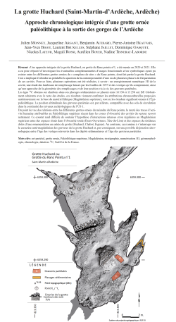
02-2024, tome 121, 1, p.35-61 - Monney J. et al. - La grotte Huchard (Saint-Martin- d'Ardèche, Ardèche) : approche chronologique intégrée d'une grotte ornée paléolithique à la sortie des gorges de l'Ardèche
La grotte Huchard (Saint-Martin-d'Ardèche, Ardèche)
Approche chronologique intégrée d'une grotte ornée
paléolithique à la sortie des gorges de l'Ardèche
Julien Monney, Jacqueline Argant, Benjamin Audiard, Pierre-Antoine Beauvais,
Jean-Yves Bigot, Laurent Bruxelles, Stéphane Jaillet, Dominique Gasquet,
Nicolas Lateur, Magali Rossi, Aurélien Royer, Nadine Tisnerat-Laborde
Résumé : Une approche intégrée de la grotte Huchard, ou grotte du Ranc pointu no1, a été menée en 2020 et 2021. Elle a eu pour objectif d'investiguer les éventuelles complémentarités d'usages fonctionnels et/ou symboliques ayant pu exister entre les différentes grottes ornées du « complexe de sites » du Ranc pointu, dont fait partie la grotte Huchard. Ceci a impliqué d'aborder au préalable la question de la contemporanéité d'une ou de plusieurs phase/s de fréquentation de ces cavités. Pour ce faire, plusieurs opérations ont été réalisées, à savoir : un enregistrement numérique 3D de la cavité, une étude des lambeaux de remplissage laissés par les fouilles de 1957 et des vestiges qu'ils comprennent, ainsi qu'une approche de la géométrie des remplissages et de leur position vis-à-vis des gravures pariétales.
Les âges 14C obtenus sur charbons dans ces placages sédimentaires se placent entre 16330 et 13250 cal. BP. Globalement cohérents avec le reste des études, ces résultats viennent confirmer les attributions chronoculturelles proposées antérieurement sur la base du matériel lithique (Magdalénien supérieur), tout en les étendant significativement à l'Épipaléolithique. La position altitudinale des gravures pariétales est, par ailleurs, compatible avec des sols de circulation dans la continuité des niveaux archéologiques de l'US 1.
Du point de vue des relations entre les différentes grottes ornées du méandre du Ranc pointu, la rareté des traces d'activité humaine attribuables au Paléolithique supérieur récent dans les zones d'obscurité des cavités du secteur ressort nettement. Ce constat rend difficile de soutenir l'hypothèse d'interactions intenses et/ou régulières au Magdalénien supérieur entre des espaces situés dans l'obscurité totale (Deux-Ouvertures, Tête-du-Lion) et des espaces de résidence dotés d'une ornementation en entrée de grotte (Huchard, Chabot, Figuier). Au contraire, ceci amène à s'interroger sur le caractère anté-magdalénien des gravures de la grotte Huchard et, par conséquent, sur une possible disjonction chronologique entre l'âge des vestiges retrouvés dans les dépôts sédimentaires et l'âge des gravures pariétales.
Mots-clés : art pariétal, grotte ornée, Paléolithique supérieur, Magdalénien, stratigraphie, numérisation 3D, géomorphologie, chronologie, datation 14C, Sud-Est de la France.
Abstract: Research was carried out at Huchard Cave in 2020 and 2021 as part of the 'Cave Art Dating' project. The aim of this project, since 2008, is to investigate the chronology of human and animal activities in the Palaeolithic rock art caves of the Ardèche river gorge, and the ways prehistoric human groups made sense and symbolically inscribed subterranean landscapes, as well as the socio-cultural contexts in which Palaeolithic cave art was created.
In 2016, a visit to Huchard Cave highlighted its chronological potential and the interest in resuming research at the site.
Huchard Cave, also known as Grotte du Ranc Pointu no1 or Grotte du Squelette, is located in the last meander of the Ardèche river gorge (Saint-Martin-d'Ardèche; Ardèche). In 1908, P. Raymond reported deep engravings, attributed to the Upper Palaeolithic in its penumbra zone, between 2.5 and 3.5 m above the current ground.
The position of Huchard Cave among a series of seven rock art caves in the 'Ranc Pointu site complex' raises the question of the possible complementarity of their - functional and/or symbolic - uses. The proximity of Deux-Ouvertures and Huchard Caves, and the latter's position as a compulsory passageway to the former raise the question of whether they should be considered as a single site. Are there contemporaneous phases of use of these two caves, as well as the other rock art caves in the Ranc Pointu meander? And, if so, what reciprocal interactions could have existed between them at an anthropological and sociological level?
While the chronology established in the Deux-Ouvertures and most of the rock art caves of the Ranc Pointu meander provide an overview of human activity in the sector, Huchard Cave had not yet benefited from an in-depth study. Since the end of the 19th century, various archaeological operations have been carried out at Huchard Cave. But the chronology of human activity in the cave during the Upper Palaeolithic remained imprecise.
In 2016, we identified against the walls some remains of the sedimentary levels excavated in 1957 by P. Huchard. These observations prompted an archaeological operation in 2020 and 2021. The aim was to obtain an age for the archaeological remains contained in these deposits and to test the chronocultural attribution previously proposed on the basis of lithic material. It was also the opportunity to check whether other chronological phases were present and to discuss the morphology of the floor during the Upper Palaeolithic.
To achieve this, we focused on: (1) a 3D digital recording of the cave, the engravings and the deposits remaining against the wall, (2.1) a geoarchaeological study of the sedimentary deposits, (2.2) an analysis of the archaeological palaeontological and paleoenvironmental material they contained, (3) a study of the natural and anthropogenic traces on the walls, and (4) an approach to the geometry of past sedimentary fillings of the cave and their chronological and spatial positioning in relation to the parietal engravings.
In the end, we identified 6 siliceous lithic pieces, 56 microcharcoal, 4 elements of red colouring matter, 3 pebbles and 3 remains of microfauna on the surface of the residual sedimentary deposits of the diverticulum. These remains were mainly concentrated in, on the upper 12 to 17 cm of the deposits (SU 1). Radiocarbon measurements yielded seven dates ranging from 16,330 to 13,250 cal. BP. This chronological range is compatible with the Upper Magdalenian attribution previously proposed by J. Combier on the basis of the lithic industry. However, the 14C ages obtained suggest that human presence also took place during the Epipaleolithic. The geoarchaeological observations and the results of the lithic and anthracological studies are also consistent with the cultural and paleoenvironmental data available for the Upper Palaeolithic in the region. Although not providing precise chronological information, the presence of colouring matter, pebbles and faunal remains is compatible as well with an Upper Palaeolithic age. The only divergent data comes from palynology. The long use of the cave as a sheepfold during the Holocene period, the circulation of water in the sediment of SU 1 and the exposition of the stratigraphy to the open air for more than 60 years, are all possible sources of pollution that could explain these discrepancies.
The altitude of the engravings is compatible with Palaeolithic circulation floors at the level of the archaeological layer (SU 1). The engraved wall would then be within the manual range of a medium-sized individual (1.70 m). However, we identified a discordance between SU 1 and SU 2. This gap covers a period from the Early Dryas to potentially the Middle Pleistocene. Although there is no archaeological evidence to substantiate it, we cannot dismiss the creation of the engravings during this pre-Magdalenian period.
Regarding the socio-cultural interplay between the various rock art caves of the Ranc Pointu meander, we identified archaeological and spatial similarities between Huchard Cave and the other engraved caves (Chabot, Figuier and, to a lesser extent, Sombre Caves). These four rock art caves are the manifestation of phenomena that seem chronologically related (pre-Magdalenian) and anthropologically similar (dwelling sites), albeit with possible complementarities. Apart from Figuier Cave, no evidence of recent Upper Palaeolithic and/or Epipalaeolithic occupation, contemporary with that of Huchard Cave, is known in these caves. It may be due to the early nature of the excavations carried out there, or it could indicate an older age for Huchard Cave engravings. In fact, both in Huchard and Figuier Caves, the presence of Magdalenian remains may simply reflect the relatively marked presence of this chronological period in the Ardèche river gorge.
As for potential connections with the three caves of the Ranc Pointu meander whose rock art is located in total darkness (Tête-du-Lion, Deux-Ouvertures, and possibly Saint-Marcel), there is a chronological dissimilarity between the periods of human activity in these caves and the dates of occupation of Huchard Cave. It is therefore difficult to support the hypothesis of regular and/or intensive Magdalenian interactions between interior spaces located in total darkness and residential spaces with rock engravings in the semi-dark zone of Huchard, Chabot and Figuier Caves. This observation calls into question the pre-Magdalenian nature of the engravings of Huchard Cave and, consequently, suggests a possible chronological disjunction between the age of the remains found in its sedimentary deposits and the age of its parietal engravings.
The Ranc Pointu meander thus emerges as an ensemble in its own that needs to be understood as a whole. The results obtained at Huchard Cave represent an important milestone opening up further prospects for research on the scale of this complex of sites.
Keywords: rock art, cave art, Upper Paleolithic, Magdalenian, stratigraphy, 3D digitalization, geomorphology, chronology, 14C dating, South-East of France.
01-2024, tome 121, 1, p.7-34 - Klaric L., Ducasse S., Langlais M. (2024) Pourquoi lhomme sans arc devrait-il chercher des flèches ? Discuter une hypothèse non parcimonieuse : le cas de larc à la Grotte Mandrin (Paléolithique supérieur initial)
Pourquoi lhomme sans arc devrait-il chercher des flèches ?
Discuter une hypothèse non parcimonieuse :
le cas de larc à la Grotte Mandrin (Paléolithique supérieur initial)
Laurent Klaric, Sylvain Ducasse, Mathieu Langlais
Résumé : En Préhistoire, au delà de trouvailles inattendues faites dans des contextes clairs, il arrive que les découvertes ou résultats détude « extraordinaires » soient sujet à controverses. Cela reflète en général la difficulté quont les archéologues à saccorder sur le degré de précision et la construction de leur argumentation. De manière concomitante, une certaine surmédiatisation vise parfois à informer et convaincre le public de limportance dune découverte jugée majeure par ses auteurs, sans que, pour autant, le résultat ne remporte une large adhésion de la communauté scientifique. Constituant un exemple de la dérive sensationnaliste évoquée, une étude récente (Metz et al., 2023) consacrée aux pointes et micro-pointes du niveau E de la Grotte Mandrin (Malataverne, Drôme) vient de conclure à lusage de larc il y a 54 000 ans par un groupe Homo sapiens en vallée du Rhône. Ce résultat proclame ainsi le vieillissement de près de 40 000 ans de lusage reconnu de larc en Europe. Une lecture attentive de cette étude ne nous a pas convaincu de la validité de ce résultat « extraordinaire » qui nous semble a priori incompatible avec le principe de parcimonie. Cest sur la base du raisonnement et de la logique argumentaire que nous proposons une réfutation du mode de propulsion inféré qui est en grande partie fondée sur un « postulat defficacité » au détriment dautres données archéologiques pourtant disponibles sur le site. Nous exposons une réfutation basée sur : 1) les données présentées dans létude ainsi quà loccasion dautres travaux antérieurs sur les armes préhistoriques, 2) des observations ethnographiques issues de trois continents et relatives à la chasse et son apprentissage par les enfants, 3) une régularité générale touchant à lapprentissage dans les sociétés dHomo sapiens. À lissue de notre réflexion, nous proposons que les pointes microlithiques de Mandrin puissent correspondre à des parties darmes miniatures potentiellement attribuables à lactivité des enfants.
Mots-clés : Paléolithique supérieur, industrie lithique, armement, chasse, apprentissage, enfants, microlithisation, miniature, argumentation, ethnographie.
Abstract: In Prehistory, beyond unexpected finds made in clear contexts, extraordinary discoveries or study results are sometimes the subject of controversy. The latter generally reflect the difficulty archaeologists often have in agreeing on the degree of precision and construction of their arguments. From the age of humankind to the settlement patterns of the Americas, the modernity of Homo sapiens and the role of women in prehistory, bold hypotheses and startling conclusions follow one another in the wake of media fashions. At the same time, there may be a certain amount of media hype aimed at informing and convincing the public of the importance of a discovery deemed major by its authors, although the announced result may not be widely supported by the academic community. A recent study (Metz et al., 2023) devoted to the points and micro-points of level E of the Mandrin Cave (Malataverne, Drôme) is just one example of the sensationalist drift mentioned above. It concludes that the bow was used 54,000 years ago by a group of Homo sapiens in the Rhône Valley. The spectacular result proclaims that the recognized use of bow and arrow in Europe is circa 40,000 years older than previously known. However, a careful reading of this study did not convince us of the validity of this extraordinary result, which seems to us a priori incompatible with the principle of parsimony. Indeed, the article by Metz and colleagues would require further comment on the technical aspects of the study (e.g. criteria for morpho-typological and productional distinction of flint points, reality of the existence of a nano-point component, criteria about the functional analysis, details of the parameters of the Initiarc experiment). However, we have chosen to accept as valid the hypothesis that a large proportion of the points analysed correspond to axial tip of hunting projectiles. It is therefore on the basis of reasoning and argumentative logic that we propose a refutation of the use of bow and arrow 54,000 years ago on the Mandrin site. Indeed, the conclusion of the study by L. Metz and colleagues is essentially based on a postulate of effectiveness that ignores certain other archaeological data available on the site. We therefore first propose a rebuttal based on 1/ the data presented in the study and in other works about to prehistoric weapons, 2/ ethnographic data from three continents relating to traditional hunting and the place of children in this activity, and 3/ a general regularity concerning learning in present-day Homo sapiens societies.
Firstly, we analyse the arguments used by L. Metz and colleagues, presenting them from the point of view of argumentative logic, using the categories explained in C. Plantin's dictionary of argumentation (Plantin, 2021). This analyse leads us to distinguish between the main arguments in the Metz et al. demonstration (archaeological impact fractures similar to those used in the experiment, the rule that the diameter of the projectile shaft is necessarily less than the width of the point, the use of the bow for maximum penetration efficiency of a light projectile, calculation of the TCSA) and the premises on which the demonstration is based. We show not only the weakness or artificiality of some of the arguments/premises presented, but also the argumentation by default nature of the demonstration put forward by L. Metz and colleagues, since no new decisive argument is proposed that would allow a direct and differential diagnosis of bow use (as opposed to spearthrower or bare-handed use).
The entire demonstration is based on the necessity of using the bow to ensure optimal penetration of projectiles armed with micro- and nano-points. This reasoning by default implies a condition of refutability: the demonstration is only valid if the small lithic points were necessarily intended to be effective from the point of view of the projectile penetrating into its target.
We then show that there are many examples among traditional hunters of the ethnographic register of miniature children's weapons, more or less faithful replicas of those used by adults, which constitute children's play or hunting training equipment. These children's weapons are not necessarily intended to be lethal or as effective as those used by adults (i.e. penetration of the tip into a living animal target is not a major requirement, since the main targets are often inanimate for beginners), but they are often functional enough for shooting, practising and playing. In fact, they can reasonably sustain damage during these uses. This simple explanation, which does not imply that the bow was used 40,000 years earlier than archaeologically attested, has not been considered or tested in Metz and colleagues study. At the end of our analysis, we propose that the Mandrin microlithic points of level E could correspond to tip of miniature weapons that could potentially be used by children. It would, of course, be necessary to ensure that such miniatures could break in the same way as adult weapons when used by children on inanimate target. However, it seems to us that, given the current state of knowledge, this hypothesis is undoubtedly more parsimonious than that of the use of bows and arrows 40,000 years earlier than currently documented in the archaeological record at Stellmoor in Germany. Through this example, we finally underline the excesses of a certain number of sensational studies and publications with a wide international audience, where a critical reading of the arguments would often prevent the promotion of non parsimonious hypotheses as solidly established scientific results.
Keywords: Upper Palaeolithic, lithic industry, weaponry, hunting, apprenticeship, children, microlithism, miniature, argumentation, ethnography.
Coordonnées
Pôle éditorial de la MSH Mondes
(Maison de l'archéologie et de l'éthnologie)
Boite 41
21 allée de l'Université
F-92023 Nanterre cedex - FRANCE