- La SPF
- Réunions
- Le Bulletin de la SPF
- Organisation et comité de rédaction
- Comité de lecture (2020-2025)
- Ligne éditoriale et consignes BSPF
- Données supplémentaires
- Annoncer dans le Bulletin de la SPF
- Séances de la SPF (suppléments)
- Bulletin de la SPF 2025, tome 122
- Bulletin de la SPF 2024, tome 121
- Bulletin de la SPF 2023, tome 120
- Bulletin de la SPF 2022, tome 119
- Archives BSPF 1904-2021 en accès libre
- Publications
- Newsletter
- Boutique
Bulletin de la Société préhistorique française 2021
Cliquez sur la photo pour zoomer
Autres familles de "Bulletins de la SPF"
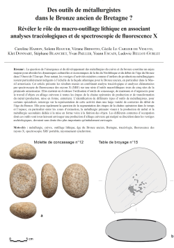
17-2021, tome 118, 4, p. 697-737 - C. HAMON, S. REGUER, V. BRISOTTO, C. LE CARLIER DE VESLUD, K. DONNART, S. BLANCHET, Y. PAILLER, Y. ESCATS, L. BELLOT-GURLET - Des outils de métallurgistes dans le Bronze ancien de Bretagne ? Révéler l
Des outils de métallurgistes dans le Bronze ancien de Bretagne ? Révéler le rôle du macro-outillage lithique en associant analyses tracéologiques et de spectroscopie de fluorescence X
Caroline Hamon, Solenn Reguer, Vérane Brisotto, Cécile Le Carlier de Veslud,
Klet Donnart, Stéphane Blanchet, Yvan Pailler, Yoann Escats, Ludovic Bellot-Gurlet
Résumé : La question de l'émergence et du développement des métallurgies du cuivre et du bronze constitue un enjeu majeur pour aborder les dynamiques culturelles et économiques de la fin du Néolithique et du début de l'âge du Bronze dans l'Ouest de l'Europe. Pour autant, les vestiges d'activités minières comme d'ateliers de productions métallurgiques restent particulièrement indigents à l'échelle de la façade atlantique pour le Bronze ancien, en particulier dans le Massif armoricain. Cet article présente les résultats menés en combinant analyse tracéologique et analyses élémentaires par spectroscopie de fluorescence des rayons X (XRF) sur une série d'outils macrolithiques issus de cinq sites de la péninsule armoricaine. Elles mettent en évidence l'utilisation d'outils de concassage, de marteaux et d'aiguisoirs pour le travail d'objets en alliage cuivreux à toutes les étapes de la chaine opératoire de production et de transformation du métal (production, mise en forme, entretien). L'identification de différents types d'outils de métallurgistes, pour certains spécialisés, interroge sur la représentation de cette activité dans une large variété de contextes du début de l'âge du Bronze. Elle pose également la question de la segmentation des étapes de la chaîne opératoire dans le temps et l'espace, en particulier entre les zones d'extraction, la métallurgie primaire visant à la production de métal et la métallurgie secondaire dédiée à la mise en forme voire à la finition des objets. Les différents contextes d'occupation dont ces outils sont issus laissent envisager une production d'alliage cuivreux qui malgré sa discrétion dans les vestiges archéologiques, devaient sans doute être plus importante qu'initialement envisagée.
Mots-clés : métallurgie, cuivre, outillage lithique, âge du Bronze ancien, Bretagne, tracéologie, fluorescence des rayons X, spectroscopie XRF portable, rayonnement synchrotron.
Abstract: The question of the emergence and development of copper and bronze metallurgies is a major issue in addressing the cultural and economic dynamics of the late Neolithic and early Bronze Age in Western Europe. This phenomenon is particularly relevant along the Atlantic coast, where the Armorican peninsula is central for better understanding how the control of these new productions contributed to the emergence of new elites and their chiefs, notably within the Armorican Tumulus culture (2150-1750 BC).
However, evidence of Early Bronze Age mining activities and metallurgical production workshops remains scarce on the Atlantic coast, particularly in the Armorican Massif. The rare sources of copper ore are generally poor which have long suggested that the presence of metallic objects discovered in the rich burials of these periods, in particular in the tumuli of the Early Bronze Age, could only be the result of imports over more or less long distances. Recent work on the composition of some Armorican bronze objects has also highlighted a close proximity to ores from Ross Island in Ireland, suggesting that ores or ingots were imported from other regions, including across the Channel. Other works have nevertheless underlined that the exploitation of local copper veins could be envisaged in the Armorican Massif, especially as copper objects appear to concentrate in this area. Therefore, the discovery of direct or indirect evidence of copper metallurgy, particularly on settlement sites, is crucial for these periods. The presence of rare crucibles, moulds and ingots, as well as hearth structures and even furnaces, are precious clues for identifying possible episodes of metallurgical production. Stone tools constitute a second group of clues attesting metallurgical production throughout the Bronze Age, since they are now known to have been used at different stages of the operating chain, from the extraction and transformation of ores to the shaping and finishing of metal objects by hammering and abrading.
This paper presents the results of a combination of use-wear and elementary X-ray fluorescence spectroscopy (XRF) analysis of a series of macrolithic tools from the Armorican Peninsula. The analyzed corpus comes from five sites in Britany dated by their pottery or by radiocarbon dating to the Early Bronze Age: it includes a settlement enclosure (Bel air, Lannion), an island settlement (Beg ar Loued, Molène) as well as less structured occupations however characteristic of the period (Kersulec, Plonéour-Lanvern; la Colignière, Trémuson; ZAC Kerisac, Plouisy). They illustrate the diversity of the contexts encountered dating to this period in the western part of the Armorican peninsula. For each of the sites, several tools were selected from a larger corpus of macrolithic tools, based on criteria of the raw materials, type of active surfaces and nature of the use-wear traces. The assemblage includes 19 macrolithic tools: 3 crushing-grinding tools, 2 tools with cupules, 1 pestle, 2 anvils, 3 hammerstones, 1 percussion or crushing tool, 3 heaps, 3 hammers and finally 2 sharpeners.
The functional analysis method is based on the combination of the results of a low and high magnification use-wear analysis and elementary X-ray fluorescence (XRF) analyses, with two implemented measurement methods: portable X-ray fluorescence spectrometer (pXRF) and X-ray fluorescence mapping under Synchrotron radiation (Sy-XRF). The use-wear analysis alone therefore made it possible to exclude metallurgical use for 3 of the 13 tools analyzed, the other 10 tools showing traces at least linked to the working of mineral materials, with three quarters of them showing a combination of traces strongly suggesting the working of ore or metal. The combination of the use-wear and XRF analyses allows us to propose a use for ore processing or the transformation of metallic materials for 8 of these 10 tools. This result underlines that the hypotheses formulated following the use-wear analysis are well supported by the elementary residue analyses. The p-XRF analysis is able to detect copper residues even in relatively small quantities and to detect the heavier elements, such as tin. An average quantification is obtained, representing an analytical area of about 3 mm. Furthermore, the analytical precision permitted by Sy-XRF analysis, thanks in particular to the elemental distribution maps, with a selected resolution of a few tens of micrometers, makes it possible to distinguish chemical elements from the minerals making up the heterogeneous rocks generally used for macro-tools from the residues of processed materials that had catched on the surface. It also shows the correlations between the elementary distributions and the areas showing the traces of use. Due to the implementation modalities, the complementarity and concordance of the results of the Sy-XRF and p-XRF analyses with regard to the detection of copper residues is therefore stressed here.
These analyses highlight the use of crushing tools, hammers and sharpeners for the working of copper alloy objects at all stages of the metal production and processing chain (production, shaping, maintenance). The identification of different types of metallurgists' tools, some of them specialized, raises questions about the representation of this activity in a wide variety of Early Bronze Age contexts. It also underlines the question of the division of the operating chain in time and space, in particular between the extraction areas, primary metallurgy aimed at metal production and secondary metallurgy dedicated to the shaping or even finishing of the objects. The different occupation contexts from which these tools originate suggest a production of copper alloys, which despite its discretion in the archaeological record, must undoubtedly have been more important than initially envisaged. The presence of such tools in Armorican funerary contexts for the Early Bronze Age echoes these results.
Keywords: metallurgy, copper, lithic tools, early Bronze age, Brittany, use-wear analysis, X-ray fluorescence, portable XRF spectrometry (pXRF), Synchrotron radiation (Sy-XRF).
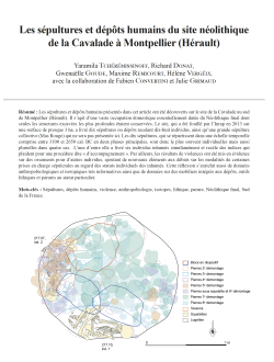
16-2021, tome 118, 4, p. 671-696 - Y. TCHEREMISSINOFF, R. DONAT, G. GOUDE, M. REMICOURT, H. VERGELY, avec la collaboration de F. CONVERTINI et J.GRIMAUD — Les sépultures et dépôts humains du site néolithique de la Cavalade à Montpellier (Hérault)
Les sépultures et dépôts humains du site néolithique de la Cavalade à Montpellier (Hérault)
Yaramila Tchérémissinoff, Richard Donat, Gwenaëlle Goude, Maxime Remicourt, Hélène Vergély, avec la collaboration de Fabien Convertini et Julie Grimaud
Résumé : Les sépultures et dépôts humains présentés dans cet article ont été découverts sur le site de la Cavalade au sud de Montpellier (Hérault). Il s'agit d'une vaste occupation domestique essentiellement datée du Néolithique final dont seules les structures excavées les plus profondes étaient conservées. Le site, qui a été fouillé par l'Inrap en 2013 sur une surface de presque 3 ha, a livré dix sépultures ou dépôts recelant dix-huit individus, ainsi qu'une grande sépulture collective (Mas Rouge) qui ne sera pas présentée ici. Les dix sépultures, qui se répartissent dans une échelle temporelle comprise entre 3100 et 2650 cal. BC en deux phases principales, sont donc le plus souvent individuelles mais aussi plurielles dans quatre cas. L'une d'entre elle a livré six individus inhumés simultanément et recèle des indices qui plaident pour une procédure dite « d'accompagnement ». Par ailleurs, les résultats de violences ont été mis en évidence sur des ossements pour d'autres individus, ajoutant de nouveaux éléments aux débats sur les modalités de certaines prises en charge sépulcrales au regard des statuts individuels des inhumés. Cette réflexion s'enrichit aussi de données anthropobiologiques et isotopiques très informatives ainsi que de données sur des mobiliers intégrés aux dépôts, outils lithiques et parures au statut particulier.
Mots-clés : Sépultures, dépôts humains, violence, anthropobiologie, isotopes, lithique, parure, Néolithique final, Sud de la France.
Abstract: The burials and human deposits presented in this article were discovered at the Cavalade site near Montpellier (Hérault). This is a large domestic occupation, essentially dating to the Final Neolithic, of which only the deepest features were preserved. The site, excavated by Inrap in 2013 over an area of almost 3 ha, yielded ten burials containing eighteen individuals, as well as a large collective burial (Mas Rouge), which will not be presented here. The ten burials date to 3100-2650 cal. BC corresponding to two main burial phases, they are mainly individual burials with four plural burials, one of which one yielded six simultaneously buried individuals that is evocative of a so-called - peripheral accompaniment- procedure. In addition, bones from other individuals bear traces of interpersonal violence, which renew the debate on the modalities of sepulchral care with regard to the individual status of the buried. This is underlined by precise and informative anthropobiological and isotopic data, as well as results on items integrated into the deposits, lithic tools and ornaments of particular status.
The 18 individuals, adults (men and women), adolescents and children (generally older than 4 years, with 1 exception), are distributed between ten graves. For the phase 2 (3100 - 2900/2880 cal. BC), three individuals were found in 2 pits; for phase 3 (2880 - 2650 cal. BC), fifteen individuals were buried in eight pits. The burials are housed in large pits that were originally small domestic cellars in some cases partially filled in with the bodies being deposited along the walls and under the overhangs. The numerous stones and blocks were used to fill the cavities before burial but also as fill once the burials in place. Most of the burials were protected by perishable casings or stone slabs. These burial modalities reflect the rare examples of ???lesser invested??? burials already known regionally for the period. This new discovery renews the debate on the sociobiological status of the dead concerned. Indeed, some skeletons bear obvious traces of violence, in particular a child between 10 and 14 years who has two depressed skull fractures resulting from blows with a pointed object such as a stone pick or axe heel. Other deceased bear the stigmata of violent blows that they survived and one burial, receiving the simultaneous deposit of six individuals, raises the question of the intentional killing of people to accompany the deceased in the tomb. The deposits, made within a still functional cellar, have a biological symmetry (2 men, 2 women, 2 children of about 6 years old) and show a positional symmetry with the men in the middle, the women near the antechamber and the children placed against the walls. There is no evidence of lethal violence on the skeletons, but two broken flint arrowheads were found, one of which was against the pelvis of one of the men. These observations plead in favour of the deaths being the result of intercommunity and/or interpersonal violence with a probable selection of individuals accompanying the dead. In this regard, isotopic analyses and anthropobiological studies indicate that the men had a different diet to the other individuals of the tomb.
Finally, the collective burial on the same site, belonging to its phase 2, raises questions about the funerary norm, on the one hand, and the possibly diversified kinship and ancestry among the dead, on the other. This is true both over time in terms of the evolution of the local population and within each of the two phases in terms of the diversity of sepulchral settings and funerary practices.
Keywords: Burials, human deposits, violence, anthropobiology, isotopes, lithics, ornament, Final Neolithic, south of France.
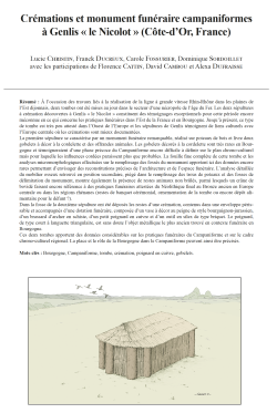
15-2021, tome 118, 4, p. 643-670 -L. CHRISTIN, F. DUCREUX, C. FOSSURIER, D. SORDOILLET, avec les participations de F. CATTIN, D. CAMBOU et A. DUFRAISSE — Crémations et monument funéraire campaniformes à Genlis « le Nicolot » (Côte-d’Or, France)
Crémations et monument funéraire campaniformes à Genlis « le Nicolot » (Côte-d'Or, France)
Lucie Christin, Franck Ducreux, Carole Fossurier, Dominique Sordoillet avec les participations de Florence Cattin, David Cambou et Alexa Dufraisse
Résumé : A l'occasion des travaux liés à la réalisation de la ligne à grande vitesse Rhin-Rhône dans les plaines de l'Est dijonnais, deux tombes ont été mises au jour dans le secteur d'une nécropole de l'âge du Fer. Les deux sépultures à crémation découvertes à Genlis « le Nicolot » constituent des témoignages exceptionnels pour cette période encore méconnue en ce qui concerne les pratiques funéraires dans l'Est de la France et en Bourgogne. Jusqu'à présent, ce type de tombe est très peu attesté dans l'Ouest de l'Europe et les sépultures de Genlis témoignent de liens culturels avec l'Europe centrale où les crémations sont mieux documentées.
La première sépulture se caractérise par un monument funéraire remarquable, réalisé sur poteaux de bois et livre deux gobelets à décor à la cordelette et des offrandes animales. Les gobelets décorés à la cordelette sont très rares en Bourgogne et témoigneraient d'une phase précoce du Campaniforme encore difficile à définir sur le plan chrono-culturel mais pour laquelle les influences cordées paraissent plus que probables. La fouille fine complète de cette tombe et les analyses micromorphologiques effectuées sur le remplissage des fossés du monument apportent ici des données encore rares permettant d'envisager des reconstitutions précises de l'architecture et de l'espace funéraire. L'analyse détaillée du mobilier osseux retrouvé en position secondaire, piégé dans le remplissage des trous de poteaux et des fosses de délimitation du monument, montre également la présence de restes animaux non brûlés, parmi lesquels un crâne de bovidé faisant encore référence à des pratiques funéraires attestées du Néolithique final au Bronze ancien en Europe centrale ou dans les régions rhénanes (restes de banquet cérémonial, ornementation de la tombe ou encore dépôt alimentaire pour le défunt ?).
Dans la fosse de la deuxième sépulture ont été déposés les restes d'une crémation, contenus dans une enveloppe péris-sable et accompagnés d'une dotation funéraire, composée d'un vase à décor au peigne de style bourguignon-jurassien, d'un brassard d'archer en schiste, d'un petit poignard en cuivre et d'un outil en silex de type briquet. Le poignard, de type court à languette triangulaire, est sans doute l'objet métallique le plus ancien trouvé en contexte funéraire en Bourgogne.
Ces deux tombes apportent des données considérables sur les pratiques funéraires du Campaniforme et sur le cadre chrono-culturel régional. La place et le rôle de la Bourgogne dans le Campaniforme peuvent ainsi être précisés.
Mots-clés : Bourgogne, Campaniforme, tombe, crémation, poignard en cuivre, gobelets.
Abstract: The building of the high-speed rail track linking the Rhine to the Rhone led to the discovery of two Bell Beaker burials in an Iron Age cemetery located in the plain to the east of Dijon. The Tilles plain is an alluvial environment, shaped by the valleys of the Tille and the Ouche and populated since Late Prehistory, particularly during the Bell Beaker and Early Bronze periods, which have yielded settlements located on the rivers. These burials are the first funerary features discovered in the area.
The two Bell Beaker cremation burials excavated at Genlis "le Nicolot" are remarkable, as still too little is known of the funerary practices of the period in the east of France and in particular in Burgundy. Few Bell Beaker cremation burials are documented in Western Europe, whereas this practice is well known in Central Europe and the Genlis burials underline the strong cultural links with this area. The Genlis cremations are unprecedented in an area where until now only individual inhumations have been found.
One of the burials has a remarkable funerary monument, with a complex layout of corner posts connected by shallow side pits. This architecture delimits a quadrangular space 1.4 m long and 1.2 m wide. The remains of a cremation, certainly originally located in the middle of the monument, were found scattered in the fill of the features that delimit it. The cremation contained two beakers with corded decoration and the remains of an ox skull. The painstaking excavation of this funerary monument and the micro-morphological analyses carried out on the ditch fill provide new data, which has contributed to precise reconstructions of the architecture and the funerary space. The detailed analysis of the bone material in the fill of the post holes and the monument's boundary pits, has also identified unburnt animal offerings, including a bovid skull, which again refers to funerary practices attested from the Final Neolithic and Bell Beaker graves in Central Europe or in the Rhine area as well as in Britain.
This cremation has yielded two beakers with corded motifs and a set of animal bones that may have been offerings. Goblets with corded decor are rare in Burgundy and bear witness to an early Bell Beaker phase that is still difficult to define from a chrono-cultural point of view, but for which corded influences seem more than likely. This early Bell Beaker phase has also been highlighted in the area of Genlis with typical features identified at the sites of Labergement-Foigney, "les Côtes-Robin" and Genlis, "la Moussenière". These features represent the first stages of an occupation that develops during the second half of the Bell Beaker phase and the Early Bronze Age.
The other burial is located in a shallow square pit interpreted as a small wooden chest. The pit housed the cremated remains, which were contained in a perishable envelope and the accompanying grave goods. These are similar to the typical Bell Beaker funerary sets containing a vessel with a Burgundian-Jurassian comb decoration, an archer's cuff made of schist, a small copper dagger and a flint tool, which was probably a lighter. The dagger with its relatively atypical shape is without doubt the oldest metal object found in a funerary context in Burgundy. Unfortunately, the metallographic analyses carried out on this object have not pinpointed the origin of the ore used in its manufacture.
These two burials provide important new information on Bell Beaker funerary practices within a regional chrono-cultural framework, in establishing links between central Eastern France and Central Europe. Funerary monuments, which are delimited by corner posts remain rare in France and show connections with Central Europe where this type of architecture built to house cremation burials, is more frequent.
The cultural links between Central and Eastern France and Central Europe are only part of the story, as there are other probable links with northern Europe, but also the Netherlands and Britain, where funerary practices similar to those at Genlis have also been identified.
These burials have shed new light on the role of Burgundy within the Bell Beaker group. They have also contributed to clarifying the place of Burgundy in the Bell Beaker network, as it transpires that this area played an important role as a buffer zone between the eastern Bell Beaker group influenced by Central and, to a lesser extent, Northern Europe, and the Atlantic Bell Beaker group, for which the cultural links are less obvious. In fact, the so-called Maritime pottery types are not found in the region.
This paper provides detailed analysis of two exceptional and unprecedented Western European Bell Beaker tombs, which also raise the question of the longevity of certain funerary sites used from the beginning of the Bronze Age to the end of the Iron Age, as attested by other local necropolises.
Keywords: Burgundy, Bell Beakers, graves, cremation, copper dagger, beakers.
14-2021, tome 118, 4, p. 619-642 - E. VAISSIE, M. MASSOULIE, J. COMBIER †, S. SORIANO — Nouveau regard sur le Moustérien
de Bourgogne : première relecture des industries lithiques de la grotte de Vergisson IV (Saône-et-Loire)
Nouveau regard sur le Moustérien de Bourgogne : première relecture des industries lithiques de la grotte de Vergisson IV (Saône-et-Loire)
Erwan Vaissié, Marine Massoulié, Jean Combier, Sylvain Soriano
Résumé : Le Paléolithique moyen de Bourgogne présente encore aujourd'hui une image hétérogène, à la jonction entre différents ensembles techno-culturels dont les influences semblent se traduire dans la diversité des industries connues. Les nombreuses redéfinitions des faciès moustériens selon une approche technologique entreprises ces dernières années mènent aujourd'hui à une meilleure compréhension de la variabilité des techno-complexes du Paléolithique moyen, en même temps que des études récentes tendent à mettre en évidence des spécificités culturelles régionales pour la Bourgogne. Le site de Vergisson IV (Saône-et-Loire) est l'un des rares sites stratifiés en milieu karstique de la région et son étude s'inscrit dans cette entreprise de révision et dans le débat sur la variabilité des industries du Paléolithique moyen. Nous présentons ici les premières données issues de la révision pétro-techno-économique des industries du gisement, initialement attribuées à un Moustérien Quina.
La relecture des données de la fouille de J. Combier a conduit à individualiser deux ensembles archéo-stratigraphiques. Ils se distinguent par leur composante techno-typologique et leurs comportements techniques et d'approvisionnement, mais sont semblables dans le statut économique de l'occupation. Les deux unités témoignent ainsi de l'introduction sur le site de matériaux locaux sous forme de matrices ou de supports déjà en grande partie élaborés ou consommés, et les indices d'activité sur le site semblent principalement liés à la phase de transformation et d'entretien de l'équipement lithique au détriment de la production. L'outillage retouché, largement dominé par les racloirs, est très nombreux (> 35%) et concerne une large variété de supports. L'ensemble supérieur illustre des séquences opératoires courtes (principalement unipolaires), sans grande prédétermination ou configuration/gestion des volumes, et une retouche abrupte de supports épais caractérisant un cycle de gestion long de l'outillage. Les comportements de collecte des matériaux siliceux sont généralistes. Malgré une apparente proximité typologique entre cette unité et l'entité du Quina rhodanien, la faible représentation de certaines pièces caractéristiques (outils à amincissement ou à caractère bifacial plano-convexe) et des divergences dans les modalités de débitage (unipolaire vs centripète) incite à la prudence. L'unité inférieure repose quant à elle sur un système de production Levallois, avec une sélection particulière des matériaux de bonne qualité, et montre dans son spectre typologique des outils bifaciaux et pointes foliacées plano-convexes. Elle trouve un écho avec certains sites du Paléolithique moyen récent du Chalonnais, suffisamment pour soulever la question de l'existence d'une entité techno-culturelle propre à cette région. Pour les deux unités, quelques objets importés sous la forme de produits isolés (retouchés ou non) illustrent des circulations plus importantes axées vers le nord (unité inférieure et supérieure) et l'ouest du gisement (unité inférieure), entre les vallées de la Saône et de la Loire.
Les caractéristiques pétro-techno-économiques des deux unités les démarquent des composantes Quina du Sud-Est de la France, et semblent davantage être la conséquence des stratégies de gestion de l'outillage et de la position du site au sein du cycle techno-économique des groupes et de leur territoire. Malgré l'absence de données chronologiques et archéoozologiques, les caractéristiques des assemblages lithiques semblent s'accorder avec des occupations courtes, répétées et anticipées (halte temporaire), probablement intégrées dans un circuit de mobilité saisonnière plus vaste et/ou un schéma régional plus complexe de stratégie logistique. Le site de Vergisson IV illustre également un exemple intéressant de persistance du statut économique d'un site en dépit d'apparentes variations techno-culturelles des groupes humains le fréquentant.
Mots-clés : Paléolithique moyen, Bourgogne, techno-économie, matières premières lithiques, territoires, mobilité.
Abstract: The Middle Palaeolithic of Burgundy still presents a heterogeneous image, at the junction between different techno-cultural complexes whose influences seem to be reflected in the diversity of known industries. The numerous redefinitions of Mousterian facies according to a technological approach undertaken in recent years are now leading to a better understanding of the variability of Middle Palaeolithic techno-complexes, while recent studies tend to highlight regional cultural specificities for Burgundy. The Vergisson IV site (Saône-et-Loire) is one of the rare stratified sites in a karstic environment in the region and its revision is part of this revision process and of the debate on the variability of Middle Palaeolithic industries. We present here the first data from the petro-technical-economic revision of the industries of the deposit, initially attributed to a Quina Mousterian.
Despite the low density of remains, this study shows the individualisation of two archaeological-stratigraphic units (lower and upper unit). They differ in their techno-typological component and their technical and supply behaviour, but are similar in the economic status of the occupation. The two units bear witness to the massive use of the secondary flint formations near the site (Cretaceous resources of the Mâconnais flint clays and Jurassic flints accessible in the colluvium of the Mâconnais flint formations) via the introduction onto the site of raw materials in the form of matrices or blanks that had already been largely elaborated or consumed. The indications of knapping activities on the site seem to be mainly linked to the phase of transformation and maintenance of the lithic equipment to the detriment of the production represented by a relatively expedient debitage (provisioning of place). A few objects made of more distant raw materials illustrate the introduction, in the form of ???personal gear???, of pre-determined raw or retouched products or with evidence of refaction of the cutting edges alone on site (provisioning of individuals; Kuhn, 1995). They testify to more important circulations oriented towards the north in the Chalonnais/Dijonnais (lower and upper unit), but also towards the west of the deposit (lower unit), between the Saône and Loire valleys. The retouched tools, largely dominated by scrapers, are very numerous (> 35%) and concern a wide variety of blanks.
The upper set illustrates short operating sequences (mainly unipolar), without much pre-determination or configuration/management of volumes, and abrupt retouching (frequently semi-Quina) of thick supports characterising a long tooling management cycle. The collection behaviours of siliceous raw materials reflect a generalist strategy and should probably be linked to the low level of requirement of the groups related with their technical production systems. Despite an apparent typological proximity between this unit and the Rhodanian Quina entity, the poor representation of certain characteristic pieces (thinning tools or plano-convex bifacial tools) and the divergence in the debitage methods (unipolar vs. centripetal) encourage caution. The lower unit is based on a Levallois production system, mainly unipolar, with a particular selection of good quality materials. The blanks produced are more slender, the retouching is mostly grazing and there are characteristic pieces in its typological spectrum, notably bifacial supports with a plano-convex section of fine workmanship, or scrapers reminiscent of bogenspitzen. It echoes certain sites of the late Middle Palaeolithic of the Chalonnais (Grottes de la Verpillière I and II, La Roche, La Clôsure) and could contribute to the recognition of a probable techno-cultural entity specific to this region.
The petro-techno-economic characteristics of the two units distinguish them from the Quina components of south-eastern France, and seem to be more the consequence of the management strategies of the tools and the position of the site within the territory and techno-economic cycle of the groups. Despite the lack of chronological and archaeozoological data, the characteristics of the lithic assemblages seem to be consistent with short, repeated and anticipated occupations (temporary halt), probably integrated into a wider seasonal mobility circuit and/or a more complex regional logistic strategy. The Vergisson IV site also illustrates an interesting example of the persistence of the economic status of a site despite the apparent techno-cultural variations of the human groups frequenting it.
Keywords: Middle Palaeolithic, Burgundy, techno-economy, lithic raw material, territories, mobility.
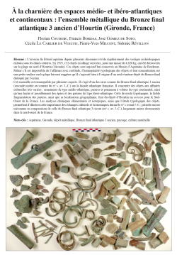
13-2021, tome 118, 3, p. 519-568 - F. Couderc, F. Bordas, J.Gomez de Soto, C. Le Carlier de Veslud, P.-Y. Milcent, S. Révillon — À la charnière des espaces médio- et ibéro-atlantiques et continentaux : l’ensemble métallique du Bronze final atlantique 3 an
A la charnière des espaces médio- et ibéro-atlantiques et continentaux : l'ensemble métallique du Bronze final atlantique 3 ancien d'Hourtin (Gironde, France)
Florian Couderc, Francis Bordas, José Gomez de Soto, Cécile Le Carlier de Veslud, Pierre-Yves Milcent, Sidonie Révillon
Résumé :
L'érosion du littoral aquitain depuis plusieurs décennies révèle régulièrement des vestiges archéologiques enfouis sous les dunes côtières. En 1993, 132 objets en alliage cuivreux, pour une masse de 4,628 kg, ont été découverts sur la plage au nord d'Hourtin (Gironde). Ces objets sont aujourd'hui conservés au Musée d'Aquitaine de Bordeaux. Même s'il est impossible de l'affirmer avec certitude, l'homogénéité typologique des objets et leur concentration sur une petite surface sur la plage laissent suggérer qu'il s'agissait bien à l'origine d'un seul et même dépôt du Bronze final disloqué par l'océan.
Cet ensemble est remarquable par plusieurs aspects. Il s'agit d'un des rares connus du Bronze final atlantique 3 ancien (seconde moitié ou courant du Xe s. av. J.-C.) sur la façade atlantique française. Il concentre des objets aux affinités culturelles très variées : armements de type médio-atlantique, parures et pommeau à volutes de type continental, ainsi qu'une hache et possiblement des épées et des parures de type ibéro-atlantique. Cette diversité typologique, la faible fragmentation des parures, ainsi que sa localisation géographique, font du dépôt d'Hourtin un unicum pour le Sud-Ouest de la France. Les analyses chimiques élémentaires et isotopiques, ainsi que l'étude typologique des objets, permettent d'illustrer cette importance des échanges culturels et économiques durant le Xe s. avant J.-C., période encore méconnue en comparaison de celle du Bronze final atlantique 3 récent (IXe s. av. J.-C.), largement mieux documentée dans le nord-ouest de la France.
Mots-clés : Aquitaine, Gironde, dépôt métallique, Bronze final atlantique 3 ancien, paysage, culture matérielle
Abstract:
The Médoc region is located in the south-west of France on the Atlantic coast. Many archaeological remains have been discovered under the sand dunes over the course of the last few decades due to the erosion of the Aquitaine shoreline. These include hoards, isolated metal objects, pottery, preserved wooden posts and flints. In 1993, a detectorist discovered 154 copper alloy objects on the beach north of the town of Hourtin. The objects were given to the Aquitaine Museum of Bordeaux, where they are still preserved today. The artefacts were scattered over a perimeter of approximately 70 meters and some were found to be clearly earlier or more recent than the Bronze Age. However, 132 objects (weighing 4,628 kilograms) do date from the end of the Bronze Age and more specifically from the Early Atlantic Late Bronze Age 3 (first half of the 10th century BC). We cannot guarantee that this discovery is a hoard, but the homogeneity and the composition of the set testify that these objects were probably deposited in the same place. Initially, the hoard was deposited inland, and not on the coast which was further out to sea at the time of the Bronze age as indicated by the clay banks that lie beneath the dune. The landscape of the Médoc has evolved a lot since Late Bronze Age, as during this period, the coastal area was wetter, overtaken by marshes with streams connecting to the ocean or the Gironde estuary.
More than fifty hoards dating to Middle Bronze Age have been found in the Médoc mainly during the 19th and the beginning of the 20th centuries. They contain mainly flanged axes and palstaves. The Hourtin discovery is the first located on the coast where metal hoarding does not seem to have been common practice during the Late Bronze Age where hoards and single finds are very uncommon. Late Bronze Age 2 and Late Bronze Age 3 (1150 ??? 800 BC) hoards in Gironde have been discovered, along the Garonne and Dordogne rivers on the other side of the Gironde estuary, but not on the coast. Furthermore, the composition of the Hourtin hoard is original with Ibero-Atlantic objects such as axes and swords, which are often fragmented. The fragmentation is typical of the medio-Atlantic area at this time. Most of the bracelets are however complete in the Hourtin hoard, which is not always common in the medio-Atlantic area. The hoard contains objects from continental productions, such as Corent type bracelets and a Klentnice type sword pommel, uncommon in France, which has two volutes inserted in a wooden handle. Only one confirmed and three possible Klentnice pommels have been found in France, notably in Brasles (Picardy). They are also rare in the rest of Europe and are generally found in Denmark and Eastern Europe. According to H. Müller Karpe, this type of sword dates from Hallstatt B2.
The presence of these objects indicates dynamic long-distance trade during the Late Bronze Age. The Médoc is located between two Ibero- and medio Atlantic cultural networks and the Hourtin discovery highlights cultural interaction around the Gironde estuary. The Pyrenees and the Atlantic coast are not obstacles for cultural contacts and trade between the north and the south of the Atlantic area and the circulation of metallic objects was important between these two entities.
The elemental composition analyses of the metal objects are very insightful. When making the objects the artisan choses the main elements of alloy, which are copper, tin and lead . The lead content of Late Bronze Age copper alloy makes interpretation of the analyses complex as it is not possible to determine if the lead was naturally present in the copper ore or if it was specifically added. Trace elements such as zinc, bismuth, antimony and arsenic can discriminate Continental, Atlantic and Iberic-Atlantic productions, however the objects of Hourtin hoard show varying results and it has not been possible to determine the origin of the metals used. The analyses do underline the important trade in metal resources during Late Bronze Age all over Europe. We cannot clearly understand the role of the south-west of France in the trade dynamics of the south of the Atlantic area no other metal hoards have been found in this area. We hope that new discoveries will give us a better understanding of the trade role of the Médoc and of the south-west of France between the various Late Bronze Age cultural and economic networks.
12-2021, tome 118, 3, p. 475-518 - Ch.-C. Besnard-Vauterin, G. Auxiette, M. Le Puil-Texier, C. Marcigny — Une enceinte de type ring fort du Bronze final et un enclos d’habitat du premier âge du Fer à Mondeville (Calvados
Une enceinte de type ring fort du Bronze final et un enclos d'habitat du premier âge du Fer à Mondeville (Calvados)
Chris-Cécile Besnard-Vauterin, Ginette Auxiette, Myriam Le Puil-Texier, Cyril Marcigny
Résumé :
La fouille préventive réalisée à Mondeville « 31 rue Nicéphore Niepce » a permis d'identifier deux phases d'occupation, l'une datée du Bronze final et l'autre du premier âge du Fer. La première est matérialisée par un double dispositif fossoyé de plan circulaire, partiellement connue dans l'emprise. Les fossés ont livré des rejets de faune et un important dépôt, mettant en évidence un spectre faunique dominé par le boeuf et offrant des observations intéressantes sur des pratiques de consommation « extraordinaires ». Une autre particularité concerne la présence d'ossements humains isolés au sein des fossés et l'alignement de restes de corps humains, ayant fait l'objet de manipulations post-sépulcrales. Cette enceinte, datée entre 1220 et 907 avant notre ère sur la base de cinq analyses 14C, est à rapprocher avec les enceintes circulaires monumentales ou ring forts, connus en Grande-Bretagne pour le Bronze final et identifiés en Normandie à Cagny et Malleville-sur-le-Bec. Le statut de ce site demeure à ce jour énigmatique, tout comme son rôle dans le panel des formes d'habitats pour les phases finales de l'âge du Bronze.
L'enclos du premier âge du Fer est formé par deux fossés rectilignes, composant un plan probablement quadrilatéral mais incomplet. Parmi les vestiges internes, une structure de captage d'eau et des fosses à vocation de stockage ou d'extraction témoignent du caractère domestique et agro-pastoral du site. La céramique permet d'avancer une datation du Hallstatt moyen pour la fondation de cet enclos, avec une perduration au Hallstatt final. Sa configuration s'intègre parfaitement dans la vague d'apparition des premières formes d'habitat encloses au cours du Hallstatt moyen/final, telle que reconnue à ce jour dans la plaine de Caen.
Mots-clés : double enceinte circulaire, ring fort, Bronze final, habitat enclos, Hallstatt, fossés, céramique, faune, sépultures.
Abstract:
The excavation at Mondeville « Rue Nicéphore Nièpce » located in the Caen plain has led to the unexpected discovery of a Protohistoric site with two chronological phases. A double circular enclosure, dating to the end of the Bronze Age is of major interest for landscape studies and ongoing research on settlements for this period. A second settlement enclosure dating to Early Iron Age sheds new light on this densely populated area during Late Prehistory. The Late Bronze Age enclosure comprises two incomplete curved parallel ditches made up of oval shaped segments of varying length. Two breaks in the ditches provide an entrance to the south-west and the south-east. The excavation covered a 2750 m² area of a site estimated at almost 6 000 m². The outer diameter of the enclosure is 90 m. As the site has two phases, it has not been possible to attribute features to this first phase due to the lack of datable artefacts.
The fill of the two ditches, specifically the lower and intermediary levels, are very similar but fail to give any indication as to the location of a bank. The upper fill of the inner ditch is an anthropogenic layer containing artefacts dating to Hallstatt D that indicate that the ditch was levelled off during the site's later phase. The large deposits of mainly cattle bones in the ditches has shed light on meat consumption on the site, with the slaughter of significant numbers of young animals. The high proportion of skulls some of which were exposed and the high mni indicate 'extraordinary' 'consumption' during specific manifestations. Another interesting aspect is the presence of some human bone in the fill with the alinement of the bones of five incomplete skeletons that showed marks of post-mortem manipulation.
The radiocarbon dates of three samples of animal bone from the lower fill and human bone indicate 1220 to 907 BC. The pottery is similar to the Plain Ware and Decorated Ware phases from Manche-Mer-du-Nord sites dating to the middle and late phases of the Late Bronze Age.
The Mondeville site plan is similar to the Late Bronze Age monumental circular enclosures or ring forts of Great Britain. The Normandy ring forts of Cagny (Calvados), Malleville-sur-le-Bec (Eure) and Lamballe « La Tourelle » (Côtes-d'Armor) in Brittany are the only French examples. The radiocarbon dates of these sites and their British counterparts (Mucking « North Ring », Springfield Lyons, Thwing, Grimthorpe and Tintore) indicate that these enclosures were in use from the 13th to the 9th century BC.
After several centuries, the Late Bronze Age ditches were two thirds filled in leaving a slight depression in the landscape obviously still visible during the Iron Age. The Hallstattian enclosure partially follows its Late Bronze age counterpart with a similar orientation of its entrance. The ditch is finally filled in by domestic and combustion waste from the Iron Age site.
The Hallstatt D enclosure comprises two perpendicular ditches forming two sides of a rectangle. The enclosed area with its western entrance has an estimated surface area of 5700 m² accessible. The pottery dates a number of features to the Hallstatt D, which include a feature to collect water, storage pits or extraction pits. These features have provided diverse artefacts characterising the domestic and agro-pastoral activities of the site. The zooarchaeological study reveals that meat and by products were mainly obtained from cattle rearing. The pottery finds date the enclosure dates to the Hallstatt D1/D2 phase and indicate that it remained in use until the Hallstatt D3. A Couville type amorican socketed axe, which constitutes a particularly important find in a domestic context, was retrieved from the enclosure ditch. The site also includes five graves, three date to the Hallstatt period and two to the Middle La Tène phase. The two La Tène graves are located in the ditch fill and show that the site was still in use during this later period when a new enclosure was built to the south of the original site.
The enclosure's layout is typical of enclosed settlements built during the Hallstatt D as has been observed in the Caen plain. The site encloses more than a hectare, which is significantly larger than contemporary sites. It is therefore tempting to see a link between the enclosure's size and the high status of the earlier Bronze Age enclosure. Another important fact about the site is that it is located in an area densely occupied at the end of the Early Iron Age.
Keywords: double circular enclosure, ring fort, Late Bronze Age, enclosed settlement, Early Iron Age, ditches, pottery, animal bone remains, burials.
11-2021, tome 118, 3, p. 453-473 - E. López-Montalvo, C. Manen, J. Guilaine, F. Baleux, F. Convertini — Figurative graphic expressions and the first Western Mediterranean farmers: a new zoomorphic contribution from Southern France
Figurative graphic expressions and the first Western Mediterranean farmers
A new zoomorphic contribution from Southern France
Esther López-Montalvo, Claire Manen, Jean Guilaine, François Baleux, Fabien Convertini
Abstract:
In Europe, the emergence of the agro-pastoral way of life is accompanied of a novel socio-symbolic system that develops new forms of expression, themes and supports. In this sense, the shape, themes and decorative patterns in ceramics have particularly favoured the characterisation of both regional identities and spheres of influence at different temporal and geographic scales. Among the themes portrayed, the figurative motifs take on special relevance since they also invoke a symbolic sphere that underlies the complex spread of farming from the Near East into Europe. Bearing this in mind, we present the first figurative zoomorphic decoration identified on pottery from the beginning of the Neolithic in Mediterranean France. Although these depictions are well known in Italy and Spain, they were still unheard of in our country.
The analysed vase comes from the coastal site of La Corrège (Leucate, Aude), discovered in the 1970s following dredging operations. New radiocarbon dates place this site in the period of full development of the cardial complex in southern France and Mediterranean Spain, between 5300 and 5000 cal. BCE.
The three-dimensional reconstruction of the decorated vessel and the microscopic observation of technical gestures, allowed us to virtually replace the motifs on the graphic space provided by the body of the vase, and thus to reproduce the spatial and narrative structure of the decoration. The in-depth analysis of the motifs and spatial patterns allows us to determine the order of the lines and the sequence of execution of the decoration, to interpret this decoration as the representation of a wild animal, probably a wild boar if we consider certain distinctive anatomical features of this species, and to deduce a narrative dimension.
This figurative ornamentation also provides new arguments regarding both the highly diversified means and forms of symbolic expression accompany the Neolithic transition in this area, and the fact that systematic opposition between schematic graphic expression and naturalist expression does not seem to be relevant. In this context, the characterization of the diversity of the graphic expressions of the first farmers' communities is an important challenge for future research. The study of graphic traditions and their large-scale distribution can thus provide new arguments for the analysis of the spatial and temporal dynamics of Mediterranean Neolithisation, while at the same time promoting our understanding of the symbolic system of the first farming societies, as the driving force of their identity and social cohesion.
Keywords: Early Neolithic, Cardial culture, Western Mediterranean, figurative ceramic decoration, schematic rock art, Spanish Levantine rock art.
Résumé :
En Europe, l'émergence du mode de vie agropastoral s'accompagne d'un changement du système socio-symbolique des sociétés qui développent de nouvelles formes d'expression graphique, de nouveaux thèmes et supports. En ce sens, la forme, les thèmes et les motifs décoratifs de la céramique ont particulièrement soutenu la caractérisation des identités régionales et des sphères d'influence néolithiques à différentes échelles temporelles et géographiques. Parmi les thèmes représentés, les motifs figuratifs revêtent une importance particulière car ils évoquent également une sphère symbolique propre aux communautés agropastorales qui diffusent depuis le Proche-Orient jusqu'en Europe occidentale, permettant ainsi d'approfondir la connaissance du cheminement des symboles identitaires dans cette vaste aire géographique.
Dans cette perspective, nous présentons le premier décor zoomorphe figuratif identifié sur une poterie du début du Néolithique en France méditerranéenne. Si ces représentations sont bien connues en Italie et en Espagne, elles étaient en effet encore inédites sur notre territoire. A ce jour, il n'est pas possible de déterminer si cette absence d'expression figurative sur les poteries est corrélée à une méthodologie biaisée (difficultés à identifier les thèmes ?), ou si elle représente une véritable lacune témoignant d'une histoire culturelle différenciée. Le vase analysé provient du gisement littoral de La Corrège (Leucate, Aude), découvert dans les années 1970 suite à des opérations de dragage. De nouvelles datations placent le gisement dans la période de plein développement du complexe cardial dans le sud de la France et en Espagne méditerranéenne, entre 5300 et 5000 cal. BCE. Parmi les éléments recueillis sur ce site, on trouve plus de 600 fragments de vases décorés selon une stylistique typique du Cardial franco-ibérique. Parmi ces fragments, trois tessons présentant un décor singulier ont été identifiés comme faisant partie du même récipient dans les premiers travaux de synthèse réalisés dans les années quatre-vingt, mais leur décor n'avait jamais fait l'objet d'une étude approfondie concernant les thèmes ou la composition des motifs. Récemment, la révision de l'assemblage céramique de La Corrège nous a permis de fournir une image plus complète de la morphologie et du décor de ce récipient en identifiant trois nouveaux tessons. Ce vase présente des caractéristiques très originales tant du point de vue de la pâte que du système décoratif qui le distinguent nettement du reste de la collection. Afin de pouvoir entreprendre une analyse exhaustive de la composition décorative du vase, nous nous sommes appuyés sur une modélisation et une reconstruction tridimensionnelle virtuelle du vase, fondée sur les caractères morphométriques des tessons conservés, ainsi que sur une observation détaillée des motifs identifiés et des techniques d'impression à l'aide d'un microscope stéréoscopique. Cette restitution 3D nous a permis de replacer virtuellement les motifs sur l'espace graphique fourni par la panse du vase, et ainsi de reproduire la structure spatiale et narrative de la décoration. L'analyse approfondie des motifs et des schémas spatiaux nous permet de déterminer l'ordre des tracés et la séquence d'exécution du décor, d'interpréter ce décor comme la figuration d'un animal sauvage, probablement un sanglier si nous considérons certains traits anatomiques distinctifs de cette espèce, et d'en déduire un sens narratif. Ce décor s'organise selon une frise horizontale, localisée à la jonction entre le col et la panse du vase, composée d'au moins 4 figurations animales opposées deux à deux.
Les caractéristiques du vase à décor figuratif de La Corrège ouvrent ainsi la discussion sur le phénomène graphique, pariétal et mobilier, qui accompagne l???émergence et l'expansion du Néolithique méditerranéen, et nous invite en même temps à nous interroger sur la valorisation de la sphère du sauvage dans le système symbolique des premières communautés agropastorales. Les parallèles formels, thématiques et techniques établis entre le vase de La Corrège et celui issu du célèbre gisement de la Cova de l'Or en Espagne, livrent de nouveaux arguments en faveur des liens existants entre les horizons cardiaux languedocien et ceux du pays Valencien. Ces expressions graphiques participent ainsi, comme les autres catégories de vestiges, à la définition des paysages culturels et des sphères d'influence des communautés néolithiques. D???une manière plus générale, on peut observer qu'il existe un fonds graphique commun aux sociétés agropastorales de Méditerranée occidentale, caractérisé par le partage de certains thèmes, notamment les anthropomorphes, ou symboles schématiques. La réalisation de décors figuratifs sur support céramique (anthropomorphes, zoomorphes et signes) est, par exemple, un mode d'expression bien connu qui accompagne l'implantation du Néolithique, bien que leur répartition sur les sites côtiers italiens, français et ibériques soit très hétérogène. On observe néanmoins, au sein de ce spectre symbolique, une hétérogénéité des moyens et des formes d???expression, comme de fortes disparités.
Cette ornementation figurative fournit également de nouveaux arguments pour relativiser l'opposition systématique faite entre l'expression graphique schématique et l'expression naturaliste. Le décor du vase de La Corrège, comme d'autres vases espagnols, montre en effet à quel point il est parfois difficile d'assigner tel caractère à telle tradition graphique et que les plages de recouvrement d'une tradition à une autre sont importantes. Dans ce contexte, la caractérisation de la diversité des expressions graphiques des premières communautés d'agriculteurs est un défi important pour la recherche future. Dans le même temps, il semble désormais intéressant d'envisager la décoration céramique sous l'angle de la production graphique. L'étude des traditions graphiques et de leur distribution à large échelle peut ainsi apporter de nouveaux arguments à l'analyse des dynamiques spatiales et temporelles de la néolithisation méditerranéenne tout en favorisant notre compréhension du système symbolique des premières sociétés paysannes, moteur de leur cohésion identitaire et sociale.
Mots-clés : Néolithique ancien, Cardial, Méditerranée occidentale, céramique, décoration figurative, art schématique, art levantin.
10-2021, tome 118, 3, p. 427-451 - G. Ricci, G. Porraz, A. Tomasso — Les systèmes techniques lithiques à la Baume de Monthiver (vallée du Jabron, Var) dans le contexte du Premier Mésolithique des Préalpes méridionales
Les systèmes techniques lithiques à la Baume de Monthiver (vallée du Jabron, Var) dans le contexte du Premier Mésolithique des Préalpes méridionales
Giulia Ricci, Guillaume Porraz, Antonin Tomasso
Résumé :
Le début de l'Holocène consacre l'émergence des sociétés mésolithiques en Europe. Cette période est marquée par une polymorphie des expressions techniques et de nombreuses questions persistent quant à la nature des scénarios régionaux et des processus historiques sous-jacents. Dans cet article, nous concentrons notre attention sur les dernières occupations humaines à la Baume de Monthiver, petit abri des Préalpes du Sud françaises localisé sur les reliefs jurassiques de la vallée du Jabron (Var, France). Ces occupations, datées du 9e millénaire cal. BP, montrent des comportements d'acquisition des roches en faveur des disponibilités immédiates, exploitées dans le cadre de débitages de structure additionnelle (courtes séquences d'enlèvements par surfaces adjacentes) et intégrée (de type pyramidal) orientés vers l'obtention d'éclats et d'éléments lamellaires et lamino-lamellaires. Les résultats de l'étude permettent de rapprocher cet assemblage lithique des traditions techniques du Sauveterrien. Toutefois l'assemblage lithique interpelle par la pauvreté de son corpus typologique et par l'absence d'armatures géométriques, renvoyant plus généralement à la question des variabilités fonctionnelles et régionales au cours de cette période. L'article engage une synthèse de nos connaissances actuelles sur le premier Mésolithique dans l'arc liguro-provençal et positionne la Baume de Monthiver dans les questions qui animent aujourd'hui l'étude du Mésolithique d'Europe de l'Ouest.
Mots-clés : Holocène, Mésolithique ancien, Sauveterrien, traditions techniques, province méditerranéenne.
Abstract:
Mesolithic heralds a period characterised by miniaturized technologies, but the nature and significance of this chronocultural phase still requires clarification. Research questions arise in particular with regard to the underlying ecological and historical driving forces at the transition from the Pleistocene to the Holocene. In this paper, we focus on the Mesolithic occupations of La Baume de Monthiver.
La Baume de Monthiver is a small rock shelter located in the middle Jabron valley in the Southern French Pre-Alps (Var, France ??? fig. 1). The site opens to the east along the Jurassic cliff of Monthiver at an altitude of about 900 m asl., a few hundred metres above the Palaeolithic site of Les Prés de Laure.
A first excavation was carried out at La Baume de Monthiver in 2017 with the aim of assessing the archaeological potential of the deposits (Porraz et al., 2018). The excavation strategy took into account the existence of a clandestine trench. Two excavation areas were opened: the first area consisted of a vertical exploration of the deposits on 1 m² until bedrock (test-pit 12), the second area (sector G-F) comprised of a horizontal exploration of the uppermost deposits on a surface of ca. 2.5 m² (fig. 2).
A stratigraphic sequence of about 90 cm was exposed, subdivided into 23 stratigraphic units (SUs) and grouped into seven sedimentary phases. Two main archaeological phases separated by a sterile horizon have been recognized. The lower phase documents ephemeral occupations from the Upper Palaeolithic, with radiocarbon dating to the 14th millennium cal. BP. The upper phase is much richer in terms of the archaeological record and documents technological traditions that refer to the Mesolithic. Here, we focus on the upper phase M-B' (fig. 2).
For the phase M-B', four radiocarbon dates are available, positioning the SU M-B???3 within the 9th millennium cal. BP (fig. 3; tab. 1). At a regional scale, namely within the liguro-provencal arc, the first Mesolithic is represented by the Sauveterrian, a technological tradition that finds its earliest expressions during the 12th millennium cal. BP at the site of Romagnano Loc III in Italy (Fontana et al., 2016) and lasts until the 8th millennium cal. BP at the site of La Grande Rivoire in the Northern French Pre-Alps (Angelin et al., 2016). The Sauveterrian features a lithic technology based on the selection of local raw materials, the production of small blanks with various morphologies, the manufacture of backed points and of geometric microliths.
Within the phase M-B??? of La Baume de Monthiver, more than 4 000 lithic elements have been recorded (tab. 2). All of them are made on flint. The blanks show a high degree of alteration (white patina, burning, etc.), which constrained the petrographic study. However, all pieces allowing an assignment to a geological formation (ca. 45% of the sample) demonstrate a strictly local procurement. Most of the raw materials, from Tertiary and Turonian formations, were collected in the Jabron alluvial deposits, while Valanginian flints were available in the neighbouring primary formations (tab. 3).
Local rocks were exploited following two chaînes opératoires (fig. 9). One concerned a unidirectional exploitation of a pyramidal shaped core (type E2; see Boëda, 2013). The other consisted of a series of unidirectional removals alternating from orthogonal surfaces of exploitation (type D2; ibidem). Both chaînes opératoires were oriented towards the production of small blanks, including blades, bladelets and elongated flakes. The various stigmata suggest the application of free hand knapping with a hammerstone alternating from an internal to a more marginal percussion.
The formal tools are not numerous and were only manufactured on bladelets. This corpus is only composed of microlithic backed tools (fig. 4, nos 27-33) with a single or double back (tab. 5); all of them are broken.
The results of the study conform to what is known as being characteristic of the Sauveterrian techno-complex. The lithic assemblage of the phase M-B??? of La Baume de Monthiver documents technical behaviours that adapted to local raw material availabilities. The reduction strategies demonstrate a low investment in terms of preparation and management of the convexities. The knappers intended to produce a set of small blades, bladelets and flakes with various morphologies, within a dimensional threshold that never exceeded 60 mm (fig. 5).
While the lithic assemblage of La Baume de Monthiver shows many similarities with the Sauveterrian, it differs with regard to its typological corpus. The sample of La Baume de Monthiver is characterised by a low number of formal tools, a low typological diversity and the absence of geometrics. A literature review highlights indeed quite an important typological variability at that time, which raises questions about the functional and/or regional variability that occurred during the first phase of the Mesolithic in Western Europe.
As documented at other Sauveterrian sites, the lithic assemblage of La Baume de Monthiver illustrates a procurement strategy based on immediate availabilities, suggesting a mobility system based on frequent displacements. Other proxies found at La Baume de Monthiver, such as Mediterranean seashells (Columbella rustica) used as ornaments, indicate a much wider socio-economic network. Based on the present set of data, we are prone to interpret the lithic assemblage of La Baume de Monthiver as a techno-economic expression of small groups who favoured short-term occupations within the framework of exploration and exploitation of the resources from the Southern Pre-Alps. Further examination of the lower Mesolithic occupations of La Baume de Monthiver as well as of the sedimentary archives of the Jabron valley will contribute to a new narrative of the cultural and paleo-environmental transformations that hunter-gatherers groups experienced at the onset of the Holocene in the South-East of France.
Keywords: Holocene, Early Mesolithic, Sauveterrian, technological traditions, Mediterranean province.
09-2021, tome 118, 2, p. 363-388- A. Schmitt, S. Van Willigen, A. Vignaud - Les inhumations du Néolithique et de l'âge du Bronze du Rouergas (Saint-Gély-du-Fesc) et leur contexte régional
Les inhumations du Néolithique et de l'âge du Bronze du Rouergas (Saint-Gély-du-Fesc) et leur contexte régional
Aurore Schmitt, Samuel Van Willigen, Alain Vignaud
Résumé :
Le site du Rouergas, fouillé en 1996, a livré, dans sa partie nord, des vestiges du Néolithique moyen. Dans la partie sud, ont été découvertes deux cabanes fontbuxiennes écroulées et des structures en creux. Le site a connu trois épisodes mortuaires. La fosse 123 contenait un dépôt primaire d'enfant, déposé sur le côté droit, tête au nord-ouest, ainsi qu'un bloc parallélépipédique de grandes dimensions qui servait sans doute de signalisation. La datation sur os indique qu'il s'agit d'une inhumation du début du Néolithique moyen. Les fosses 109, 120 et 122, situées à proximité les unes des autres, témoignent d'un deuxième épisode mortuaire du site. Creusées dans le substrat, elles ont chacune livré les restes d'un défunt (un individu de taille adulte et deux enfants de moins de 5 ans). Les datations radiocarbones sur chacun des individus les situent à la fin du Néolithique moyen alors que les quelques éléments de mobilier issus des mêmes creusements sont attribuables à des périodes plus récentes (Néolithique final et Antiquité). Il est donc permis de supposer que, dans ces cas, le creusement de ces fosses a perturbé des inhumations antérieures. Les vestiges humains qui ont séjourné aux abords ont été réensevelis lors du comblement des fosses. Le dernier épisode mortuaire, daté de l'âge du Bronze moyen, est une inhumation d'enfant, déposé sur le dos, les jambes hyperfléchies sous les cuisses, dans les ruines d'une des cabanes fontbuxiennes. Cette configuration ne permet pas d'affirmer qu'il s'agit d'une sépulture.L'inhumation de la fosse 123 est bien conservée et date de la première moitié du Ve millénaire avant notre ère, une période charnière pour la région. Depuis quelques années, les découvertes qui correspondent à cet horizon chrono-logique se multiplient et permettent de poser quelques jalons sur le dossier des pratiques mortuaires du Midi de la France durant cette période. Nous en proposons un panorama fondé sur 14 sites de comparaison. Certains éléments apparaissent dès le Néolithique ancien (lieu de dépôt, position sur le côté gauche dominante, présence de parure, traite-ment non funéraire, absence de regroupement des morts), alors que d'autres, notamment les dépôts en fosse circulaire, semblent faire leur apparition à ce moment.
Mots-clés : Néolithique moyen, âge du Bronze, inhumation, Midi de la France, pratiques mortuaires, sépultures.
Abstract: The site of Rouergas excavated in 1996 yielded, in its northern part, remains dating to the Middle Neolithic as well as four features containing human remains dated to the "Chasséen". Two collapsed fontbuxian huts, pits and a burial in the ruins of one of the huts were discovered in the southern part of the site. This paper proposes to present the features that yielded human remains that were subsequently radiocarbon dated and to place them in their regional context. The site has three mortuary phases. The features 109, 120 and 122 were disturbed, whereas the pit 123, located nearby, was found to be intact. It contained the primary deposit of a child (2-4 years old), deposited at the bottom of the pit, with the head to the northwest. The upper part of the body was slightly turned on the right side, the arms were placed away from the body in a symmetrical position and the forearms flexed. The lower limbs were folded on the right side. Most of the movement of the bones during decay occurred within the initial volume of the corpse. A large parallelepiped shaped block was located in the middle of the pit and perpendicular to the body, separated by a layer of sediment. The block probably served as a tomb marker and its presence may explain the preservation of the burial, which was not the case for the re-used pits 109 and 122. The radiocarbon dating of a bone sample indicates the early Middle Neolithic. Pits 109 and 122 contained archaeological material dating to the Middle and Late Neolithic, which include human remains. The study of the pottery from the fill, in correlation with the stratigraphy, suggest that the human remains come from earlier deposits that were disturbed when the pits were dug. The skeletal remains are incomplete, but do indicate an individual of adult size and a child under the age of 5 years. It has not been possible to render the mode of the deposit (primary, secondary), nor the mode of decay. Pit 120 is slightly different as it contains artefacts from the Middle Neolithic and the bones were radiocarbon dated to the end of this period. However, it is likely that the events leading to their deposition follow the same scenario as for pits 109 and 122. It is however possible that the human remains, an individual younger than five years, are in their original deposit. Radiocarbon dating places these 3 deposits at the end of the Middle Neolithic. These human deposits, the second funerary phase of the site, were probably grouped in an area of the site. Their present condition provides little information other than the intention to group the all the burials (adults and children) together near to a settlement. The last funerary phase (SU 810) dates to the Middle Bronze Age. It involves the discovery of the skeleton of a child aged between 6 and 10 years, covered by debris from the collapse of the roof and walls of one of the fontbuxian huts. The context and the position of the body, on its back, with its lower legs hyperflexed under the thighs, are unusual for this period in the area and it seems unlikely that these remains were laid to rest in a grave. The use of a Fontbuxian settlement as a funerary site in the Bronze Age is documented on at least one other site in the area, but in this case, the funerary context of the burial is clear. The recent discoveries from 14 sites dating to 5000-4400 BC have underlined trends in mortuary practices in the South of France. Primary individual deposits are most frequent The position of the deceased is mostly on the left side but three individuals were deposited on their right side. A child was buried in a sitting position and another deposit involved an adult corpse that has been thrown into a storage pit from above and not properly deposited. Other treatments of the body are also documented. Evidence of decarnisation was found on two sites. We suspect that cannibalism occurred on the site "La Baume de Fontbregoua" but this settlement deserves further investigation to determine whether it was endo-cannibalism (a funerary practice) or exo-cannibalism involving an enemy.. Most of the burials have no grave goods, except for three with ornaments. We have documented both male and female burials but children are underrep-resented except in the collective grave at "Les Bréguières". The burials are generally housed in pits, either dug for the purpose of burial or re-used, or in natural cavities or in open settlements. Some practices that date back to the Early Neolithic persist well into the first half of the Vth millennium: burials in caves or in especially designated open areas, the positioning of the body on its left side, the use of grave markers and the presence of ornaments. Pottery and lithic tools remain rare and many deceased have no grave goods whatsoever. There are no large funerary groups in dedicated "cemeteries", but collective tombs are documented even if the ideology behind this practice is unlikely similar to the ideology that developed during the Late Neolithic. In the Vth millennium, the main innovation is the re-use of large circular domestic pits for burials. This new custom is seen as specific to the Middle Neolithic but does in fact appear earlier. As with the Early Neolithic, the funerary nature of these human depos-its is not necessarily systematic.
Keywords: Middle Neolithic, Bronze age, burial, South of France, mortuary practice, tomb
08-2021, tome 118, 2, p. 323-362 - F. Lorenzi, A. Colonna, M. Dubar, C. Nicollet, B. Zamagni, J. Conforti
Économies des populations néolithiques de Corse : apport de l'étude typo-technologique du matériel en pierre polie et du macro-outillage du site de A Guaita (Morsiglia, Haute-Corse)
Françoise Lorenzi, Antonia Colonna, Michel Dubar, Christian Nicollet, Barbara Zamagni, Jacopo Conforti
Résumé : Au Mésolithique, très peu de traces d'occupation humaine sont attestées dans le Cap Corse, comme dans l???ensemble de l'île. Ce n'est qu'avec les vagues successives de néolithisation, et surtout dans le courant du VIe millé-naire avant notre ère, que des petits groupes humains s'installent majoritairement le long des côtes dans des abris. Ils pratiquent une économie de subsistance axée sur une agriculture sommaire et un élevage adapté au relief (ovicaprinés et suinés) tout en pratiquant cueillette, chasse et pêche. Situé sur une petite colline littorale au nord-ouest du Cap Corse, le gisement de A Guaita a livré, sur une terrasse sommitale, deux occupations successives du Néolithique ancien et moyen (fin du VIe millénaire-fin du IVe millénaire BCE), dont une grande structure d'habitat attribuable au Néolithique moyen. De nombreux vestiges céramiques et lithiques propres à chacune des occupations ont été recueillis, dont plus d'une soixantaine d'outils en pierre non taillée (macro-outillage) et en pierre polie, rarement publiés, sinon étudiés en Corse. En effet, les meules, molettes, lissoirs, percuteurs et lames polies sont souvent analysés, mais d'autres outils (enclumes, aiguisoirs, pièces intermédiaires ou outils multifonctionnels) sont très rarement évoqués. Sans doute n'apparaissent-ils pas en aussi grand nombre sur de nombreux sites insulaires. Depuis quelques années, plusieurs publications nationales ont abordé une étude systématique de ces pièces. Nous avons donc réalisé une description et une analyse par catégorie de notre corpus, et chacun de ces groupes est présenté et illustré. La localisation spatiale des pièces indique les aires probables d'activité des groupes. En plus d'un examen macroscopique systématique, plusieurs éléments ont fait l'objet d'analyses pétrographiques qui ont mis en évidence leur origine locale : en effet, la quasi-totalité de ces outils sont issus de galets, ou façonnés à partir de blocs qui proviennent de l'environnement immédiat du site (approvisionnement local) ou du Cap Corse (microrégional). L'ensemble de ces données (éléments de meunerie, outils en pierre polie, mais aussi macro-outils servant au façonnage, au débitage, ou à la production d'industries en pierre taillée) laisse supposer des activités de production nécessaires à la vie des occupants du site. Enfin, des rapprochements culturels sont envisagés avec des sites corses et d'Italie centrale, ainsi que les circuits et échanges que ces artefacts semblent suggérer dans l'aire tyrrhénienne.
Mots-clés : Néolithique ancien, Néolithique moyen, outillage en pierre polie, macro-outillage, étude et analyse pétro-graphique, échanges en contexte tyrrhénien.
Abstract: A Guaita is an open-air settlement located on a hill in low relief coastal at the north-west end of the Cap Corse. The archaeological operations conducted between 2004 and 2013 have brought to light two Neolithic occupan-cy's successive levels: the first one, dated at the end of the Early Neolithic (end of the sixth or the first half of the fifth millennium BC, not calibrated), the second at the Middle Neolithic with radiocarbon dates from 4400-4000 BC cali-brated. We have before presented in Congresses or publications several studies of ceramic or lithic elements brought to light in this site, and we want just present with this paper the principal results of each occupations level, which give to A Guaita a sure originality. But, in fact, the matter of this article are many artifacts in polished and not polished stones or pebbles (macro-tools), which are rarely published and studied in Corsica, because probably not found during the exca-vations. Indeed, querns and grinders, pebbles utilized as polishers, or hammer-stones and axes, are the most described and studied in publications. But sharpeners, wedges, or tools with many uses (poly-functional), intermediate objects and anvils with particularly form are rarely studied and published. At A Guaita, our attention was minded by all these numerous tools, very diversified, which were fund in both occupancy levels and on other terraces of the A Guaita hill. The original composition and abundance of this artifacts were incentives for the thorough study in this paper. We hope thus to lay the basis of a first useful reference for the study of this material in Corsica. On other continental settlements, for some years, systematical studies of this pieces were published. We are referred to these studies for suggest in our publication a corpus of more than 64 pieces found in the excavations, but also some pieces from not excavated terraces as additional information. Despite bioturbation's problems during the excavations (presence of many roots), characteristic lithic tools and ceramic artifacts of Early Neolithic and Middle Neolithic were brought to light. Ceramic with cardium-decoration is present, but also, for the prime time at Corsica, pieces with incised decoration derived from productions of ceramic a linee incise(italic trend) were found. The lithic artifacts show links with Sardinia (obsidian from Monte Arci and flint stone from Bassin of Perfugas), but also possible origin of flint stone from Italy. In the Early Neolithic phase were found typical trapezoidal transverse arrows in obsidian, rhyolite and flint stone. To the Middle Neolithic phase, are most artifacts (arrows in different forms and blades) in flint stone, rhyolite and obsidian present. In both archaeologic levels the quartz has been extensively carved cut particular using anvils. The ceramic pieces of the Middle Neolithic phase are very small and have often polished superficies with carenate forms, but they are generally most broken.The greatest interest comes from a wide variety of macro-tools found in both levels: the assemblage consists in grinding stones, millstones, hammer-stones, polishers, anvils, polished blades, axes, roughs and chisels. Detailed analysis of raw lithic material reveals the preference for local area resources: gabbro, gneiss, mica-schist, amphibolite, and quartz or quartzite mainly. The most pieces as blades of axes and adzes or hammer-stones, etc, were analyzed by petrographic determinations, adzes and chisel by non-destructive analyses: weighty hammer-stones are in eclogite, blades and chisel in jadeitite. This pieces in eclogite, especially dense, have a particular form (good ergonomy) and they were careful selected and manufactured (micro-regional supply); they reveal a good knowledge from prehistoric groups of lithic sources in their environment.The major part of anvils came from pebbles in ovoid or rectangular form. The most pieces, nearly on pebbles, are polishers and hammer-stones, but several poly-functional pieces with two or three functions were recognized. Grind-ers, anvils, hammer-stones are most poly-functional tools: this is visible through the traces of use that reveal their faces or edges. Four intermediate elements were also found: they are small and long pebbles, but their utilization was occasional. Our study is based on classifications of A. Leroi-Gourhan concerning the different forms of percussions: the launched percussion is used on anvils, the posed percussion is used by polishers, etc. Smoothing tools are utilized specially for ceramic working whereas hammer-stones are used for the "chaîne opératoire" by production of many lithic artifacts; they are strictly linked with anvils that were found in stratigraphy in each occupation level, Early as Middle Neolithic.This functional diversity reveals that Neolithic people of A Guaita have had domestic activities (production of lithic industry and ceramic vessel), perhaps too craft activities. They are in relationships or occasional contacts with local or micro-regional communities from Corsica, but also from Tuscany or Sardinia, for raw material supply, as reveal the presence of industry and nuclei in obsidian and flint stone varieties mainly - that results through actually research. They have too occasional or regular (?) contacts with Central Italy, at the Early Neolithic, ceramic vessel through influences of communities with a line incise facies, attested by determination of clays composition.
Keywords: Early and Middle Neolithic, studies of polished and/or macro-tools, petrographic analysis, Tyrrhenian area
07-2021, tome 118, 2, p. 277-322- V. Blouet, D. Bosquet, C. Constantin, H. Fock, M. Ilett, I. Jadin, T. Klag, M.-P. Petitdidier, L. Thomashausen-Le Rubané en Belgique : nouvelle chronologie céramique et synchronisation avec les régions voisines
Le Rubané en Belgique : nouvelle chronologie céramique et synchronisation avec les régions voisines.
En hommage à Émile Decker, ancien conservateur du musée de Sarreguemines, pionnier de la recherche sur le Rubané en Lorraine
Vincent Blouet, Dominique Bosquet, Claude Constantin, Heike Fock, Michael Ilett, Ivan Jadin, Thierry Klag, Marie-Pierre Petitdidier, Laurent Thomashausen
Résumé :
Des analyses statistiques réalisées à partir de 165 ensembles céramiques de Belgique et du Limbourg néerlandais, totalisant 5101 éléments de décors, permettent de proposer une périodisation en six phases et treize stades à valeur chronologique pour le Rubané de la Meuse. Cette séquence peut être synchronisée avec celles établies pour la région de Langweiler, la Lorraine française et le bassin de la Seine, ce qui permet de mieux caractériser chaque style régional et de mesurer les interactions entre les différents groupes de la zone d'étude. Les premières implantations du Limbourg et de Hesbaye relèvent du style de Flomborn qui s'impose, au Rubané ancien, dans tout le bassin du Rhin. A partir de l'étape moyenne, sur le cours moyen de la Meuse et en Hainaut, le Rubané partage avec le plateau d'Aldenhoven des motifs constitués de bandes délimitées remplies d'impressions au poinçon qui définissent un style Rhin-Meuse. Au Rubané récent, la Belgique se distingue par des bandes très larges remplies d'impressions au poinçon ou, plus fréquemment, au peigne à dents multiples. Ce style particulier, pour lequel il est légitime de conserver le terme d'Omalien, se distingue encore au Rubané final par une proportion majoritaire de motifs curvilignes, alors que partout ailleurs, ce sont les thèmes rectilignes qui s'imposent. A ces époques, la Hesbaye et le Hainaut se montrent relativement peu sensibles aux influences du style de Cologne, qui prédomine en Rhénanie du Nord.Depuis le Rubané moyen et jusqu'au Rubané final, la Lorraine du Nord entretient des échanges soutenus avec les régions mosanes, ce qui se traduit par des transferts de style, principalement en rive gauche de la Moselle, et par l'importation massive de lames en silex du Maastrichtien et du Campanien de Belgique. Au Rubané terminal, une rupture semble se produire au moment de la mise en place du groupe de Blicquy-Villeneuve-Saint-Germain, qui forme une même entité stylistique entre le bassin de la Seine et la Belgique, régions qui jusqu'alors n'entretenaient pratiquement aucun échange.
Mots-clés : Belgique, Bassin de la Meuse, Néolithique ancien, Rubané, décor céramique, sériation, chronologie, styles régionaux.
Abstract:
This article presents a new relative chronology for the Linearbandkeramik (LBK) of the Meuse basin. Divided into six main phases, the sequence is based on analysis of decorated ceramics from sixteen sites in Belgium and two sites in Holland. Eleven of the Belgian sites are located in Hesbaye, the province with the densest LBK set-tlement. The other five sites form an outlying group in Hainaut, a little over 100 km to the west. The two Dutch sites are located in southern Limburg, about 50 km north-east of Hesbaye. Fine-ware ceramics were coded for rim, main and intermediate decoration motifs, employing a classification system previously developed in work on the LBK in Lorraine, with particular attention paid to the various techniques used for impressed decoration. The new Meuse basin sequence was established using 165 assemblages containing at least eight decoration motifs, representing a total of 5101 coded motifs. In a majority of cases, these assemblages were formed by grouping ceramics from lateral pits of houses. Correspondence analysis and hierarchical clustering were used to seriate the assemblages and to define phases and sub-phases. By comparing quantitative trends in decoration motifs, the new Meuse chronology can be synchronized with the Lang-weiler (Aldenhoven plateau), Lorraine and Seine basin LBK sequences, not only enabling a finer characterization of each regional style but also enhancing the view of interactions between the different groups in the study zone.During the early LBK, the period that sees the first settlements in Hesbaye and north Lorraine, the Flomborn style pre-vails throughout the Rhine basin. When this cultural entity breaks down, decoration evolves in each region in a different manner. In the middle LBK, the Langweiler area, Dutch Limburg and Belgium form a coherent complex, termed the Rhine-Meuse style, characterized by bands delimited by incised lines and filled with rows of point impressions, which is the majority decoration. In the Moselle basin, as in southern Hessia, the Main style prevails, predominately with bands filled with transverse, crossed or longitudinal incised lines, while in the Seine basin the Champagne region is closely linked in stylistic terms to southern Alsace.The late LBK sees further regional differences, notably with the appearance of the Leihgestern style on the upper course of the Lahn, in central Hessia, and the emergence of the Cologne style in the lower Rhine. The Belgian LBK remains relatively unaffected by these processes and maintains its originality by developing the excessively broad curvilinear motifs, composed of bands filled with incised lines or with multiple-tooth (three or more teeth) comb impressions. These motifs characterize the Omalian style. In north Lorraine, the Main style remains important but the region is now split into two, with on the right bank of the Moselle a strong presence of the Oberrhein-Pfalz style, whose epicentre lies in the Palatinate, and on the left bank a predominance of Omalian influences. These favoured stylistic relations are also reflected by the circulation of lithic raw materials: on the middle and lower course of the Moselle, most of the flint tool-kit is made from blades in Maastrichtian and Campanian flint, imported from the Meuse basin as semi-finished products. In return, one finds in Hainaut, on the site of Blicquy "Petite Rosière", Moselle-type motifs in noticeably higher numbers than attested elsewhere in Belgium. In the same period, on the upper course of the Moselle, the LBK of south Lorraine is linked to northern Alsace, while the Champagne LBK maintains its preferential relations with south-ern Alsace. Throughout the late LBK, there is only limited interaction and exchange between these two groups and the Meuse, lower Rhine and middle Moselle.In the final LBK, the situation is more difficult to assess because the documentation varies in quality from one region to another. At this time, the Langweiler area is apparently abandoned by the LBK, while the Omalian-style LBK still flourishes in Hesbaye and to a lesser extent in Hainaut. On the middle course of the Rhine, new cultural entities appear, with the emergence of the Hinkelstein group on the Neckar and in the northern Palatinate, and the development of the Plaidt style on the lower course of the Moselle, from the Rhine confluence up to Luxembourg. A particular style appears in north Lorraine, derived from the Oberrhein-Pfalz style, while in south Lorraine another original style develops, combining elements from southern and northern Alsace as well as from north Lorraine. In the Seine basin, the LBK spreads northwards and westwards out of Champagne, settling the middle and lower courses of the Aisne and Yonne. Here again, one sees the formation of an original style, characterized by T motifs and predominant use of two- or three-toothed combs, at a time when combs with four or more teeth are more frequently used on the Meuse. At this stage, there is virtually no exchange between the Meuse and the Seine, while the middle Moselle distances itself stylistically from the Omalian but still imports large numbers of blades in Campanian flint from Hesbaye.The preferential relations maintained between Belgium and north Lorraine during the LBK apparently cease in the ter-minal LBK stage. At this time, the Blicquy-Villeneuve-Saint-Germain (BVSG) culture appears in the Seine basin and in Belgium, possibly slightly earlier in Hainaut than in Hesbaye. The emergence and subsequent development of this new stylistic entity represents a significant change, because there is relatively little evidence for contacts between Belgium and the Seine basin during the previous LBK phases. In the terminal LBK, the Moselle basin finds a new supply of raw material in the Secondary and Tertiary flint of Champagne. The early BVSG site of Reims-Tinqueux shows that this "economic" exchange is also accompanied by some stylistic interaction.
Keywords: Belgium, Meuse basin, Early Neolithic, Linearbandkeramik, ceramic decoration, seriation, chronology, regional styles
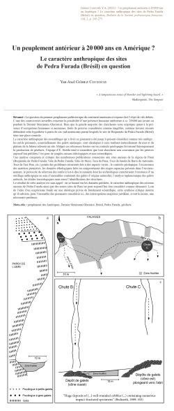
06-2021, tome 118, 2, p. 245-275-Y. A. Gómez Coutouly - Un peuplement antérieur à 20 000 ans en Amérique ? Le caractère anthropique des sites de Pedra Furada (Brésil) en question...
Un peuplement antérieur à 20000 ans en Amérique ? Le caractère anthropique des sites de Pedra Furada (Brésil) en question
Yan Axel Gómez Coutouly
Résumé : La question du premier peuplement préhistorique du continent américain a toujours fait l'objet de vifs débats. L'une des controverses actuelles concerne la possibilité d'une présence humaine antérieure à ca. 20000 ans (avant ou pendant le Dernier Maximum Glaciaire). Bien que la grande majorité des chercheurs reste sceptique quant à la présence d'occupations humaines si anciennes, faute de preuves considérées comme tangibles, certains travaux récents défendent cette hypothèse à partir de cas sud-américains parmi lesquels le site de Boqueirão da Pedra Furada (Brésil) tient une place centrale. Le caractère anthropique des assemblages qu'a livré ce gisement a été jusqu'à présent considéré comme très ambigu : les outils présumés, essentiellement des galets aménagés, sont identiques à ceux tombant naturellement du mur et du plateau de la falaise adossée au site. Malgré ces réticences basées sur un contexte géologique favorisant théoriquement la production de géofacts, l'équipe d'É.Boëda tend à considérer que tout chercheur non convaincu par les preuves aujourd'hui publiées l'est pour de simples raisons idéologiques et non scientifiques.Une analyse comparée et critique des nombreuses publications consacrées aux sites anciens de la région de Piauí (Boqueirão da Pedra Furada, Vale da Pedra Furada, Sítio do Meio, Toca da Pena, Toca da Janela da Barra do Antonião, Toca da Tira Peia, etc.) pointe des problèmes récurrents liés à des aspects variés : le contexte géologique, l'occurrence des matières premières, les données éthologiques liées au comportement des singes capucins présents dans l'environnement, le protocole de sélection des outils (c'est-à-dire la manière dont les archéologues caractérisent l'existence d'un outillage anthropique au sein d'ensembles contenant des galets d'origine naturelle), l'analyse taphonomique des galets naturels, les études tracéologiques mais aussi l'identification des structures. Le résultat de cette analyse est sans appel : en se basant sur les données publiées, le caractère anthropique des niveaux anciens de Pedra Furada ainsi que des autres sites de Piauí ne peut aujourd'hui être considéré comme démontré. Loin de l'idée d'un scepticisme fondé sur une idéologie privée de fondement scientifique, cette synthèse critique montre qu'il subsiste, pour l'ensemble des gisements considérés ici, des interrogations majeures justifiant, à tout le moins, une nécessaire prudence.
Mots-clés : peuplement des Amériques, Dernier Maximum Glaciaire, Brésil, Pedra Furada, géofacts.
Abstract: The first colonization of the Americas has always been a hotly debated issue. One of the current discussions is the presence of assemblages (and thus human occupation) in the Americas dating from or before the Late Glacial Maximum (LGM), i.e. before ca. 20.000 years ago. Many archaeologists are skeptical about the presence of humans in the Americas before the LGM, considering that the claim is not yet sustained by hard evidence. Indeed, there are relevant concerns about the published pre-LGM assemblages. The Boqueirão da Pedra Furada rock-shelter (Brazil) is one of the most famous and published pre-LGM sites from the Americas. However, the site has so far been considered very ambiguous because all alleged artifacts are simple cobble tools made on the same raw material cobbles as those naturally falling from the cliff's wall hanging above the site. Nonetheless, for É.Boëda and co-workers, who have been working at various sites of the region for the last decade, researchers that are still skeptical about the anthropic origin of the assemblages have a psychological barrier and no scientific arguments. Were all skeptics completely blinded by their preconceptions that they could not see the obvious and unambiguous evidence coming out of these South American LGM/pre-LGM sites? In order to find out, I dove into the publications of the Piauí sites. Why the Piauí sites? Because for the last 40 years there has been extensive research and publications on Boqueirão da Pedra Furada and related sites, thus offering the possibility of a detailed analysis. According to É.Boëda, most critics never took the time to go back to the published data. So to take up the challenge and refine my own judgment, I launched a large-scale comparative analysis of the published data on the Piauí site (close to 60 publications, including peer-reviewed articles, book chapters, unpublished master and PhD theses) concerning the Piauí sites, from the first article announcing the discovery of Boqueirão da Pedra Furada published in Nature in 1986 to the most recent research articles of the É.Boëda team in 2021. These publications include original research from the N.Guidon and F.Parenti excavations, from É.Boëda's excavations, original work by other researchers, original etho-logical studies on tool-use by capuchin monkeys, as well as points of view from outside archaeologists arguing either for or against the anthropic nature of these sites. In the following sections, I will present some of the main concerns archaeologists have with Boqueirão da Pedra Furada and other related sites (Vale da Pedra Furada, Sítio do Meio, Toca da Pena, Toca da Janela da Barra do Antonião, Toca da Tira Peia, etc). Indeed, the problems do not only lie in the geological context of the sites, but also with the raw mate-rials, the selection protocol of artifacts (i.e., how archaeologists determine alleged artifacts within the large quantity of natural cobbles in the sediment), the taphonomical analyses of natural cobbles, the use-wear analysis and the anthropic nature of the structures and hearths. In the introduction of their very first article, É.Boëda and his colleagues state that "this very passionate debate is actually little suited for scientific argument" and "it would thus be futile to present argu-ments" and that we simply have "to trust" in their capabilities. But the fact is that there are many questions about Pedra Furada and the Piauí sites that have yet to be addressed.The outcome of my analysis is straightforward: the anthropic nature of the LGM/pre-LGM levels of Pedra Furada and the other Piauí sites has not been demonstrated based on the data presently available in the scientific literature. Throughout this article, my goal is to show that far from skepticism based on ideological grounds with no scientific basis, many and major scientific issues remain with the Piauí sites. The present article focuses on deconstructing the methodological caveats concerning the alleged pre-LGM artifacts and structures/hearths from Boqueirão da Pedra Furada and other related sites from the Piauí region. The final outcome of this analysis, based on the analysis of the numerous published data, is that it is difficult to support a human presence in this region during or before the Last Glacial Maximum. However, the published data seem to convincingly establish a human presence at these sites start-ing with the Serra Talhada phases (Pleistocene/Holocene transition). Is it because the chronology is then acceptable and fits our colonization model? No, the reason lies in the available and published archaeological data: (1) to date, no taphonomical study has been published to exclude the presence of geofacts in the assemblages from the older Pedra Furada phases; (2) ethological data show how Capuchin monkeys have been using and making simple stone tools for at least a few millennia; (3) during the Serra Talhada phases (Pleistocene/Holocene transition), we see the appearance of unambiguous tools, exogenous raw materials, pit hearths, rock art, human remains and human coprolites; (4) current paleogenetic data show a peopling of the Americas (excluding Beringia) starting around 20,000 years ago.
Keywords: peopling of the Americas, Late Glacial Maximum, Brazil, Pedra Furada, geofacts
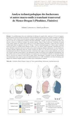
05-2021, tome 118, 2, p. 215-243 - J. CAPDEVIELLE, A.-L. RAVON - Analyse technotypologique des hachereaux et autres macro-outils à tranchant transversal de Menez-Dregan I (Plouhinec, Finistère)
Analyse technotypologique des hachereaux et autres macro-outils à tranchant transversal de Menez-Dregan I (Plouhinec, Finistère) P. 215-243
Juliette Capdevielle, Anne-Lyse Ravon
Résumé :
Les problématiques liées aux technologies de débitage de grands éclats, supérieurs à 10 cm de longueur, figurent parmi les pistes actuelles de recherche visant une meilleure caractérisation des systèmes techniques acheuléens d'Europe de l'Ouest, dont la diversité demeure complexe à appréhender. L'étude du hachereau en particulier, macro-outil sur éclat lié à un phénomène technique clairement identifiable, constitue un angle d'approche privilégié pour aborder le thème des traditions techniques des groupes humains. Dans le Massif armoricain, l'utilisation de grands éclats comme supports de certains macro-outils sur le site de Menez-Dregan I interpelle, compte tenu de la rareté de ce phénomène dans les industries du nord de l'Europe. L'analyse technotypologique de 12 macro-outils à tranchant transversal, parmi les 154000 artefacts lithiques récoltés sur ce site majeur, permet d'identifier cinq hachereaux, trois pièces bifaciales à tranchant transversal et quatre pièces dont le technotype demeure indéterminé. Les rares hachereaux de Menez-Dregan I apparaissent dans des couches corrélées aux SIM 10 à 8. Ils sont tous du type 0 de J. Tixier, au tranchant transversal situé à l'intersection de la face ventrale de l'éclat-support et d'une surface naturelle, et présentent une retouche restreinte souvent limitée à une élimination du bulbe de percussion. Des similitudes technologiques sont perceptibles entre ces pièces localement atypiques et les hachereaux issus d'industries rattachés à l'Acheuléen ibérique dans le sud-ouest du continent, inscrits dans la même fenêtre chronologique. Cependant, la part des déterminismes environnementaux, mais aussi les aspects morphofonctionnels de ces outils, demandent à être étayés davantage pour apporter des éléments tangibles quant à d'éventuels traits technoculturels communs.
Mots-clés : Acheuléen, Menez-Dregan, Europe de l'Ouest, grand débitage, hachereaux, tranchant transversal.
Abstract:
The research issues related to large flake (e.g. whose length exceed 10 cm) technologies can from now on help to characterize the Acheulean technical systems of Western Europe, whose diversity remains complex to grasp. Taking part in this variability, the Iberian Acheulean, which extends in the current state of research from the eponymous peninsula to the South of the Aquitaine Basin, testifies to the recurrent use of large flakes as blanks for the production of macro-tools. Contrastingly, the North and East of the continent are apparently largely devoid of these singular material cultures. However, the lithic industry of the major site of Menez-Dregan I in the Armorican Massif reveals the use of large flakes as blanks for the production of macro-tools, of which choppers and handaxes are the most representatives. The study of the cleaver, a particular tool technotype systematically made from large flakes, is a privileged angle of approach to the theme of the technical traditions of human groups. However, its definition is a matter of debate in the scientific community, and the various technotypological and terminological approaches addressed by different schools of thought disturb the lines of research on the subject. The fundamental difference between these points of view lies in the nature of the cutting edge, and more precisely in the concept of its production, reflecting differing views on the technocultural scope of this tool. Indeed, only J. Tixier's strict definition gives the cleaver the status of a clearly identi-fiable technical phenomenon, as a tool with a sharp cutting edge, whose production requires a mental representation of the applied method and not only of the desired form. Nevertheless, the original conceptual scheme ruling the creation of the cleaver is not necessarily applied in a homogeneous way of production. The analysis of the methods and techniques used during its production could help to clarify the variability of this technical manifestation, without neglecting the possible limiting nature of certain environments.Twelve macro-tools which have in common their transversal ending and the possibility of a flake as blank appear spo-radically within the large sequence of the site of Menez-Dregan I, within occupation levels ranging from marine isotopic stages (MIS) 11 to 8. The in-depth technological study of this new collection allows us to identify five cleavers, three Juliette Capdevielle, Anne-Lyse Ravon216Bulletin de la Société préhistorique française bifacial pieces with transversal cutting edges, and four pieces of an undetermined technotype. The analysis provides reflection on the cultural implication of these technotypes at Menez Dregan I. At first glance, cleavers and pieces with transversal cutting edges offer a relatively identical morphology with a sharp transversal cutting-edge considered as the desired purpose of the tool, which has led some authors to bring them together under the same determination. However, these pieces are part of distinct production concepts, the elaboration of the transversal cutting edge being at the heart of this nuance. Several hypotheses are ultimately possible regarding the use of different conceptual schemes to produce a transversal cutting edge, but these explanations are always linked to specific circumstances and are not generalizable. Therefore, the phenomenon seems complex, the factors influencing the production of a particular tool technotype being multiple and intertwined. It is clear, however, that the obvious technological difference between bifacial pieces and cleavers justifies a technotypological distinction of these tools in the study of material cultures. This discrepancy could reveal, in particular, a functional diversity, revealing distinct roles of these technotypes within prehistoric societies, although this theory requires further argument through further studies. The bifacial cleaver, on the other hand, is only a morphotype within the biface typological group. It is not excluded that the specific transversal cutting edge of certain bifacial pieces may reflect a functional position close to or complementary to that of the cleavers among the range of tools available to populations, the morphometrical properties of these cutting edges requiring to be specified.The rare cleavers from Menez-Dregan I appear in layers correlated with MIS 10 to 8. They all belong to Tixier's type 0, with a transversal cutting-edge located at the intersection of the ventral face of the flake-blank and a natural surface, and display a restricted retouch often limited to eliminating the bulb of percussion. A contextualization at the scale of Western Europe highlights certain technological similarities between these locally atypical pieces, and cleavers from industries related to the Iberian Acheulean in the South-West of the continent, within the same chronological time frame. As a matter of fact, a strong preponderance of Tixier's type 0 is perceptible within series from El Sartalejo, Pinedo and Porto Maior level PM4. However, the share of environmental determinisms needs to be further supported to bring tangible elements to the technocultural implication of these tools. Indeed, the eventuality that the presence or absence cleavers, as well as their modalities of production, may be linked to the limiting character or to the potentials of the available raw materials cannot be rejected. The abondance of tenacious rocks in the form of cobbles, well adapted to the debitage of large neocortical flakes, and offering particularly resisting raw linear cutting-edges, may have drawn the knappers to favoring the production of type 0 cleavers. Furthermore, the role of these tools in the mental template of the societies who produce them needs to be further precised. If the global morphometric characteristics of the different series of studied cleavers show some divergences, they do not necessarily reflect the knapper's intentions. In order to better encompass the intention of use of these tools, it would be relevant to study their structure in the frame of a techno-morpho-functional approach, leaning on the characterization of areas displaying technical and morphological convergences, considered as potential functional entities.
Keywords: Acheulean, Menez-Dregan, Western Europe, large flake technology, cleavers, transversal cutting edge.
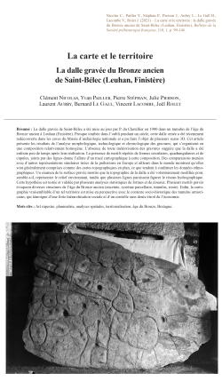
04-2021, tome 118, 1, p. 99-146 - C. NICOLAS, Y. PAILLER, P. STEPHAN, J. PIERSON, L. AUBRY, B. LE GALL, B. LE GALL, V. LACOMBE, J. ROLET - La carte et le territoire : la dalle gravée du Bronze ancien de Saint-Bélec (Leuhan, Finistère)
La carte et le territoire : la dalle gravée du Bronze ancien de Saint-Bélec (Leuhan, Finistère) p.99-146
Clément Nicolas, Yvan Pailler, Pierre Stéphan, Julie Pierson, Laurent Aubry, Bernard Le Gall, Vincent Lacombe & Joël Rolet
Résumé : La dalle gravée de Saint-Bélec a été mise au jour par P. du Chatellier en 1900 dans un tumulus de l'âge du Bronze ancien à Leuhan (Finistère). Presque tombée dans l'oubli pendant un siècle, cette dalle ornée a été récemment redécouverte dans les caves du Musée d'archéologie nationale et a pu faire l'objet de plusieurs scans 3D. Cet article présente les résultats de l'analyse morphologique, technologique et chronologique des gravures, qui s'organisent en une composition relativement homogène. L'absence de toute météorisation des gravures suggère que la dalle a été enfouie peu de temps après leur réalisation. La présence de motifs répétés de formes circulaires, quadrangulaires et de cupules, joints par des lignes donne l'allure d'un tracé cartographique à cette composition. Des comparaisons menées avec d'autres représentations similaires tirées de la préhistoire en Europe et ailleurs dans le monde montrent qu'elles sont généralement comprises comme des cartes topographiques en plan, ce que tendent à confirmer les données ethnographiques. Un examen de la surface gravée montre que la topographie de la dalle a été volontairement modifiée pour, semble-t-il, représenter le relief environnant, tandis que plusieurs lignes paraissent figurer le réseau hydrographique. Cette hypothèse est testée et validée par plusieurs analyses statistiques de formes et de réseaux. Plusieurs motifs gravés évoquent diverses structures de l'âge du Bronze ancien (enceinte, système parcellaire, tumulus, route). Enfin, la cartographie vraisemblable d'un tel territoire est mise en perspective avec le contexte socio-historique des tumulus armoricains, qui témoigne d'une forte hiérarchisation sociale et d'un contrôle sans doute étroit de l'économie.
Mots-clés : Art rupestre, planimétrie, analyses spatiales, territorialisation, âge du Bronze, Bretagne.
Abstract: The intricately carved Saint-Bélec slab found in the Leuhan parish (Finistère) was found within an early Bronze Age barrow in 1900 (fig. 1 and 2). A recent re-examination of the Saint-Bélec slab suggests that its sculptured surface and scattered motifs represent the surrounding landscape and a series of contemporary structures now known from archaeological evidence. When discovered, the slab formed the western side of one of the largest stone-cists in the region. It was orientated east-west and measured 3.86 m long, 2.1 m wide, and 1.86 m high (fig. 3). However, at the time of its excavation, the slab was partly broken, presumably in antiquity, with the upper part missing. It was surmounted by several layers of rubble stone (fig. 3, no. 6). Within the grave, was a broken ceramic vessel, now lost but characteristic of early Bronze Age pottery. The study of the slab was conducted using whole slab observations, general and detailed photographs with oblique lighting, and several 3D survey methods (photogrammetry, general and high definition 3D-scanning) to record the surface topography of the slab at different scales and to analyse the morphology, technology, and chronology of the engravings (tabl. 1, fig. 5 and 6). The generation of a 3D-Digital Elevation Map from high definition 3D-scanning and various visualisation techniques was the basis for subsequent interpretation and analysis (fig. 7 and 8). The slab is a grey-blue coloured schist, c. 2.2 m long, 1.53 m wide and 0.16 m thick. Under polarized light, the groundmass appears to be typical of the Douarnenez Phyllade series that form locally the bedrock in the Saint-Bélec area (fig. 4). All the engravings are relatively fresh and show no trace of weathering (fig. 8, no. 1 and 2), although they have suffered biological, chemical and mechanical alterations in recent times (fig. 9). This suggests that the carved slab was not exposed in the open air for long. The motifs cut into the surface are relatively uniform and show simple geometric shapes: i.e. round and oval cup-marks; straight or curved lines; and squares, circles, ovals or curved shapes (fig. 10). Some associations between motifs appear to form recurrent patterns, for example one or more cup-marks included in a closed shape, and cup-marks at line ends or intersections. One of the peculiarities of the Saint-Bélec slab is its sculptured surface. A triangular hollow has been carved out from the centre to the left-hand end. Its upper and lower edges have been shaped by two deep-pecked bas-reliefs (B1, B2/B3), the lower one having been split and cemented together in recent times (fig. 11). In between, the surface was variously weathered or freshly flaked by pecking related to superimposed motifs, suggesting that the triangular hollow probably took advantage of a pre-existing depression in the surface of the slab (fig. 8, no. 1). While there are relatively few blank areas on the decorated surface, there is very little overlap of the motifs, except at their ends. Therefore, it appears that the successive phases in creating the panel did not significantly change the overall composition but were rather added in a planned way (tabl. 2 and fig. 11). The main issue about the dating of the Saint-Bélec slab is its probable re-use. Stylistically, the motifs are quite different from those found in the regional Neolithic traditions of ???megalithic??? art. This is supported by the freshness of the engravings which implies a relatively short time-span between their creation and the subsequent burial of the slab. The most spectacular characteristic of the Saint-Bélec slab is its map-like pattern that consists of a homogeneous composition of repeated motifs joined by a series of lines. Comparisons with other similar representations from prehistoric times in Europe and elsewhere in the world show that they are commonly regarded as plan topographical maps (fig. 12 and 13); a hypothesis which is further supported as well by ethnographic data (fig. 14 to 16). A key point is that the engravers seem to have modified the original surface relief of the slab to create the desired 3D-form that compares to the topography of the surrounding landscape, the upper Odet River valley, overlooked by the Saint-Bélec barrow (fig. 17, no. 1 and 2). Furthermore, a series of lines appear to figure a more extended river network (fig. 17, no. 3 and 4). To test this hypothesis, we have led several network and shape analyses that confirm a good correspondence between the carvings and the topography (fig. 18), with similar results to ethnographic solicited maps (fig. 19). Such correlations give the opportunity to georeferenced the Saint-Bélec slab and get an idea of the possible scale of the space represented: an area c. 30 km long and 21 km wide (fig. 17, no. 5). Furthermore, the carved motifs might have depicted early Bronze Age settlements, barrows, field systems, and tracks (fig. 20, no. 1 and 2, 21 and 22). The early Bronze Age in Brittany is well known for its princely burials (fig. 23) which are regularly distributed in western Brittany and are assumed to reflect the centres of established territories that can be modelled using Thiessen Polygons. Although no such burial is known in the area, the central motif on the Saint-Bélec slab could be interpreted as a central place of an early Bronze Age territory, extending over an area of 545 to 843 sq. km (fig. 20, no. 3 and 4). One outstanding question about the Saint-Bélec slab is why it was made? One possibility is that such a territorial depiction was a material and symbolic act enforcing. Set alongside the contemporary development of field systems in Brittany making the slab perhaps suggests the appearance of a new form of land tenure, while the distribution of elite graves is closely linked to soil fertility. Against this background, we can hypothesize that the Saint-Bélec slab was used as a cadastral plan for managing the territory and controlling land.
Keywords: Rock art, planimetry, spatial analyses, territorialisation, Bronze Age, Brittany.
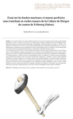
03-2021, tome 118, 1, p.77-98 - M. MAUVILLY, L. KRAMER - Essai sur les haches-marteaux et masses perforées sans tranchant en roches tenaces de la Culture de Horgen du canton de Fribourg (Suisse)
Essai sur les haches-marteaux et masses perforées sans tranchant en roches tenaces de la Culture de Horgen du canton de Fribourg (Suisse) p. 77-98
Michel Mauvilly & Léonard Kramer
Résumé : Une récente étude sur les lames de haches-marteaux et les masses perforées des collections archéologiques fribourgeoises a mis en évidence la présence d'un certain nombre de pièces singulières datées du Néolithique récent. Découvertes dans trois stations lacustres (Muntelier « Platzbünden », Delley-Portalban « Les Grèves » (Delley « Portalban II ») et Gletterens « Les Grèves ») de la culture de Horgen de Suisse occidentale (3250-3000 avant J.-C.), elles se démarquent non seulement par leur morphologie des pièces du Néolithique moyen (Cortaillod) et du Néolithique final (Auvernier-Cordé), mais également par la présence sur plusieurs d'entre-elles de décors gravés. Avec seulement deux pièces, force est de reconnaitre une certaine rareté des masses perforées dans les séries fribourgeoises. Cette indigence s'explique certainement par la concurrence ayant probablement existé avec des pièces fabriquées en bois de cerf, à l'instar des deux individus issus des fouilles de la station lacustre de Muntelier « Platzbünden ». Les haches-marteaux, au nombre de sept, sont généralement trapues et cordiformes. Formant un groupe morphométrique relativement homogène, elles ont comme caractéristique commune un « tranchant » mousse, parfois tellement arrondi que l'on peut s'interroger sur l'existence même d'un véritable tranchant. Le nombre de pièces portant des gravures intentionnelles (quatre sur sept), constitue une singularité de la série fribourgeoise. Les décors gravés apparaissent sous forme de séries de traits parallèles ou de stries/rainures formant quadrillages, étoiles ou croix. Certains éléments renvoient à la décoration présente sur quelques récipients en céramique et nous amène à nous interroger également sur le statut de ces lames perforées au sein des sociétés du Néolithique récent de Suisse occidentale.
Mots-clés : Néolithique récent, Horgen, Suisse occidentale, haches-marteaux, masses perforées, gravures.
Abstract: A recent study of stone battle-axes and mace-heads in the canton of Fribourg archaeological collections has brought to light a number of singular pieces dated to the Late Neolithic period. They come from the three main pile dwellings sites of the Horgen culture in western Switzerland (3250 - 3000 BC) : - Muntelier « Platzbünden » : This site is located on the shores of Lake Murten. A partial excavation of the village took place between 1978 and 1982. The thickness of the archaeological layer observed is in places more than 80 cm. Dendrochronological data indicates that it was occupied between 3229 and 3110 BC. - Gletterens « Les Grèves » : Located on the shores of Lake Neuchatel, this pile dwellings site has been known since the 19th century. Two archaeological layers related to the culture of Cortaillod and Horgen were discovered during excavations prior to the construction of a building between 1980 and 1987. Concerning the period of the Horgen culture, this site was occupied between 3286 and 3149 BC. It is currently a UNESCO World Heritage Site. - Delley « Portalban II » : The excavation of this lakeside village took place between 1962 and 1979 in one of the richest areas of pile dwellings sites in the canton of Fribourg. Occupations from the Middle Neolithic to the end of the Final Neolithic have been identified. Dendrochronology indicates that this village of the Culture of Horgen was occupied between 3272 and 3095 BC. On the scale of canton of Fribourg, the distribution of the Late Neolithic sites shows that they are mostly located in the low altitude zones near the lakes. Those located in the immediate hinterland of the lakes are certainly linked to hunting, agricultural and forest exploitation practices. A secondary spot of occupation has been observed along the Sarine canyon. These sites are certainly related to the exploitation of a riverside environment and along an axis of passage. Battle-axes and mace-heads from the Culture of Horgen are distinguished by their morphology of pieces from the Middle Neolithic (Cortaillod) and the Final Neolithic (Auvernier-Cordé), but also by the presence on several of them of engraved decorations. Only two mace-heads are known for the canton of Fribourg. They come from the Delley « Portalban II » site. This rarity is probably due to the existence of similar objects made of deer antlers. Two of them were found at Muntelier « Platzbünden ». In Switzerland, these objects are also quite rare in collections. The seven battle-axes from the Culture of Horgen are generally compact and cordiform. They form a relatively homogeneous morphometric group with a smooth or very rounded edge. The length of these pieces is between 97 and 119 mm for a width of 43 to 64 mm. The diameter of the perforation is also quite regular (between 15 and 22 mm). Five of these objects were discovered at Muntelier « Platzbünden », one at Delley « Portalban II » and one at Gletterens « Les Grèves ». Four pieces bear intentional engravings, which is a particularity of the canton of Fribourg. In Swiss literature, only three sites (Zürich « Parkhaus », Zürich « Opera » and Hünenberg « Chämleten ») have delivered comparable specimens. There are also rare antler battle-axes. Two pieces have been identified in two Horgen sites in Three-Lakes Region (Muntelier « Platzbünden » and Saint-Blaise « Bains des Dames ». In contrast to rock battle-axes, which are rare, and as numerous finds in the various pile dwellings sites of the Culture of Horgen show, deer antler battle-axes are part of the common tools made from hard materials of animal origin. On the battle-axes, the engraved decorations appear as a series of parallel lines or striations / grooves forming squares, stars or crosses. They are mainly located on the flanks or sometimes on the upper part and were made after polishing. Similar elements can be also found on contemporary axes. On the engraved Horgen pieces, the signs often appear to be organized in series, each one corresponding either to a type of sign or to signs opposing or complementing each other. These signs also seem to combine with each other, notably through symmetry effects. While these engraved signs may correspond to distinctive property marks, a basic system of accounting or embellishment, they may just as well have been invested with apotropaic, prophylactic, or perhaps a simplified form of symbolic cosmology. Some of these signs are also found on ceramics of the Culture of Horgen. They are not part of the ordinary vase decorations. As rare as the signs on the battle-axes are, these engraved motifs are usually simple, vertical, horizontal, or oblique segments that cross each other. There are also more complex elements forming sun, rake, fir, or herringbone decorations. All of these patterns are also found on axes. These battle-axes, because of the time of manufacture, were given a special status like almost all perforated rock objects of the Neolithic period. Some authors attribute a purely symbolic value to these particular objects refuting a more functional use. Because of their relative fragility, these pieces are not for example the best tools for splitting wood. On the other hand, it is possible that in combination with a wooden handle, they could have been used as a weapon.
Keywords: Late Neolithic, Horgen, Western Switzerland, battle-axes, mace-heads, engravings.
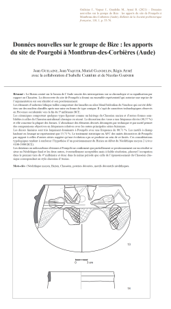
02-2021, tome 118, 1, p. 33-76 - J. GUILAINE, J. VAQUER, M. GANDELIN, R. AYME, avec la collaboration d'I. CARRERE et de N. GARNIER
Données nouvelles sur le groupe de Bize : les apports du site de Pourgobi à Montbrun-des-Corbières (Aude), p.33-76
Jean Guilaine, Jean Vaquer, Muriel Gandelin, Régis Aymé, avec la collaboration de, Isabelle Carrère & Nicolas Garnier
Résumé : Le Bizien centré sur le bassin de l'Aude suscite des interrogations sur sa chronologie et sa signification par rapport au Chasséen. La découverte du site de Pourgobi a fourni un ensemble représentatif qui autorise une reprise de l'argumentation sur son identité et son positionnement. Les éléments d'industrie lithique taillée comportent des lamelles en silex blond bédoulien du Vaucluse qui ont été débitées sur des nucléus chauffés après une mise en forme de type conique. Il s'agit de caractères technologiques observés en Provence occidentale vers la fin du 5e millénaire BCE. Les céramiques comportent quelques types figurant comme un héritage du Chasséen ancien et d'autres formes semblables à celles du Chasséen méridional classique ou récent. La décoration des vases a une fréquence élevée (48,57 %) et elle concerne la plupart des formes. L'abondance des éléments décorés décomptés par technique et par motif permet des comparaisons objectives en fréquences relatives avec les autres principales séries biziennes. Les décors linéaires sont très largement dominants à Pourgobi avec une fréquence de 80,71 %. Les motifs à champ hachuré ou losangé ne représentent que 15,71 %. Le traitement statistique en AFC des unités décoratives de Pourgobi par rapport à celles d'autres séries suggère qu'une évolution a pu se produire au sein de ce faciès. Ces considérations typologiques tendent à renforcer l'hypothèse d'un positionnement du Bizien au début du Néolithique moyen 2 (circa 4100-3900 BCE). Les datations au radiocarbone obtenues à Pourgobi ne confirment que partiellement ce positionnement car un résultat se situe au Néolithique final et les deux autres, éventuellement acceptables mais à faible résolution, placent l'occupation dans le premier tiers du 4e millénaire et donc dans la même période que celle de l'épanouissement du Chasséen classique correspondant au style chasséen d'Auriac.
Mots-clés : Néolithique moyen, Bizien, Chasséen, poteries décorées, motifs décoratifs néolithiques.
Abstract: Since its first identification and definition, the Bize group centred on the Aude basin has raised many questions about its chronological position, its significance in relation to the Chasséen and its cultural affinities. Once considered to be a transitional group between the Early and Middle Neolithic, it is now seen as a transitional group between the early Chasséen and the classical or late Southern Chasséen. Its position around 4000 BCE remains hypothetical, despite the growing number of excavations on new sites and the obtainment of several radiocarbon dates that widely overlap with late Chasseen dates. In this context, the Pourgobi site at Montbrun-des-Corbières (Aude), located to the north of the Corbières in a bend of the Aude river and revealed by vineyard deep ploughing that destroyed features, presents the advantages of providing a well-preserved set of finds and justifies reopening the debate on the chronological and cultural position of the Bize group. Survey of the ploughed field produced 16 find-spots of artefacts or burnt stones, corresponding to an equivalent number of destroyed features. Most could not be dated due to the lack of determinable finds. Others can be attributed to the Late Neolithic (2) and the Bronze Age or the Early Iron Age (2). Larger numbers of finds typical of the Bize group were found at spots 15 and 16. Pourgobi is thus a new site with an assemblage representative of the Bize group. Unlike other assemblages from the Aude basin, in which Bize style pottery is mixed with pots showing classical aspects of the Chasséen, this new assemblage can be considered homogeneous, resulting from a short-lived occupation and thus enabling a clearer definition of this original style of the Neolithic in southern France. The lithic finds are few in number but informative. They include prismatic bladelets in Bedoulian honey-coloured flint, knapped from heated conical-shaped cores. These are technological characteristics observed at the beginning of Middle Neolithic 2 in western Provence, where this type of core was manufactured and exported towards the end of the 5th millennium BCE. The lithic industry also includes a few polished stone tools made from local pebbles and grinding equipment consisting of querns, grindstones and hammers. Only one bone tool was found. These finds seem to reflect normal subsistence activities on a Neolithic settlement, ruling out the possibility that the pottery associated was used for special ritual or funerary activities. Pottery is the most significant find category. The assemblage contains 21 vessels with complete profiles, as well as a number of decorated sherds. A high percentage of the pottery is decorated (48.5 %) and this includes most shapes. Due to the quantity of decorated material, counts of techniques and motifs can be used to make objective comparisons in terms of frequency with the other main Bize assemblages. Linear decorations largely predominate at Pourgobi with a frequency of 80.7 %. Cross-hatched or grid motifs, whose role was to fix coloured paste, represent only 15.7 %. Correspondence analysis was used to examine statistically the relationship between decoration at Pourgobi and six other assemblages from the Aude basin. The results suggest that the Bize group sees a development from an early phase with coloured decoration to a later phase with mostly linear decoration. Generally speaking, the Bize style pottery presents a combination of elements that can be grouped into three components. The first includes vessels with a non-segmented profile (plates with a thickened rim, hemispherical or globular bowls, curved pots found at Pourgobi), together with segmented shapes such as the deep carinated bowl, wide-rimmed plate and pyxis which are clearly a legacy of the early Chasséen, as are the numerous hatched or lozenge decoration motifs. The second component, more specifically in the Bize style, includes segmented shapes such as shallow carinated bowls, whose cap-shaped body was probably formed with a basket, and the short, flared wall added using a single coil. The joint between the two parts is visible as a hollow on the inner side. Another typical shape is the deeper carinated bowl with concave wall. The main originality of the Bize style lies in the decoration of vessels, generally complex and extensive, with the use of particular techniques such as dotted impressions, combinations of various techniques (broad or narrow grooves, engraving, coloured incrustations) and especially curvilinear arch, garland or meander motifs. The third component presents traits that are found in assemblages of the classic or late Languedoc Chasséen (Auriac and Cavanac-Toronde style). Particularly noteworthy at Pourgobi are the many cap-shaped bowls, the most common category throughout the Middle Neolithic 2, especially the variant with a groove drawn along the inner side of the rim and sometimes "moustache" decoration linking the suspension lugs. This type is present on several Bize sites but in a more complex form, notably with rectilinear recto-verso decoration that could be the archetype of the simplified motifs of the classic and final Chasséen. Further elements heralding the segmented shapes of the classic and late Chasséen include the shouldered forms or the distinctly necked vessels that can have the customary multiple-perforated lugs. These vessels present grooved or incised linear decoration that can occur in simplified form in the classic and late Chasséen. In terms of decoration motifs, the Pourgobi assemblage appears to hold an intermediate position between assemblages with frequent and extensive coloured decoration, as on the eponymous site, and other assemblages with simplified or limited decoration such as La Salle at Carcassonne or Poste-Vieille at Pezens. These variations suggest that the Bize style lasted a certain length of time and can be divided into an early period of engraved decoration (hatching and lozenges), in the early Chasséen tradition, and a later period with incised or grooved linear decoration, forerunning the Chasséen Auriac style. These typological considerations rather support the hypothesis that the Bize group dates to the beginning of Middle Neolithic 2, either at the end of the 5th millennium or the beginning of the 4th millennium BCE. The radiocarbon dates from Pourgobi only partially confirm this chronological position. One date corresponds to the final Neolithic and the other two lie in the first third of the 4th millennium BCE, the period when the classic Chasséen flourished, corresponding to the Auriac style.
Keywords: Middle Neolithic, Bize, Chasséen, decorated pottery, Neolithic decoration motifs.
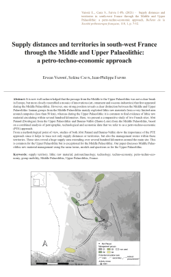
01-2021, tome 118, 1, p.7-32 - E. VAISSIE, S. CAUX, J.-P. FAIVRE - Supply distances and territories in south-west France through the Middle and Upper Palaeolithic: a petro-techno-economic approach
Supply distances and territories in south-west France through the Middle and Upper Palaeolithic: a petro-techno-economic approach p.7-32
Erwan Vaissié, Solène Caux & Jean-Philippe Faivre
Abstract: It is now well-acknowledged that the passage from the Middle to the Upper Palaeolithic was not a clear break in Europe, but more closely resembled a mosaic of innovations (art, ornament and osseous industries) that first appeared during the Middle Palaeolithic. However, one strong position reveals a clear distinction between the Middle and Upper Palaeolithic: human groups from the Middle Palaeolithic mainly exploited lithic raw materials from a very limited area around campsites (less than 50 km), whereas during the Upper Palaeolithic it is common to find evidence of lithic raw material circulating within several hundred kilometres. Here, we present a comparative study of two French sites: Abri Pataud (Dordogne) from the Upper Palaeolithic and Baume-Vallée (Haute-Loire) from the Middle Palaeolithic, based on a combined analysis of petrographic, technological and economic data that we refer to as a petro-techno-economic (PTE) approach. From a methodological point of view, studies of both Abri Pataud and Baume-Vallée show the importance of the PTE approach since it helps to trace not only supply distances or territories, but also the management routes within these territories. These sites reveal a huge supply area extending over several hundred kilometres around the main site. This is common for the Upper Palaeolithic but is exceptional for the Middle Palaeolithic. Our paper discusses Middle Palaeolithic raw material management using the same terms, models and questions as for the Upper Palaeolithic.
Keywords: supply territory, lithic raw material, petroarchaeology, technology, techno-economy, petro-techno-economy, group mobility, Middle Palaeolithic, Upper Palaeolithic, France.
Résumé : Le passage du Paléolithique moyen au Paléolithique récent n'est désormais plus perçu comme une rupture franche mais comme la succession d'une mosaïque d'innovations (art, ornements, industries osseuses) apparues au cours du Paléolithique moyen. Il n'en demeure pas moins qu'une distinction forte demeure entre ces deux périodes : les groupes humains du Paléolithique moyen exploitent majoritairement les matériaux lithiques présents à courtes distances du gisement (moins de 50 km) tandis qu'au Paléolithique récent il est fréquent de trouver des évidences de circulations de géomatériaux sur plusieurs centaines de kilomètres. Nous présentons ici une étude comparative de deux gisements français : l'abri Pataud (Dordogne) pour le Paléolithique supérieur, et le gisement de Baume-Vallée (Haute-Loire) pour le Paléolithique moyen, basée sur une approche combinée de données pétrographique, technologique et économiques que nous nommons approche pétro-techno-économique (PTE). Cette approche intègre les démarches et avancées récentes des disciplines de la pétroarchéologie, et de la techno-typologie au service d'une problématique techno-économique (Geneste, 2010), et permet de mettre en évidence les comportements socio-économiques des populations passées. Nous proposons donc ici de discuter de la gestion des ressources lithiques au Paléolithique moyen en utilisant les mêmes termes, méthodes et questions que pour le Paléolithique récent. Du point de vue méthodologique, l'étude des gisements de l'Abri Pataud et de Baume-Vallée s'est articulée autour d'une double approche. D'une part les déterminations pétroarchéologiques exhaustives à l'échelle macro-mésoscopique (loupe binoculaire à fort grossissement, ×20 à ×150, et macroscope) selon des principes analytiques discutés et enrichis depuis les années 1980 (Masson, 1981 ; Séronie-Vivien et al., 1987 ; Affolter et al., 2008 ; Fernandes, 2012) et l'intégration des principes de chaîne évolutive (Fernandes et Raynal, 2006 ; Fernandes, 2012) permettant une meilleure compréhension et identification des gitologies de collecte potentielles. D'autre part l'étude des comportements techno-économiques (Geneste, 2010) appliqués à chaque matériau suivant une analyse segmentée de la chaîne opératoire suivant quatre étapes principales. Cette double approche permet la mise en évidence de groupes pétro-techno-économiques homogènes, utilisés pour discuter et comparer les comportements socio-économiques. Nous pouvons ainsi envisager les distances d'approvisionnement et les territoires des groupes humains, mais également identifier les variations de gestions sur certains itinéraires au sein de ces territoires, la planification des mobilités et les potentiels réseaux de transferts. Les deux gisements étudiés montrent un espace d'approvisionnement en matière première lithique très large s'étendant sur plusieurs centaines de kilomètres autour du gisement. Si de tels résultats sont communs pour le Paléolithique récent, ils demeurent extrêmement rares pour le Paléolithique moyen. Ils apparaissent notamment en contradiction avec la décroissance quantitative supposée des matériaux, et leur plus forte consommation économique, à mesure que la distance au gite augmente. Pour l'Abri Pataud, six groupes principaux de matières premières se répartissant en quatre groupes PTE de gestion ont été identifiés (tableau 1) : les silex sénoniens du Périgord (groupe PTE 1), les silex du Bergeracois et du Grain de Mil (groupe PTE 2), les silex du Turonien supérieur du Grand-Pressigny (groupe PTE 3) et les silex du Turonien d'Angoulême et du Crétacé de Chalosse (groupe PTE 4). Les interprétations divergent en fonction de l'importance accordée aux réseaux de transferts : si l'on favorise une acquisition directe des matériaux, les données pourraient illustrer un territoire organisé autour d'une mobilité saisonnière à longue distance entre le sud du Bassin parisien et le Périgord. Cette hypothèse peut être mise en relation avec les données issues des études archéozoologiques (Sekhr, 1998 ; Soulier, 2013) qui illustrent une chasse préférentielle au printemps et en été. La Charente constituerait alors un espace pivot, propice à la constitution de stock de matières premières avant un séjour en Périgord, quand les matériaux originaires de Chalosse marqueraient des transferts avec d'autres groupes situés vers les Pyrénées. Si l'on favorise l'hypothèse des acquisitions indirectes, les espaces charentais et périgordiens représenteraient les pôles terminaux d'un territoire social centré autour de la vallée de la Dordogne, et des espaces relais au sein d'un réseau de transfert intégrant des territoires voisins centrés sur le Sud du Bassin parisien et les Pyrénées. Ces hypothèses rejoignent celles déjà formulées antérieurement pour l'Aurignacien récent à burin busqué (Bordes et al., 2005 ; Féblot-Augustins, 2008 et 2009 ; Caux, 2015 ; Caux et Bordes, 2016). Pour Baume-Vallée, 37 groupes de matériaux issus de 15 géotopes principaux ont été identifiés (Vaissié et al., 2017) et se répartissent en quatre groupes PTE de gestion (tableau 2) : silex oligocènes de la vallée de la Borne (groupe PTE 1) ; silex aaléniens du Velay, silcrète de Saint-Pierre-Eynac, silicifications du bassin de Naussac, silcrètes de la Paléo-Truyère et de Saint-Léger-du-Malzieu, silex du Turonien inférieur de la vallée du Cher et du Turonien supérieur du Grand-Pressigny (groupe PTE 2) ; silcrète de la vallée de la Laussone (La Collange), silex du Mazet-Saint-Voy, silcrète d'Arlanc, silex barrémo-bédoulien de Rochemaure-Cruas, silex oligocènes du bassin des Limagnes et du bassin d'Aurillac (groupe PTE 3) ; silcrète pédogénétique de Madriat et silex sénoniens du Loiret (groupe PTE 4). Que ce soit par l'ampleur des circulations ou l'économie des matériaux représentés sur le site, les données pétro-techno-économiques livrent des résultats qui dénotent de la variabilité des comportements couramment observés au Paléolithique moyen. Loin d'exprimer les stratégies opportunistes couramment décries, on observe une réelle planification et une anticipation des besoins en matière première, à la fois à une échelle régionale et extrarégionale. Si l'hypothèse d'une acquisition directe semble pouvoir être privilégiée en majorité, la présence de matériaux faiblement représentés et dont l'acquisition implique le franchissement de contraintes naturelles majeures pourrait être un argument en faveur de la mise en évidence de réseaux de transferts. Dans ce cas, le territoire des groupes humains de Baume-Vallée s'organiserait suivant des cycles de nomadismes saisonniers à grande échelle entre le sud du Bassin parisien et l'espace vellave. Ce territoire pourrait s'articuler, via des réseaux sociaux structurés, avec d'autres territoires moustériens limitrophes : Bassin aquitain, Bassin parisien, vallée du Rhône et potentiellement vallée de la Loire.
21 articles disponibles
 17-2021, tome 118, 4, p. 697-737 - C. HAMON, S. REGUER, V. BRISOTTO, C. LE CARLIER DE VESLUD, K. DONNART, S. BLANCHET, Y. PAILLER, Y. ESCATS, L. BELLOT-GURLET - Des outils de métallurgistes dans le Bronze ancien de Bretagne ? Révéler l
Prix : 15,00 € TTC
 16-2021, tome 118, 4, p. 671-696 - Y. TCHEREMISSINOFF, R. DONAT, G. GOUDE, M. REMICOURT, H. VERGELY, avec la collaboration de F. CONVERTINI et J.GRIMAUD — Les sépultures et dépôts humains du site néolithique de la Cavalade à Montpellier (Hérault)
Prix : 15,00 € TTC
 15-2021, tome 118, 4, p. 643-670 -L. CHRISTIN, F. DUCREUX, C. FOSSURIER, D. SORDOILLET, avec les participations de F. CATTIN, D. CAMBOU et A. DUFRAISSE — Crémations et monument funéraire campaniformes à Genlis « le Nicolot » (Côte-d’Or, France)
Prix : 15,00 € TTC
 14-2021, tome 118, 4, p. 619-642 - E. VAISSIE, M. MASSOULIE, J. COMBIER †, S. SORIANO — Nouveau regard sur le Moustérien
 de Bourgogne : première relecture des industries lithiques de la grotte de Vergisson IV (Saône-et-Loire)
Prix : 15,00 € TTC
 13-2021, tome 118, 3, p. 519-568 - F. Couderc, F. Bordas, J.Gomez de Soto, C. Le Carlier de Veslud, P.-Y. Milcent, S. Révillon — À la charnière des espaces médio- et ibéro-atlantiques et continentaux : l’ensemble métallique du Bronze final atlantique 3 an
Prix : 15,00 € TTC
 12-2021, tome 118, 3, p. 475-518 - Ch.-C. Besnard-Vauterin, G. Auxiette, M. Le Puil-Texier, C. Marcigny — Une enceinte de type ring fort du Bronze final et un enclos d’habitat du premier âge du Fer à Mondeville (Calvados
Prix : 15,00 € TTC
 11-2021, tome 118, 3, p. 453-473 - E. López-Montalvo, C. Manen, J. Guilaine, F. Baleux, F. Convertini — Figurative graphic expressions and the first Western Mediterranean farmers: a new zoomorphic contribution from Southern France
Prix : 15,00 € TTC
 10-2021, tome 118, 3, p. 427-451 - G. Ricci, G. Porraz, A. Tomasso — Les systèmes techniques lithiques à la Baume de Monthiver (vallée du Jabron, Var) dans le contexte du Premier Mésolithique des Préalpes méridionales
Prix : 15,00 € TTC
 09-2021, tome 118, 2, p. 363-388- A. Schmitt, S. Van Willigen, A. Vignaud - Les inhumations du Néolithique et de l'âge du Bronze du Rouergas (Saint-Gély-du-Fesc) et leur contexte régional
 Prix : 15,00 € TTC
 08-2021, tome 118, 2, p. 323-362 - F. Lorenzi, A. Colonna, M. Dubar, C. Nicollet, B. Zamagni, J. Conforti
Prix : 15,00 € TTC
 07-2021, tome 118, 2, p. 277-322- V. Blouet, D. Bosquet, C. Constantin, H. Fock, M. Ilett, I. Jadin, T. Klag, M.-P. Petitdidier, L. Thomashausen-Le Rubané en Belgique : nouvelle chronologie céramique et synchronisation avec les régions voisines
Prix : 15,00 € TTC
 06-2021, tome 118, 2, p. 245-275-Y. A. Gómez Coutouly - Un peuplement antérieur à 20 000 ans en Amérique ? Le caractère anthropique des sites de Pedra Furada (Brésil) en question...
Prix : 15,00 € TTC
 05-2021, tome 118, 2, p. 215-243 - J. CAPDEVIELLE, A.-L. RAVON - Analyse technotypologique des hachereaux et autres macro-outils à tranchant transversal de Menez-Dregan I (Plouhinec, Finistère)
Prix : 15,00 € TTC
 04-2021, tome 118, 1, p. 99-146 - C. NICOLAS, Y. PAILLER, P. STEPHAN, J. PIERSON, L. AUBRY, B. LE GALL, B. LE GALL, V. LACOMBE, J. ROLET - La carte et le territoire : la dalle gravée du Bronze ancien de Saint-Bélec (Leuhan, Finistère)
Prix : 15,00 € TTC
 03-2021, tome 118, 1, p.77-98 - M. MAUVILLY, L. KRAMER - Essai sur les haches-marteaux et masses perforées sans tranchant en roches tenaces de la Culture de Horgen du canton de Fribourg (Suisse)
Prix : 15,00 € TTC
 02-2021, tome 118, 1, p. 33-76 - J. GUILAINE, J. VAQUER, M. GANDELIN, R. AYME, avec la collaboration d'I. CARRERE et de N. GARNIER
Prix : 15,00 € TTC
Coordonnées
Pôle éditorial de la MSH Mondes
(Maison de l'archéologie et de l'éthnologie)
Boite 41
21 allée de l'Université
F-92023 Nanterre cedex - FRANCE
Société préhistorique française
- La SPF
- Réunions
- Le Bulletin de la SPF
- Organisation et comité de rédaction
- Comité de lecture (2020-2025)
- Ligne éditoriale et consignes BSPF
- Données supplémentaires
- Annoncer dans le Bulletin de la SPF
- Séances de la SPF (suppléments)
- Bulletin de la SPF 2025, tome 122
- Bulletin de la SPF 2024, tome 121
- Bulletin de la SPF 2023, tome 120
- Bulletin de la SPF 2022, tome 119
- Archives BSPF 1904-2021 en accès libre
- Publications
- Newsletter
- Boutique
Powered by aiw-pro | all-in-web © 2025 | Simplifiez-vous la vie!
Chargement de la page : 1973 ms

