- La SPF
- Réunions
- Le Bulletin de la SPF
- Organisation et comité de rédaction
- Comité de lecture (2020-2025)
- Ligne éditoriale et consignes BSPF
- Données supplémentaires
- Annoncer dans le Bulletin de la SPF
- Séances de la SPF (suppléments)
- Bulletin de la SPF 2025, tome 122
- Bulletin de la SPF 2024, tome 121
- Bulletin de la SPF 2023, tome 120
- Bulletin de la SPF 2022, tome 119
- Archives BSPF 1904-2021 en accès libre
- Publications
- Newsletter
- Boutique
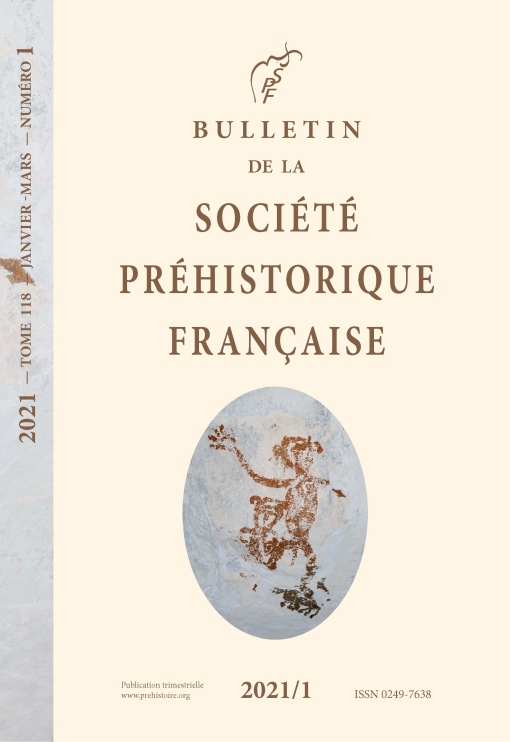
EN - Bulletin de la Société préhistorique française 2021
Cliquez sur la photo pour zoomer
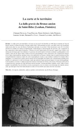
04-2021, tome 118, 1, p. 99-146 - C. NICOLAS, Y. PAILLER, P. STEPHAN, J. PIERSON, L. AUBRY, B. LE GALL, B. LE GALL, V. LACOMBE, J. ROLET - La carte et le territoire : la dalle gravée du Bronze ancien de Saint-Bélec (Leuhan, Finistère)
La carte et le territoire : la dalle gravée du Bronze ancien de Saint-Bélec (Leuhan, Finistère) p.99-146
Clément Nicolas, Yvan Pailler, Pierre Stéphan, Julie Pierson, Laurent Aubry, Bernard Le Gall, Vincent Lacombe & Joël Rolet
Résumé : La dalle gravée de Saint-Bélec a été mise au jour par P. du Chatellier en 1900 dans un tumulus de l'âge du Bronze ancien à Leuhan (Finistère). Presque tombée dans l'oubli pendant un siècle, cette dalle ornée a été récemment redécouverte dans les caves du Musée d'archéologie nationale et a pu faire l'objet de plusieurs scans 3D. Cet article présente les résultats de l'analyse morphologique, technologique et chronologique des gravures, qui s'organisent en une composition relativement homogène. L'absence de toute météorisation des gravures suggère que la dalle a été enfouie peu de temps après leur réalisation. La présence de motifs répétés de formes circulaires, quadrangulaires et de cupules, joints par des lignes donne l'allure d'un tracé cartographique à cette composition. Des comparaisons menées avec d'autres représentations similaires tirées de la préhistoire en Europe et ailleurs dans le monde montrent qu'elles sont généralement comprises comme des cartes topographiques en plan, ce que tendent à confirmer les données ethnographiques. Un examen de la surface gravée montre que la topographie de la dalle a été volontairement modifiée pour, semble-t-il, représenter le relief environnant, tandis que plusieurs lignes paraissent figurer le réseau hydrographique. Cette hypothèse est testée et validée par plusieurs analyses statistiques de formes et de réseaux. Plusieurs motifs gravés évoquent diverses structures de l'âge du Bronze ancien (enceinte, système parcellaire, tumulus, route). Enfin, la cartographie vraisemblable d'un tel territoire est mise en perspective avec le contexte socio-historique des tumulus armoricains, qui témoigne d'une forte hiérarchisation sociale et d'un contrôle sans doute étroit de l'économie.
Mots-clés : Art rupestre, planimétrie, analyses spatiales, territorialisation, âge du Bronze, Bretagne.
Abstract: The intricately carved Saint-Bélec slab found in the Leuhan parish (Finistère) was found within an early Bronze Age barrow in 1900 (fig. 1 and 2). A recent re-examination of the Saint-Bélec slab suggests that its sculptured surface and scattered motifs represent the surrounding landscape and a series of contemporary structures now known from archaeological evidence. When discovered, the slab formed the western side of one of the largest stone-cists in the region. It was orientated east-west and measured 3.86 m long, 2.1 m wide, and 1.86 m high (fig. 3). However, at the time of its excavation, the slab was partly broken, presumably in antiquity, with the upper part missing. It was surmounted by several layers of rubble stone (fig. 3, no. 6). Within the grave, was a broken ceramic vessel, now lost but characteristic of early Bronze Age pottery. The study of the slab was conducted using whole slab observations, general and detailed photographs with oblique lighting, and several 3D survey methods (photogrammetry, general and high definition 3D-scanning) to record the surface topography of the slab at different scales and to analyse the morphology, technology, and chronology of the engravings (tabl. 1, fig. 5 and 6). The generation of a 3D-Digital Elevation Map from high definition 3D-scanning and various visualisation techniques was the basis for subsequent interpretation and analysis (fig. 7 and 8). The slab is a grey-blue coloured schist, c. 2.2 m long, 1.53 m wide and 0.16 m thick. Under polarized light, the groundmass appears to be typical of the Douarnenez Phyllade series that form locally the bedrock in the Saint-Bélec area (fig. 4). All the engravings are relatively fresh and show no trace of weathering (fig. 8, no. 1 and 2), although they have suffered biological, chemical and mechanical alterations in recent times (fig. 9). This suggests that the carved slab was not exposed in the open air for long. The motifs cut into the surface are relatively uniform and show simple geometric shapes: i.e. round and oval cup-marks; straight or curved lines; and squares, circles, ovals or curved shapes (fig. 10). Some associations between motifs appear to form recurrent patterns, for example one or more cup-marks included in a closed shape, and cup-marks at line ends or intersections. One of the peculiarities of the Saint-Bélec slab is its sculptured surface. A triangular hollow has been carved out from the centre to the left-hand end. Its upper and lower edges have been shaped by two deep-pecked bas-reliefs (B1, B2/B3), the lower one having been split and cemented together in recent times (fig. 11). In between, the surface was variously weathered or freshly flaked by pecking related to superimposed motifs, suggesting that the triangular hollow probably took advantage of a pre-existing depression in the surface of the slab (fig. 8, no. 1). While there are relatively few blank areas on the decorated surface, there is very little overlap of the motifs, except at their ends. Therefore, it appears that the successive phases in creating the panel did not significantly change the overall composition but were rather added in a planned way (tabl. 2 and fig. 11). The main issue about the dating of the Saint-Bélec slab is its probable re-use. Stylistically, the motifs are quite different from those found in the regional Neolithic traditions of ???megalithic??? art. This is supported by the freshness of the engravings which implies a relatively short time-span between their creation and the subsequent burial of the slab. The most spectacular characteristic of the Saint-Bélec slab is its map-like pattern that consists of a homogeneous composition of repeated motifs joined by a series of lines. Comparisons with other similar representations from prehistoric times in Europe and elsewhere in the world show that they are commonly regarded as plan topographical maps (fig. 12 and 13); a hypothesis which is further supported as well by ethnographic data (fig. 14 to 16). A key point is that the engravers seem to have modified the original surface relief of the slab to create the desired 3D-form that compares to the topography of the surrounding landscape, the upper Odet River valley, overlooked by the Saint-Bélec barrow (fig. 17, no. 1 and 2). Furthermore, a series of lines appear to figure a more extended river network (fig. 17, no. 3 and 4). To test this hypothesis, we have led several network and shape analyses that confirm a good correspondence between the carvings and the topography (fig. 18), with similar results to ethnographic solicited maps (fig. 19). Such correlations give the opportunity to georeferenced the Saint-Bélec slab and get an idea of the possible scale of the space represented: an area c. 30 km long and 21 km wide (fig. 17, no. 5). Furthermore, the carved motifs might have depicted early Bronze Age settlements, barrows, field systems, and tracks (fig. 20, no. 1 and 2, 21 and 22). The early Bronze Age in Brittany is well known for its princely burials (fig. 23) which are regularly distributed in western Brittany and are assumed to reflect the centres of established territories that can be modelled using Thiessen Polygons. Although no such burial is known in the area, the central motif on the Saint-Bélec slab could be interpreted as a central place of an early Bronze Age territory, extending over an area of 545 to 843 sq. km (fig. 20, no. 3 and 4). One outstanding question about the Saint-Bélec slab is why it was made? One possibility is that such a territorial depiction was a material and symbolic act enforcing. Set alongside the contemporary development of field systems in Brittany making the slab perhaps suggests the appearance of a new form of land tenure, while the distribution of elite graves is closely linked to soil fertility. Against this background, we can hypothesize that the Saint-Bélec slab was used as a cadastral plan for managing the territory and controlling land.
Keywords: Rock art, planimetry, spatial analyses, territorialisation, Bronze Age, Brittany.
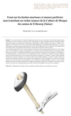
03-2021, tome 118, 1, p.77-98 - M. MAUVILLY, L. KRAMER - Essai sur les haches-marteaux et masses perforées sans tranchant en roches tenaces de la Culture de Horgen du canton de Fribourg (Suisse)
Essai sur les haches-marteaux et masses perforées sans tranchant en roches tenaces de la Culture de Horgen du canton de Fribourg (Suisse) p. 77-98
Michel Mauvilly & Léonard Kramer
Résumé : Une récente étude sur les lames de haches-marteaux et les masses perforées des collections archéologiques fribourgeoises a mis en évidence la présence d'un certain nombre de pièces singulières datées du Néolithique récent. Découvertes dans trois stations lacustres (Muntelier « Platzbünden », Delley-Portalban « Les Grèves » (Delley « Portalban II ») et Gletterens « Les Grèves ») de la culture de Horgen de Suisse occidentale (3250-3000 avant J.-C.), elles se démarquent non seulement par leur morphologie des pièces du Néolithique moyen (Cortaillod) et du Néolithique final (Auvernier-Cordé), mais également par la présence sur plusieurs d'entre-elles de décors gravés. Avec seulement deux pièces, force est de reconnaitre une certaine rareté des masses perforées dans les séries fribourgeoises. Cette indigence s'explique certainement par la concurrence ayant probablement existé avec des pièces fabriquées en bois de cerf, à l'instar des deux individus issus des fouilles de la station lacustre de Muntelier « Platzbünden ». Les haches-marteaux, au nombre de sept, sont généralement trapues et cordiformes. Formant un groupe morphométrique relativement homogène, elles ont comme caractéristique commune un « tranchant » mousse, parfois tellement arrondi que l'on peut s'interroger sur l'existence même d'un véritable tranchant. Le nombre de pièces portant des gravures intentionnelles (quatre sur sept), constitue une singularité de la série fribourgeoise. Les décors gravés apparaissent sous forme de séries de traits parallèles ou de stries/rainures formant quadrillages, étoiles ou croix. Certains éléments renvoient à la décoration présente sur quelques récipients en céramique et nous amène à nous interroger également sur le statut de ces lames perforées au sein des sociétés du Néolithique récent de Suisse occidentale.
Mots-clés : Néolithique récent, Horgen, Suisse occidentale, haches-marteaux, masses perforées, gravures.
Abstract: A recent study of stone battle-axes and mace-heads in the canton of Fribourg archaeological collections has brought to light a number of singular pieces dated to the Late Neolithic period. They come from the three main pile dwellings sites of the Horgen culture in western Switzerland (3250 - 3000 BC) : - Muntelier « Platzbünden » : This site is located on the shores of Lake Murten. A partial excavation of the village took place between 1978 and 1982. The thickness of the archaeological layer observed is in places more than 80 cm. Dendrochronological data indicates that it was occupied between 3229 and 3110 BC. - Gletterens « Les Grèves » : Located on the shores of Lake Neuchatel, this pile dwellings site has been known since the 19th century. Two archaeological layers related to the culture of Cortaillod and Horgen were discovered during excavations prior to the construction of a building between 1980 and 1987. Concerning the period of the Horgen culture, this site was occupied between 3286 and 3149 BC. It is currently a UNESCO World Heritage Site. - Delley « Portalban II » : The excavation of this lakeside village took place between 1962 and 1979 in one of the richest areas of pile dwellings sites in the canton of Fribourg. Occupations from the Middle Neolithic to the end of the Final Neolithic have been identified. Dendrochronology indicates that this village of the Culture of Horgen was occupied between 3272 and 3095 BC. On the scale of canton of Fribourg, the distribution of the Late Neolithic sites shows that they are mostly located in the low altitude zones near the lakes. Those located in the immediate hinterland of the lakes are certainly linked to hunting, agricultural and forest exploitation practices. A secondary spot of occupation has been observed along the Sarine canyon. These sites are certainly related to the exploitation of a riverside environment and along an axis of passage. Battle-axes and mace-heads from the Culture of Horgen are distinguished by their morphology of pieces from the Middle Neolithic (Cortaillod) and the Final Neolithic (Auvernier-Cordé), but also by the presence on several of them of engraved decorations. Only two mace-heads are known for the canton of Fribourg. They come from the Delley « Portalban II » site. This rarity is probably due to the existence of similar objects made of deer antlers. Two of them were found at Muntelier « Platzbünden ». In Switzerland, these objects are also quite rare in collections. The seven battle-axes from the Culture of Horgen are generally compact and cordiform. They form a relatively homogeneous morphometric group with a smooth or very rounded edge. The length of these pieces is between 97 and 119 mm for a width of 43 to 64 mm. The diameter of the perforation is also quite regular (between 15 and 22 mm). Five of these objects were discovered at Muntelier « Platzbünden », one at Delley « Portalban II » and one at Gletterens « Les Grèves ». Four pieces bear intentional engravings, which is a particularity of the canton of Fribourg. In Swiss literature, only three sites (Zürich « Parkhaus », Zürich « Opera » and Hünenberg « Chämleten ») have delivered comparable specimens. There are also rare antler battle-axes. Two pieces have been identified in two Horgen sites in Three-Lakes Region (Muntelier « Platzbünden » and Saint-Blaise « Bains des Dames ». In contrast to rock battle-axes, which are rare, and as numerous finds in the various pile dwellings sites of the Culture of Horgen show, deer antler battle-axes are part of the common tools made from hard materials of animal origin. On the battle-axes, the engraved decorations appear as a series of parallel lines or striations / grooves forming squares, stars or crosses. They are mainly located on the flanks or sometimes on the upper part and were made after polishing. Similar elements can be also found on contemporary axes. On the engraved Horgen pieces, the signs often appear to be organized in series, each one corresponding either to a type of sign or to signs opposing or complementing each other. These signs also seem to combine with each other, notably through symmetry effects. While these engraved signs may correspond to distinctive property marks, a basic system of accounting or embellishment, they may just as well have been invested with apotropaic, prophylactic, or perhaps a simplified form of symbolic cosmology. Some of these signs are also found on ceramics of the Culture of Horgen. They are not part of the ordinary vase decorations. As rare as the signs on the battle-axes are, these engraved motifs are usually simple, vertical, horizontal, or oblique segments that cross each other. There are also more complex elements forming sun, rake, fir, or herringbone decorations. All of these patterns are also found on axes. These battle-axes, because of the time of manufacture, were given a special status like almost all perforated rock objects of the Neolithic period. Some authors attribute a purely symbolic value to these particular objects refuting a more functional use. Because of their relative fragility, these pieces are not for example the best tools for splitting wood. On the other hand, it is possible that in combination with a wooden handle, they could have been used as a weapon.
Keywords: Late Neolithic, Horgen, Western Switzerland, battle-axes, mace-heads, engravings.
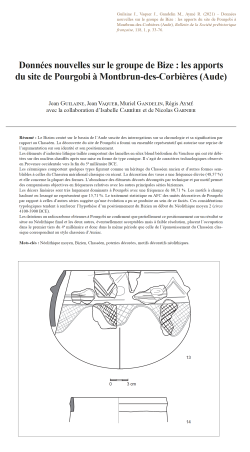
02-2021, tome 118, 1, p. 33-76 - J. GUILAINE, J. VAQUER, M. GANDELIN, R. AYME, avec la collaboration d'I. CARRERE et de N. GARNIER
Données nouvelles sur le groupe de Bize : les apports du site de Pourgobi à Montbrun-des-Corbières (Aude), p.33-76
Jean Guilaine, Jean Vaquer, Muriel Gandelin, Régis Aymé, avec la collaboration de, Isabelle Carrère & Nicolas Garnier
Résumé : Le Bizien centré sur le bassin de l'Aude suscite des interrogations sur sa chronologie et sa signification par rapport au Chasséen. La découverte du site de Pourgobi a fourni un ensemble représentatif qui autorise une reprise de l'argumentation sur son identité et son positionnement. Les éléments d'industrie lithique taillée comportent des lamelles en silex blond bédoulien du Vaucluse qui ont été débitées sur des nucléus chauffés après une mise en forme de type conique. Il s'agit de caractères technologiques observés en Provence occidentale vers la fin du 5e millénaire BCE. Les céramiques comportent quelques types figurant comme un héritage du Chasséen ancien et d'autres formes semblables à celles du Chasséen méridional classique ou récent. La décoration des vases a une fréquence élevée (48,57 %) et elle concerne la plupart des formes. L'abondance des éléments décorés décomptés par technique et par motif permet des comparaisons objectives en fréquences relatives avec les autres principales séries biziennes. Les décors linéaires sont très largement dominants à Pourgobi avec une fréquence de 80,71 %. Les motifs à champ hachuré ou losangé ne représentent que 15,71 %. Le traitement statistique en AFC des unités décoratives de Pourgobi par rapport à celles d'autres séries suggère qu'une évolution a pu se produire au sein de ce faciès. Ces considérations typologiques tendent à renforcer l'hypothèse d'un positionnement du Bizien au début du Néolithique moyen 2 (circa 4100-3900 BCE). Les datations au radiocarbone obtenues à Pourgobi ne confirment que partiellement ce positionnement car un résultat se situe au Néolithique final et les deux autres, éventuellement acceptables mais à faible résolution, placent l'occupation dans le premier tiers du 4e millénaire et donc dans la même période que celle de l'épanouissement du Chasséen classique correspondant au style chasséen d'Auriac.
Mots-clés : Néolithique moyen, Bizien, Chasséen, poteries décorées, motifs décoratifs néolithiques.
Abstract: Since its first identification and definition, the Bize group centred on the Aude basin has raised many questions about its chronological position, its significance in relation to the Chasséen and its cultural affinities. Once considered to be a transitional group between the Early and Middle Neolithic, it is now seen as a transitional group between the early Chasséen and the classical or late Southern Chasséen. Its position around 4000 BCE remains hypothetical, despite the growing number of excavations on new sites and the obtainment of several radiocarbon dates that widely overlap with late Chasseen dates. In this context, the Pourgobi site at Montbrun-des-Corbières (Aude), located to the north of the Corbières in a bend of the Aude river and revealed by vineyard deep ploughing that destroyed features, presents the advantages of providing a well-preserved set of finds and justifies reopening the debate on the chronological and cultural position of the Bize group. Survey of the ploughed field produced 16 find-spots of artefacts or burnt stones, corresponding to an equivalent number of destroyed features. Most could not be dated due to the lack of determinable finds. Others can be attributed to the Late Neolithic (2) and the Bronze Age or the Early Iron Age (2). Larger numbers of finds typical of the Bize group were found at spots 15 and 16. Pourgobi is thus a new site with an assemblage representative of the Bize group. Unlike other assemblages from the Aude basin, in which Bize style pottery is mixed with pots showing classical aspects of the Chasséen, this new assemblage can be considered homogeneous, resulting from a short-lived occupation and thus enabling a clearer definition of this original style of the Neolithic in southern France. The lithic finds are few in number but informative. They include prismatic bladelets in Bedoulian honey-coloured flint, knapped from heated conical-shaped cores. These are technological characteristics observed at the beginning of Middle Neolithic 2 in western Provence, where this type of core was manufactured and exported towards the end of the 5th millennium BCE. The lithic industry also includes a few polished stone tools made from local pebbles and grinding equipment consisting of querns, grindstones and hammers. Only one bone tool was found. These finds seem to reflect normal subsistence activities on a Neolithic settlement, ruling out the possibility that the pottery associated was used for special ritual or funerary activities. Pottery is the most significant find category. The assemblage contains 21 vessels with complete profiles, as well as a number of decorated sherds. A high percentage of the pottery is decorated (48.5 %) and this includes most shapes. Due to the quantity of decorated material, counts of techniques and motifs can be used to make objective comparisons in terms of frequency with the other main Bize assemblages. Linear decorations largely predominate at Pourgobi with a frequency of 80.7 %. Cross-hatched or grid motifs, whose role was to fix coloured paste, represent only 15.7 %. Correspondence analysis was used to examine statistically the relationship between decoration at Pourgobi and six other assemblages from the Aude basin. The results suggest that the Bize group sees a development from an early phase with coloured decoration to a later phase with mostly linear decoration. Generally speaking, the Bize style pottery presents a combination of elements that can be grouped into three components. The first includes vessels with a non-segmented profile (plates with a thickened rim, hemispherical or globular bowls, curved pots found at Pourgobi), together with segmented shapes such as the deep carinated bowl, wide-rimmed plate and pyxis which are clearly a legacy of the early Chasséen, as are the numerous hatched or lozenge decoration motifs. The second component, more specifically in the Bize style, includes segmented shapes such as shallow carinated bowls, whose cap-shaped body was probably formed with a basket, and the short, flared wall added using a single coil. The joint between the two parts is visible as a hollow on the inner side. Another typical shape is the deeper carinated bowl with concave wall. The main originality of the Bize style lies in the decoration of vessels, generally complex and extensive, with the use of particular techniques such as dotted impressions, combinations of various techniques (broad or narrow grooves, engraving, coloured incrustations) and especially curvilinear arch, garland or meander motifs. The third component presents traits that are found in assemblages of the classic or late Languedoc Chasséen (Auriac and Cavanac-Toronde style). Particularly noteworthy at Pourgobi are the many cap-shaped bowls, the most common category throughout the Middle Neolithic 2, especially the variant with a groove drawn along the inner side of the rim and sometimes "moustache" decoration linking the suspension lugs. This type is present on several Bize sites but in a more complex form, notably with rectilinear recto-verso decoration that could be the archetype of the simplified motifs of the classic and final Chasséen. Further elements heralding the segmented shapes of the classic and late Chasséen include the shouldered forms or the distinctly necked vessels that can have the customary multiple-perforated lugs. These vessels present grooved or incised linear decoration that can occur in simplified form in the classic and late Chasséen. In terms of decoration motifs, the Pourgobi assemblage appears to hold an intermediate position between assemblages with frequent and extensive coloured decoration, as on the eponymous site, and other assemblages with simplified or limited decoration such as La Salle at Carcassonne or Poste-Vieille at Pezens. These variations suggest that the Bize style lasted a certain length of time and can be divided into an early period of engraved decoration (hatching and lozenges), in the early Chasséen tradition, and a later period with incised or grooved linear decoration, forerunning the Chasséen Auriac style. These typological considerations rather support the hypothesis that the Bize group dates to the beginning of Middle Neolithic 2, either at the end of the 5th millennium or the beginning of the 4th millennium BCE. The radiocarbon dates from Pourgobi only partially confirm this chronological position. One date corresponds to the final Neolithic and the other two lie in the first third of the 4th millennium BCE, the period when the classic Chasséen flourished, corresponding to the Auriac style.
Keywords: Middle Neolithic, Bize, Chasséen, decorated pottery, Neolithic decoration motifs.
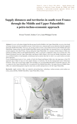
01-2021, tome 118, 1, p.7-32 - E. VAISSIE, S. CAUX, J.-P. FAIVRE - Supply distances and territories in south-west France through the Middle and Upper Palaeolithic: a petro-techno-economic approach
Supply distances and territories in south-west France through the Middle and Upper Palaeolithic: a petro-techno-economic approach p.7-32
Erwan Vaissié, Solène Caux & Jean-Philippe Faivre
Abstract: It is now well-acknowledged that the passage from the Middle to the Upper Palaeolithic was not a clear break in Europe, but more closely resembled a mosaic of innovations (art, ornament and osseous industries) that first appeared during the Middle Palaeolithic. However, one strong position reveals a clear distinction between the Middle and Upper Palaeolithic: human groups from the Middle Palaeolithic mainly exploited lithic raw materials from a very limited area around campsites (less than 50 km), whereas during the Upper Palaeolithic it is common to find evidence of lithic raw material circulating within several hundred kilometres. Here, we present a comparative study of two French sites: Abri Pataud (Dordogne) from the Upper Palaeolithic and Baume-Vallée (Haute-Loire) from the Middle Palaeolithic, based on a combined analysis of petrographic, technological and economic data that we refer to as a petro-techno-economic (PTE) approach. From a methodological point of view, studies of both Abri Pataud and Baume-Vallée show the importance of the PTE approach since it helps to trace not only supply distances or territories, but also the management routes within these territories. These sites reveal a huge supply area extending over several hundred kilometres around the main site. This is common for the Upper Palaeolithic but is exceptional for the Middle Palaeolithic. Our paper discusses Middle Palaeolithic raw material management using the same terms, models and questions as for the Upper Palaeolithic.
Keywords: supply territory, lithic raw material, petroarchaeology, technology, techno-economy, petro-techno-economy, group mobility, Middle Palaeolithic, Upper Palaeolithic, France.
Résumé : Le passage du Paléolithique moyen au Paléolithique récent n'est désormais plus perçu comme une rupture franche mais comme la succession d'une mosaïque d'innovations (art, ornements, industries osseuses) apparues au cours du Paléolithique moyen. Il n'en demeure pas moins qu'une distinction forte demeure entre ces deux périodes : les groupes humains du Paléolithique moyen exploitent majoritairement les matériaux lithiques présents à courtes distances du gisement (moins de 50 km) tandis qu'au Paléolithique récent il est fréquent de trouver des évidences de circulations de géomatériaux sur plusieurs centaines de kilomètres. Nous présentons ici une étude comparative de deux gisements français : l'abri Pataud (Dordogne) pour le Paléolithique supérieur, et le gisement de Baume-Vallée (Haute-Loire) pour le Paléolithique moyen, basée sur une approche combinée de données pétrographique, technologique et économiques que nous nommons approche pétro-techno-économique (PTE). Cette approche intègre les démarches et avancées récentes des disciplines de la pétroarchéologie, et de la techno-typologie au service d'une problématique techno-économique (Geneste, 2010), et permet de mettre en évidence les comportements socio-économiques des populations passées. Nous proposons donc ici de discuter de la gestion des ressources lithiques au Paléolithique moyen en utilisant les mêmes termes, méthodes et questions que pour le Paléolithique récent. Du point de vue méthodologique, l'étude des gisements de l'Abri Pataud et de Baume-Vallée s'est articulée autour d'une double approche. D'une part les déterminations pétroarchéologiques exhaustives à l'échelle macro-mésoscopique (loupe binoculaire à fort grossissement, ×20 à ×150, et macroscope) selon des principes analytiques discutés et enrichis depuis les années 1980 (Masson, 1981 ; Séronie-Vivien et al., 1987 ; Affolter et al., 2008 ; Fernandes, 2012) et l'intégration des principes de chaîne évolutive (Fernandes et Raynal, 2006 ; Fernandes, 2012) permettant une meilleure compréhension et identification des gitologies de collecte potentielles. D'autre part l'étude des comportements techno-économiques (Geneste, 2010) appliqués à chaque matériau suivant une analyse segmentée de la chaîne opératoire suivant quatre étapes principales. Cette double approche permet la mise en évidence de groupes pétro-techno-économiques homogènes, utilisés pour discuter et comparer les comportements socio-économiques. Nous pouvons ainsi envisager les distances d'approvisionnement et les territoires des groupes humains, mais également identifier les variations de gestions sur certains itinéraires au sein de ces territoires, la planification des mobilités et les potentiels réseaux de transferts. Les deux gisements étudiés montrent un espace d'approvisionnement en matière première lithique très large s'étendant sur plusieurs centaines de kilomètres autour du gisement. Si de tels résultats sont communs pour le Paléolithique récent, ils demeurent extrêmement rares pour le Paléolithique moyen. Ils apparaissent notamment en contradiction avec la décroissance quantitative supposée des matériaux, et leur plus forte consommation économique, à mesure que la distance au gite augmente. Pour l'Abri Pataud, six groupes principaux de matières premières se répartissant en quatre groupes PTE de gestion ont été identifiés (tableau 1) : les silex sénoniens du Périgord (groupe PTE 1), les silex du Bergeracois et du Grain de Mil (groupe PTE 2), les silex du Turonien supérieur du Grand-Pressigny (groupe PTE 3) et les silex du Turonien d'Angoulême et du Crétacé de Chalosse (groupe PTE 4). Les interprétations divergent en fonction de l'importance accordée aux réseaux de transferts : si l'on favorise une acquisition directe des matériaux, les données pourraient illustrer un territoire organisé autour d'une mobilité saisonnière à longue distance entre le sud du Bassin parisien et le Périgord. Cette hypothèse peut être mise en relation avec les données issues des études archéozoologiques (Sekhr, 1998 ; Soulier, 2013) qui illustrent une chasse préférentielle au printemps et en été. La Charente constituerait alors un espace pivot, propice à la constitution de stock de matières premières avant un séjour en Périgord, quand les matériaux originaires de Chalosse marqueraient des transferts avec d'autres groupes situés vers les Pyrénées. Si l'on favorise l'hypothèse des acquisitions indirectes, les espaces charentais et périgordiens représenteraient les pôles terminaux d'un territoire social centré autour de la vallée de la Dordogne, et des espaces relais au sein d'un réseau de transfert intégrant des territoires voisins centrés sur le Sud du Bassin parisien et les Pyrénées. Ces hypothèses rejoignent celles déjà formulées antérieurement pour l'Aurignacien récent à burin busqué (Bordes et al., 2005 ; Féblot-Augustins, 2008 et 2009 ; Caux, 2015 ; Caux et Bordes, 2016). Pour Baume-Vallée, 37 groupes de matériaux issus de 15 géotopes principaux ont été identifiés (Vaissié et al., 2017) et se répartissent en quatre groupes PTE de gestion (tableau 2) : silex oligocènes de la vallée de la Borne (groupe PTE 1) ; silex aaléniens du Velay, silcrète de Saint-Pierre-Eynac, silicifications du bassin de Naussac, silcrètes de la Paléo-Truyère et de Saint-Léger-du-Malzieu, silex du Turonien inférieur de la vallée du Cher et du Turonien supérieur du Grand-Pressigny (groupe PTE 2) ; silcrète de la vallée de la Laussone (La Collange), silex du Mazet-Saint-Voy, silcrète d'Arlanc, silex barrémo-bédoulien de Rochemaure-Cruas, silex oligocènes du bassin des Limagnes et du bassin d'Aurillac (groupe PTE 3) ; silcrète pédogénétique de Madriat et silex sénoniens du Loiret (groupe PTE 4). Que ce soit par l'ampleur des circulations ou l'économie des matériaux représentés sur le site, les données pétro-techno-économiques livrent des résultats qui dénotent de la variabilité des comportements couramment observés au Paléolithique moyen. Loin d'exprimer les stratégies opportunistes couramment décries, on observe une réelle planification et une anticipation des besoins en matière première, à la fois à une échelle régionale et extrarégionale. Si l'hypothèse d'une acquisition directe semble pouvoir être privilégiée en majorité, la présence de matériaux faiblement représentés et dont l'acquisition implique le franchissement de contraintes naturelles majeures pourrait être un argument en faveur de la mise en évidence de réseaux de transferts. Dans ce cas, le territoire des groupes humains de Baume-Vallée s'organiserait suivant des cycles de nomadismes saisonniers à grande échelle entre le sud du Bassin parisien et l'espace vellave. Ce territoire pourrait s'articuler, via des réseaux sociaux structurés, avec d'autres territoires moustériens limitrophes : Bassin aquitain, Bassin parisien, vallée du Rhône et potentiellement vallée de la Loire.
5 articles disponibles
 04-2021, tome 118, 1, p. 99-146 - C. NICOLAS, Y. PAILLER, P. STEPHAN, J. PIERSON, L. AUBRY, B. LE GALL, B. LE GALL, V. LACOMBE, J. ROLET - La carte et le territoire : la dalle gravée du Bronze ancien de Saint-Bélec (Leuhan, Finistère)
Prix : 15,00 € TTC
 03-2021, tome 118, 1, p.77-98 - M. MAUVILLY, L. KRAMER - Essai sur les haches-marteaux et masses perforées sans tranchant en roches tenaces de la Culture de Horgen du canton de Fribourg (Suisse)
Prix : 15,00 € TTC
 02-2021, tome 118, 1, p. 33-76 - J. GUILAINE, J. VAQUER, M. GANDELIN, R. AYME, avec la collaboration d'I. CARRERE et de N. GARNIER
Prix : 15,00 € TTC
Coordonnées
Pôle éditorial de la MSH Mondes
(Maison de l'archéologie et de l'éthnologie)
Boite 41
21 allée de l'Université
F-92023 Nanterre cedex - FRANCE
Société préhistorique française
- La SPF
- Réunions
- Le Bulletin de la SPF
- Organisation et comité de rédaction
- Comité de lecture (2020-2025)
- Ligne éditoriale et consignes BSPF
- Données supplémentaires
- Annoncer dans le Bulletin de la SPF
- Séances de la SPF (suppléments)
- Bulletin de la SPF 2025, tome 122
- Bulletin de la SPF 2024, tome 121
- Bulletin de la SPF 2023, tome 120
- Bulletin de la SPF 2022, tome 119
- Archives BSPF 1904-2021 en accès libre
- Publications
- Newsletter
- Boutique
Powered by aiw-pro | all-in-web © 2025 | Simplifiez-vous la vie!
Chargement de la page : 556 ms

